The above table gives the weather forecast for Avoriaz at the specific elevation of 1699 m. Our sophisticated weather models allow us to provide snow forecasts for the top, middle and bottom ski stations of Avoriaz. To access the weather forecasts for the other elevations, use the tab navigation above the table. For a wider view of the weather, check out the Weather Map of France.
Click here to read further information on freezing levels and how we forecast our temperatures.
I am a huge fan of Avoriaz, especially with kids.
Some pluses:
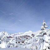
- Wild architectural style that looks great in the snow, in amazing cliff setting
- Fully ski-in-ski-out
- Few lifts typically have long queues (although the Tour lift in the resort is a bottleneck and can get busy in holiday weeks)
- Fun pool with no stupid restrictions on trunks
- Horse taxis, no cars
- Good for self catering with several small supermarkets and an excellent boulangerie-patisserie
- Good value lift pass, particularly at Easter when kids are free with adults
- More snowfall than any other French resort
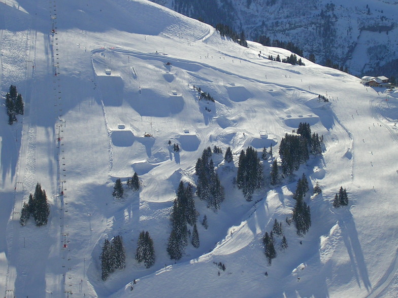
- Good variety of intermediate runs and lots of snow parks
- Well situated, with easy access to a LOT of terrain in adjacent resorts (Chatel, several Swiss resorts, Morzine...)
- Folie Douce for those wanting apres-ski
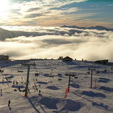
- Sunsets very often give you a fabulous cloud inversion
- Free and reasonably easy access to Morzine for variety of restaurants and night life, great coffee shop, and amazing skiwear charity shop
- Only 1h45 from Geneva
- snow sure at Easter.
Some minuses:
- Restaurant scene seems quite burger focused, limited night life in Avoriaz per se
- If you want a third-wave coffee or a really excellent pizza, you might need to make your way down to Morzine.
- Trip down to Morzine for the better night life involves a cable car and a free bus, and after 8pm you're in danger of missing the last bus to the last cable car
- Elevations are limited - nothing above ~2300m.
Overall, I love this place and always want to find ways to come back, even if we sometimes choose a different resort.
Some pluses:
- Wild architectural style that looks great in the snow, in amazing cliff setting
- Fully ski-in-ski-out
- Few lifts typically have long queues (although the Tour lift in the resort is a bottleneck and can get busy in holiday weeks)
- Fun pool with no stupid restrictions on trunks
- Horse taxis, no cars
- Good for self catering with several small supermarkets and an excellent boulangerie-patisserie
- Good value lift pass, particularly at Easter when kids are free with adults
- More snowfall than any other French resort
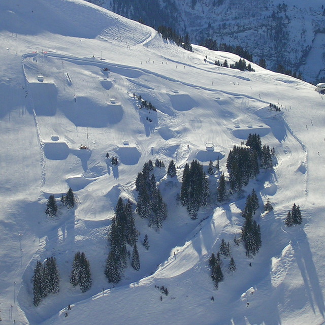
- Good variety of intermediate runs and lots of snow parks
- Well situated, with easy access to a LOT of terrain in adjacent resorts (Chatel, several Swiss resorts, Morzine...)
- Folie Douce for those wanting apres-ski
- Sunsets very often give you a fabulous cloud inversion
- Free and reasonably easy access to Morzine for variety of restaurants and night life, great coffee shop, and amazing skiwear charity shop
- Only 1h45 from Geneva
- snow sure at Easter.
Some minuses:
- Restaurant scene seems quite burger focused, limited night life in Avoriaz per se
- If you want a third-wave coffee or a really excellent pizza, you might need to make your way down to Morzine.
- Trip down to Morzine for the better night life involves a cable car and a free bus, and after 8pm you're in danger of missing the last bus to the last cable car
- Elevations are limited - nothing above ~2300m.
Overall, I love this place and always want to find ways to come back, even if we sometimes choose a different resort.
Free Snow-Forecast.com weather widget for your website
Embed the Avoriaz weather widget on your site for free. It provides a weekly snapshot of snow and rain conditions across all elevations. Follow the two quick steps to grab your custom code and paste it into your site. Choose between metric or imperial units. Click here to get the code.


 Nearest