Issued by Snow-Forecast.com at:1 am (local time) / 01 Aug 2026
Last 6 daysScroll left for last 6 daysNow
Next 3 days weather summary:
Heavy rain (total 40.0mm), heaviest during Sun afternoon. Mild temperatures (max 8°C on Sat morning, min 6°C on Sun morning). Wind will be generally light.
Days 4-6 weather summary:
Moderate rain (total 15.0mm), heaviest on Tue afternoon. Mild temperatures (max 9°C on Wed afternoon, min 7°C on Tue morning). Wind will be generally light.
The above table gives the weather forecast for Alagna at the specific elevation of 3275 m. Our sophisticated weather models allow us to provide snow forecasts for the top, middle and bottom ski stations of Alagna. To access the weather forecasts for the other elevations, use the tab navigation above the table. For a wider view of the weather, check out the Weather Map of Italy.
Click here to read further information on freezing levels and how we forecast our temperatures.
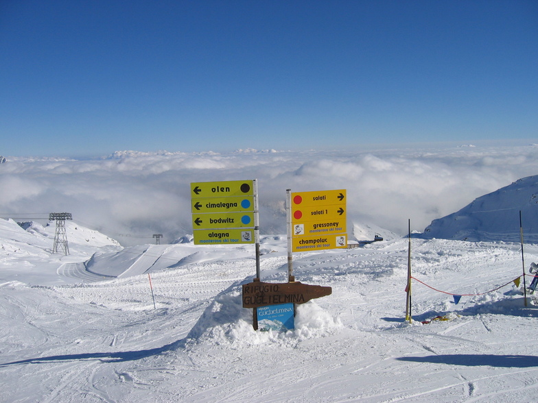
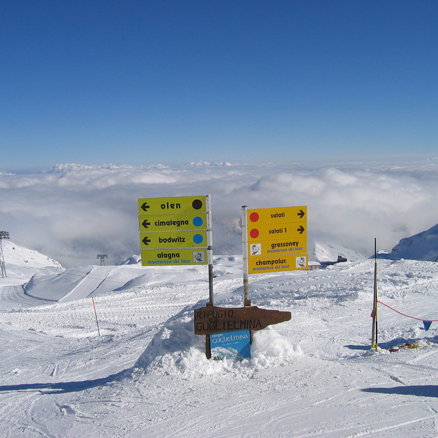
I have become a regular visitor to Alagna and Monterosa Ski. For off-piste and day ski-touring, I normally work with a local guide for the sake of both efficiency of time use and overcoming sometimes demanding technical manoeuvrers (like entry into the Lost Valley or Malfatta run). I also regularly ski on the other side of the big mountain range in Swiss (Zermatt-Saas Fee). Compared with the other side, this Alagna side does not offer spectacular scenery. But the availability of big bowls, which are not over-worked, and long highly slippery descents on-piste and many other on-piste and off-piste features make you a repeater. 2019 has been a dry season but I gather that 2019 has been an exception. Check live web images. By the way, with the current set up of lifts, Alagna-Champoluc is about 100-120 min one way (not on school holidays, though). You come back as late as possible and get the final downward piste skiing from Saltati to Alagna (c.1800m vertical) with few other skiers. Stop at a bar towards the end but still a few slippery slopes to go thereafter. A wine bar in Alagna is also highly recommended for hospitality and for the selection of wine (local Gattinara wine, especially, as it is difficult to get them once you leave the region).
I have become a regular visitor to Alagna and Monterosa Ski. For off-piste and day ski-touring, I normally work with a local guide for the sake of both efficiency of time use and overcoming sometimes demanding technical manoeuvrers (like entry into the Lost Valley or Malfatta run). I also regularly ski on the other side of the big mountain range in Swiss (Zermatt-Saas Fee). Compared with the other side, this Alagna side does not offer spectacular scenery. But the availability of big bowls, which are not over-worked, and long highly slippery descents on-piste and many other on-piste and off-piste features make you a repeater. 2019 has been a dry season but I gather that 2019 has been an exception. Check live web images. By the way, with the current set up of lifts, Alagna-Champoluc is about 100-120 min one way (not on school holidays, though). You come back as late as possible and get the final downward piste skiing from Saltati to Alagna (c.1800m vertical) with few other skiers. Stop at a bar towards the end but still a few slippery slopes to go thereafter. A wine bar in Alagna is also highly recommended for hospitality and for the selection of wine (local Gattinara wine, especially, as it is difficult to get them once you leave the region).
Free Snow-Forecast.com weather widget for your website
Embed the Alagna weather widget on your site for free. It provides a weekly snapshot of snow and rain conditions across all elevations. Follow the two quick steps to grab your custom code and paste it into your site. Choose between metric or imperial units. Click here to get the code.


 Nearest