WORLD SNOW ROUNDUP #215
(Updated 15 November 2023) A comprehensive review of snow conditions, weather, and updates for Europe, North America and Asia's winter sports destinations.
Issued: 15th November 2023
By Patrick “Snowhunter” Thorne
World Overview
The 23-23 season build-up continues and we now have more than 50 ski areas open, with a fairly even divide between Europe and North America. Austria, Switzerland and the USA are the three countries with the most centres open, each with 8 or more, the US the only country to make it into double-figures so far.
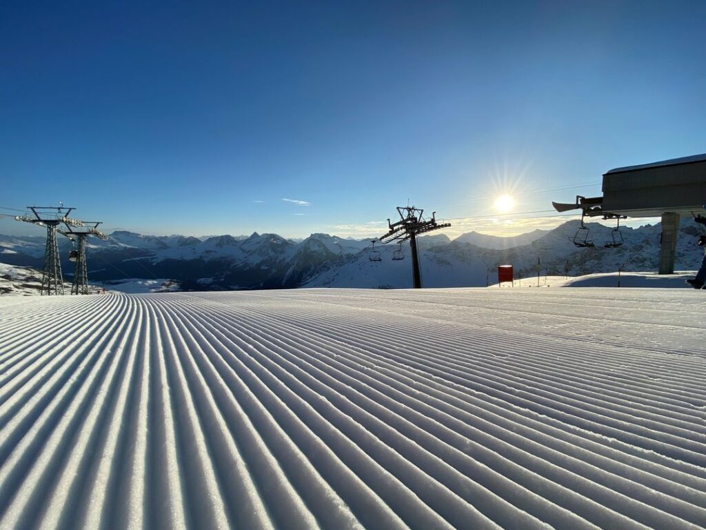
As to snowfall, the Alps are continuing to see spectacular November snowfall, particularly in the west where many resorts are now posting more than a metre lying now above about 2,000m. North America has had another quieter week with a few inches in the west and north and snow-making guns fired up where possible in the east. Elsewhere, it is cold and snowy in northern and eastern European mountains although unfortunately, temperatures have climbed up again in the Pyrenees.
There are also early signs from Japan that winter is getting started with a temperature drop and snowfall arriving.
Europe
EUROPE INTRO
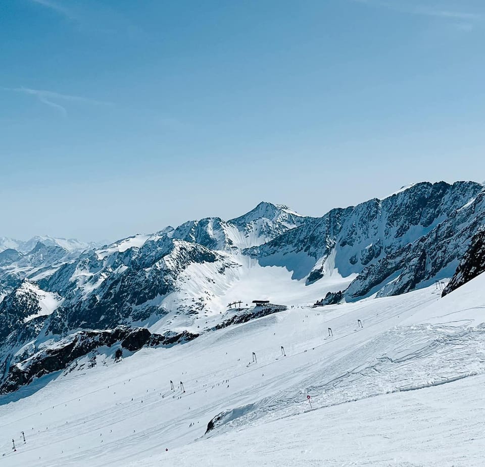
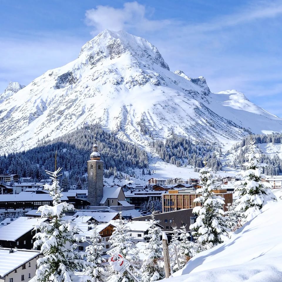
The season is gathering pace in the Alps and another week of cold and snowy weather has the pre-season looking as good as it has done in some time. Higher slopes at a growing number of resorts have now had more than a metre of snowfall since the start of the month and we’re passed the 30 mark for the number of areas open already, including many big names. Davos, Kitzbuhel, Schladming and Verbier were among those opening last weekend and Tignes will kick off the French 23-24 season this coming weekend, all being well, and Italy’s Madonna di Campiglio plans to open early next weekend too. It’s not just the number of centres open but the amount of terrain available at each that’s growing. Solden (5/122cm / 2/49”) has jumped into winter mode opening more than 60km of runs, beyond just its glacier area, at the weekend. There remains nowhere open outside of the Alps and Scandinavia but nowhere had planned to be for at least another fortnight and there have been more promising signs with more early snowfall and low temperatures on many of the continent’s other mountain ranges. The only ‘blip’ in the positive picture is the Pyrenees, where temperatures have risen again and the skies have cleared.
AUSTRIA REPORT
Austria just about continues to lead Europe in terms of open resorts, closing in on double figures, which should be reached this weekend with Obergurgl set to open. Where it does lead the world is the amount of terrain open, as although the US has now taken the top spot for most centres open, there are more runs open at most Austrian resorts. This is particularly the case at Solden, which doubled its terrain available to 60km (38 miles) at the weekend, double what it had previously, although that had already been the most in the world. The move came as Kitzbuhel and Schladming (1/40cm / 0.5/16”) joined the seven glacier areas already open in Austria. Kitzbuhel is using a combination of snow-farmed snow from last season and the natural snow that has been piling up in recent weeks to open the lowest slopes in the Alps so far this autumn down at 1900m altitude, albeit its highest terrain. The snow has kept falling with sunny spells across Austria, although not as heavily as further west. Also, already open are the Kaprun, Kitzsteinhorn (0/50 cm / 020”), Molltal, Pitztal and Stubai glaciers.
AUSTRIA FORECAST
The forecast continues to look good for snow accumulation with light to moderate falls expected most days through the coming week above about 1500m. Temperatures remaining below freezing 24-7 above 2,000m, with daytime highs of around +5C in valleys.
SWITZERLAND REPORT
The number of open Swiss resorts jumped at the weekend with Arosa, the Parsenn slopes of Davos (2/40cm / 1/16”) and Verbier all opening while Adelboden also opened some cross-country ski tracks. They joined already open Gstaad (10/63cm / 4/25” – Glacier 3000), Saas Fee (10/170cm / 4/68”), Zermatt (0/200cm / 0/80”), St Moritz (15/115cm / 6/46” – Diavolezza glacier) and Murren (0/20cm / 0/8”) to give a total of 8 or 9 Swiss areas now open, putting it in the top two in the world for choice of early-season skiing areas, although quite a few of these are currently only open at weekends. Actually ski racing fans from around the world have been focused on Swiss slopes this week with four World Cup downhill races planned for the opening of the 23-24 speed racing season across the Swiss-Italian, Zermatt-Cervinia border. The men’s races were due to have been held last weekend, the women’s next. Ironically though, after last year’s inaugural races were cancelled for too little snow, this year there was too much, along with gusty winds, leading to cancellations. As with the rest of the Alps, most Swiss areas have seen another 50cm or so of snowfall, on average, on their higher slopes this week, with occasionally sunny periods between the cloud and snow. Mountain lows of -15C degrees at 3,000m, but getting up to +10C or above in lower valleys so not so much down to resort level yet.
SWITZERLAND FORECAST
There’s still no big change in the current snowy weather forecast with more areas likely to see more snow and low temperatures through to the weekend, possibly rain at lower elevations though.
FRANCE REPORT
The French season should start a week earlier than planned, this coming Saturday, 18th November, rather than the 25th, after Tignes announced it would open, and a few days later Val Thorens announced that it would do the same. For Tignes, the slopes up on the Glacier de la Grande Motte are to open first, unsurprisingly, but there’ll also be the option of a returning slope to Val Claret, via the Double M piste, after more than a metre of snowfall was recorded at the resort. Tignes announcement was last Wednesday evening, Val Thorens on Friday morning, and it has kept snowing since. Tignes will continue with a ‘progressive opening’ of the rest of the ski area from the originally planned 25th November opening date but will have at least 1300m of vert available from day one. Val Thorens will stay open to its planned Grand Premiere celebrations at the end of next week, which had originally been due to start their season. Other ski areas that have hinted but not yet confirmed that they might open early thanks to all the snowfall include La Clusaz and Montgenevre. The French Alps have been seeing the best of the current snowstorms with snow continuing all through the last week and temperatures feeling very cold, remaining below freezing above 2000m and only getting up towards +5C in the daytime in valleys.
FRANCE FORECAST
It looks like we’re heading towards a third week of regular snowfall with lots more snow in the forecast for the remainder of this week. Temperatures remaining low too, in the -12C to -2C range at 3,000m, -5 to +5C at 1500m.
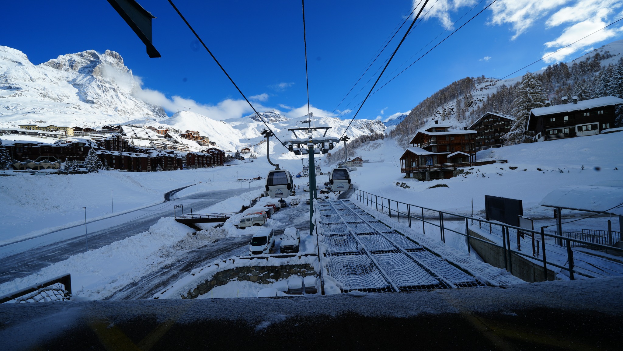
ITALY REPORT
The number of ski centres open in Italy remains at one, although a second, Cervinia (0/200cm / 0/80”), which offers year-round access to the glacier slopes above Zermatt, has announced that as we go to publish this week’s report, they’re opening the Plan Maison, Fornet and Bontadini chair lifts and that piste number 5 will be open with for the return to the village. The centre is one of many in Italy to post further big snowfalls in the last seven days, with Livigno posting repeat 45-50cm 24-hour accumulation alerts. Sulden (40/90cm / 16/36”) has reported similar healthy falls and already has about a third of its terrain amounting to some 15km (8 miles) of slopes open with powder conditions reported. As a result of all the snowfall at least two Italian ski areas are expected to open early for their 23-24 seasons this coming weekend. The Pragelato Glacier has the altitude as well as the benefit of the fresh snowfall, but less expected is Madonna di Campiglio, which plans to open a week early, all being well, this coming Saturday 18th, thanks to a half-metre of early November snowfall followed by cold temperatures for snow-making.
ITALY FORECAST
Another fairly promising week for snowfall and low temperatures in Italy, if less snow in the forecast than for the previous fortnight. The freezing point will be at around 1600m much of the week and just getting a few degrees above at lower elevations. Light to moderate snowfall (2-7cm / 1-3”) most days.
GERMANY REPORT
It’s continuing to look good for the start of the German 23-24 season in early December. Temperatures have been in the -5 to +5C range on the Zugspitze glacier and there’s been more snowfall through the week.
GERMANY FORECAST
There’s not a great deal of change in the immediate forecast with still more snow forecast, along with cold temperatures, on high slopes. Some of this will be rain on Germany’s lower slopes at traditional resorts.
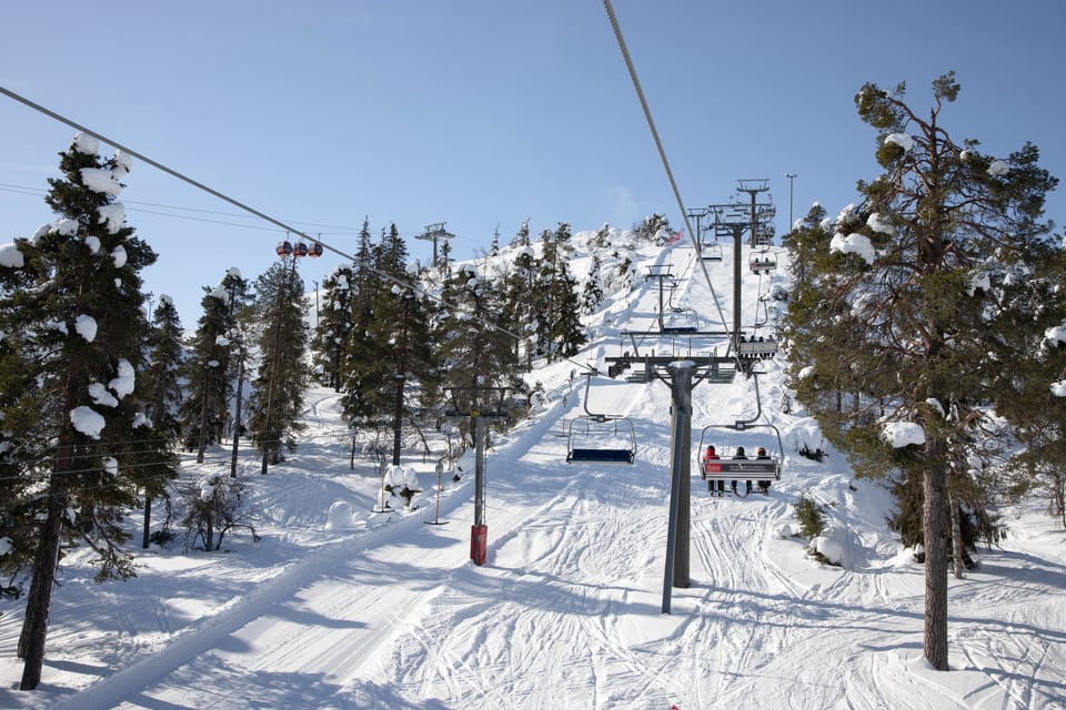
SCANDINAVIA REPORT
Scandinavia continues to seem like it’s in full winter mode already with fast-diminishing daylight hours, more small ski centres opening, subzero temperatures around the clock and plenty more snowfall. Ski racing attention was on Levi (10/30cm / 4/12″), in Lapland, over the weekend. Already into its second month of its 7-month long 23-24 season, it and fellow Lapland ski area Ruka (5/30cm / 2/12″) posted daytime highs of -10C this week, overnight lows in the -20s. More smaller areas have opened in Finland, Norway and Sweden but next weekend should see more of the region’s bigger resorts including the largest, Sweden’s Åre, as well as Norway’s Trysil and leading Finnish area Pyha, all opening for their 23-24 seasons.
SCANDINAVIA FORECAST
Staying very cold and mostly sunny in the north of the region with temperatures in the -10C to –25C range in Lapland. Largely clear skies are forecast but with some light snow showers.
SCOTLAND REPORT
There have been lower temperatures in Scotland over the past week and some more snowfall, although not yet really building much of a base, even on mountain tops. Glencoe did show almost top top-to-bottom thin cover at the end of last week, however. There’s no sign of anywhere opening imminently with natural snowfall but all five centres could fire up their all-weather snow-making systems to create small snow areas for beginners, terrain parks or snow fun. However, that looks unlikely to happen before December when demand increases.
SCOTLAND FORECAST
The recent cold temperatures will ease a little with valley temperatures climbing up towards +7 or +8C, but weather remains very changeable with showers of snow on mountaintops and rain on lower slopes continuing.
SPAIN / ANDORRA REPORT
It has, unfortunately, turned much sunnier, warmer and drier in the Pyrenees with highs back up to +15C in valleys and +10C on higher slopes with lots of sunshine. Overnight lows have been getting back down towards freezing on high slopes so almost snow-making temperatures, but it seems borderline. Nowhere is expected to open here until the start of December unless there’s a big improvement in conditions and somewhere opens early.
SPAIN / ANDORRA FORECAST
There’s not much change in the forecast with clear skies, no precipitation and warm temperatures continuing at least to the weekend.
BULGARIA / ROMANIA REPORT
There’s nowhere open yet or expected to open before the end of the month or early December, but there have been more snow flurries in the past week, with Serbia’s Kopaoinik among the ski areas posting images of brief snowfalls on high slopes over the past week. Bansko, in Bulgaria, also posted video of snowfall at the weekend.
BULGARIA / ROMANIA FORECAST
Quite a promising forecast with light to moderate snowfalls expected daily through the remainder of this week and mountain temperatures in the range of freezing down to -10C. Warmer in valleys (freezing to +8C).
CZECH REPUBLIC / SLOVAKIA REPORT
It is looking increasingly wintry on higher slopes in the Czech and Slovak Republics. Jasna posted images of drifting snow at its higher lift stations over the past week. There’s nowhere open in the region yet though with most areas targeting the first half of December for their season start.
CZECH REPUBLIC / SLOVAKIA FORECAST
Remaining fairly wintery over the remainder of this week with light to moderate snowfalls of 1-10cm (1-4”) expected daily on higher slopes and temperatures in the -7C to +2C range up high. Warmer in valleys but not that much more, -2C to +5C generally.
NORTH AMERICA INTRO
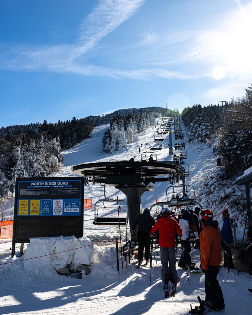
Alas, there have not been the huge snowfalls we’ve seen in the Alps for North American ski areas in November, but there have been some snowfalls between spells of sunny weather and temperatures have been low enough for snow-making systems to continue to fire up, particularly in the east where there’s a battle underway to lay down a base and open between dozens of resorts there, with still only one managing to do so, and only very limited terrain. It’s a more promising picture in the west with California’s season getting underway at the weekend and now seven areas open in Colorado alone, meaning the US is the first country to get into double figures for the number of ski areas it has open. They include some big names like Breckenridge, Mammoth and Vail, which opened at the weekend. Dozens more are lining up for next weekend including the first in Utah and the country’s largest ski area at Park City Mountain.
ROCKIES REPORT
After a largely dry and sunny week set snow-making efforts back, things have turned colder and snowier in recent days and three more Colorado ski areas have opened, taking the total for the state to six so far. There’s still only very limited terrain available at each but things are moving in the right direction. Big names Breckenridge and Vail opened on Friday, along with Loveland, which had been snow-making on and off for more than 40 days before finally managing to open. Copper was the latest to open on Monday and Winter Park also has limited terrain available. They all joined already open Arapahoe Basin (18/18” / 45/45cm), Eldora (18/18” / 45/45cm) and Keystone (18/18” / 45/45cm) to give Colorado eight areas open already, overtaking Tirol in Austria with six, to give the most of any state/province/canton/prefecture. Utah’s ski season was due to have got underway last weekend at Brian Head but they delayed opening by a week to this coming weekend, when other Utah areas are due to open, including America’s biggest, Park City Mountain Resort.
ROCKIES FORECAST
Unfortunately, we seem to be in a bit of a holding pattern of clear skies. Although overnight lows will continue to be in the 20s Fahrenheit and cold enough for snow-making, there’s no natural snowfall forecast for now and daytime highs in the 40s may thaw some of the snowpack, slowing progress.
USA WEST REPORT
The ski season is underway in the Western US with two Californian ski areas opening for the 23-24 season last Friday, 10th November. Mt. Rose and Mammoth have both started their seasons with initially very limited terrain, following several inches of fresh snowfall over the previous few days. Neither have any beginner runs open yet. Mammoth only ended their 22-23 season, one of their longest ever thanks to exceptional snowfall last winter, in August, three months ago. Other Californian areas plan to open in the coming days and weeks include Heavenly, Northstar and Boreal targeting this Friday (November 17th) and Palisades Tahoe targeting Wednesday, November 22nd.
USA WEST FORECAST
It’ll be cold, generally below freezing in the mountains, but dry and sunny for much of the West Coast. However, a weak front is expected to bring a few inches (5-10cm) of snowfall to the Sierras on Thursday/Friday.
MIDWEST REPORT
It’s a very different fall to a year ago when Midwestern ski areas had already been operating for a month and had been the first in the US to open. This year Wild Mountain (2/12” / 5/30cm), in Minnesota, and Trollhaugen, in Wisconsin, both finally managed to open a week ago, but then the marginal conditions with lots of sunshine melting the thin cover and nights too warm for snow-making have led to Trollhaugen temporarily closing again, although Wild Mountain is managing to maintain top to bottom cover, just about.
MIDWEST FORECAST
Unfortunately, there’s no clear sign that conditions are going to improve in the next few days with daytime highs still in the low 50s, overnight lows above freezing and more dry weather expected.
USA EAST REPORT
It remains just Killington (0/12″ / 0/30cm), in Vermont, open but other ski areas in the East are snow-making and posting increasingly wintery-looking images, so the season start is getting closer for many, with “in time for Thanksgiving” the main aim for many. Sunday River, in Maine, has announced that it will open its Jordan slopes this week.
USA EAST FORECAST
Unfortunately, the forecast is looking rather warm over the remainder of this week, which may thwart snow-making efforts for the time being. Largely dry but with a high chance that what precipitation there is will be rain not snow at most elevations.
CANADA
CANADA WEST REPORT
Temperatures have been at or below freezing, just about, through the day as well as overnight, and we have seen some fresh snowfalls in Western Canada, but it has mostly been just a few centimetres here and there rather than significant snowfall, so there’s not a lot of change on a week ago in terms of what’s open. Indeed, Marmot Basin, up near Jasper, has delayed a week up to next weekend, although it reported 25cm (10″) of fresh snowfall on Saturday so things are looking more promising. We do have one new opener, Sunshine (20/27cm / 8/11”), meaning all three Banff area resorts are now open. Bases remain rather meagre so far with Lake Louise (29/29cm / 12/12”) posting the most runs open at about 8km (5 miles). Mt Norquay (40/60cm / 16/24″) has the deepest snowpack. The first resorts to open in BC for 23-24, including Sun Peaks, are expected to open next weekend.
CANADA WEST FORECAST
After the unsettled weather of the last few days things look dry and sunny in the west for the remainder of this week. Daytime highs at resorts are still at the freezing point, and overnight lows below -10C, so snow-making systems can work at least where resorts have them.
CANADA EAST REPORT
Cold temperatures have continued in the East and resorts like Tremblant have posted images of slopes turning whiter thanks to snow-making, but there’s not much natural stuff to report yet. Sommet Ste Sauveur (10/20cm / 4/8”) remains the only area open in the east, thanks to its snow-making efforts, with a single run, about 800m (half a mile) long, which is also open under the floodlights in the evening.
CANADA EAST FORECAST
Unfortunately, it looks like temperatures will climb a little over the coming days so snow-making will get more problematic and forecast precipitation will probably fall as rain to higher elevations.
JAPAN REPORT
We’re less than a fortnight away from the main opening day of the 23-24 season for many of Japan’s larger resorts and we’re just starting to see the big drop in temperatures and the first good dumps of the season arriving. Even the Yeti ski area with all-weather snow-making was forced to close over the last week due to warm temperatures. Nozawa Onsen reported 25cm in 24 hours to start things off on Sunday. Myoko has also reported fresh snow to low levels over the past few days and there have seen subzero temperatures on Hokkaido too with some promising early falls (5-10cm / 2-4” a day) on the slopes of resorts including Niseko.
JAPAN FORECAST
A midweek warm front will set back the snowfalls of the weekend and the start of this week with daytime temps going back up to +10 to {15C. They should drop again by Friday when another front is expected to move in and temperatures drop back below freezing.