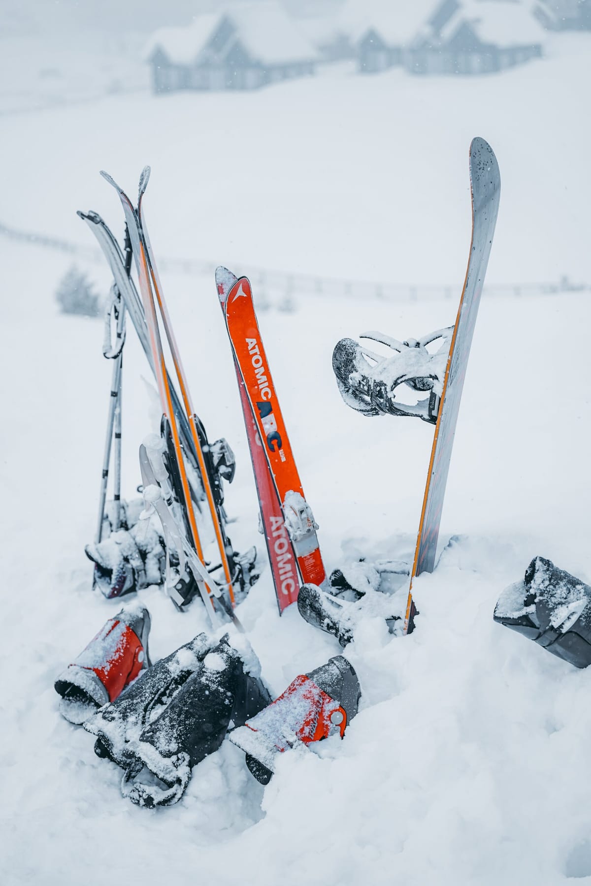
El Niño And This Year’s Ski Season
There’s lots of talk about this winter being a strong El Niño year, and a lot of people are getting very excited about what that could mean for snow conditions. But what does it really mean?
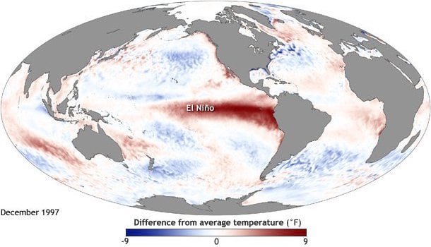
El Niño and La Niña are (still not fully understood…) alternating warming and cooling patterns of the Pacific Ocean, most notable in the region from the southwestern US coast down to the northwestern South American Coast.
El Niño is the warm phase and we’re currently beginning what America’s National Oceanic and Atmospheric Administration (NOAA) think will most likely be a strong and possibly very strong/intense El Niño – peaking early in the new year/middle of the ski season.
“Our system is predicting a warmer event than many other systems,” National Center for Atmospheric Research scientist Stephen Yeager said. “But it isn’t out of the realm of possibilities. Only time will tell if we’re accurate, but we believe our system has something to offer and we’re excited to be able to contribute this knowledge to the conversation going on right now about the impacts El Nino may have in the coming months.”
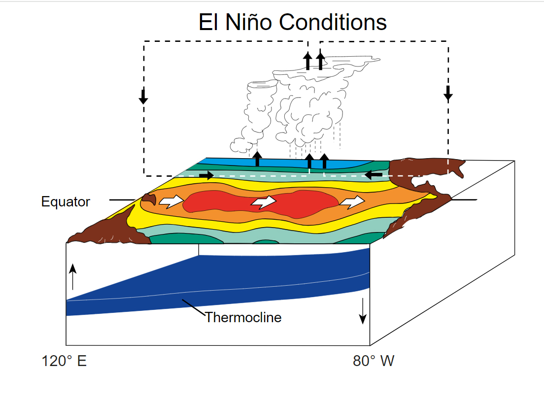
Typically El Niño winters mean more moisture and more precipitation so those with glass-half-full kind of outlook focus on this potentially meaning more snow. On the other hand it also drives up global temperatures, which besides not being a great thing in what’s already deemed a “climate emergency” means that more of that precipitation is likely to be rain or sleet than nice fluffy snow.
But that’s very much the big picture. Getting down to details, El Niño (and La Niña) both tend to be good news for some parts of the ski world and less good news for others. Well, on average anyway, we usually see some areas that’s supposed to do poorly/well for snow in one particular year, actually doing better/worse than expected. That’s the weather for you.
There is also the question of how strongly the El Niño / La Niña influence extends. It’s fairly clearly defined in North America and elsewhere around the Pacific but meteorologists are divided on how big and direct an impact there is on weather in Europe as you get further from the El Niño / La Niña epicentre and other weather factors are likely to have a stronger influence.
Those who do believe there’s an impact on the Alps and elsewhere in Europe tend to look at what happened in previous winters when there was an El Niño winter and hope that will be the case this time around.
Part of the buzz about this El Niño is that it’s the first ’strong El Niño winter’ for eight years. They don’t come around very often with the winters if 1982–83,1997–98 and 2015–16 the stand outs of the past four decades. The NOAA have said this one could be the strongest for more than half a century. They’re 80% sure now it’ll be “strong” but have added a 35% chance it will be “historic”.
“We’re talking about some really warm waters here in the eastern Pacific. A majority of the models now push us to about 2 degrees Celsius above normal, which is huge. That puts us in Super El Nino territory. With climate change, it increasingly looks like regular El Nino events will become super events because of all the heat in the oceans,” Bring Me The News meteorologist Sven Sundgaard commented.
The past three winters, including last year’s which saw record 900”+ snowfalls in Utah and huge accumulations elsewhere in the western US, were La Niña winters.
Early Signs
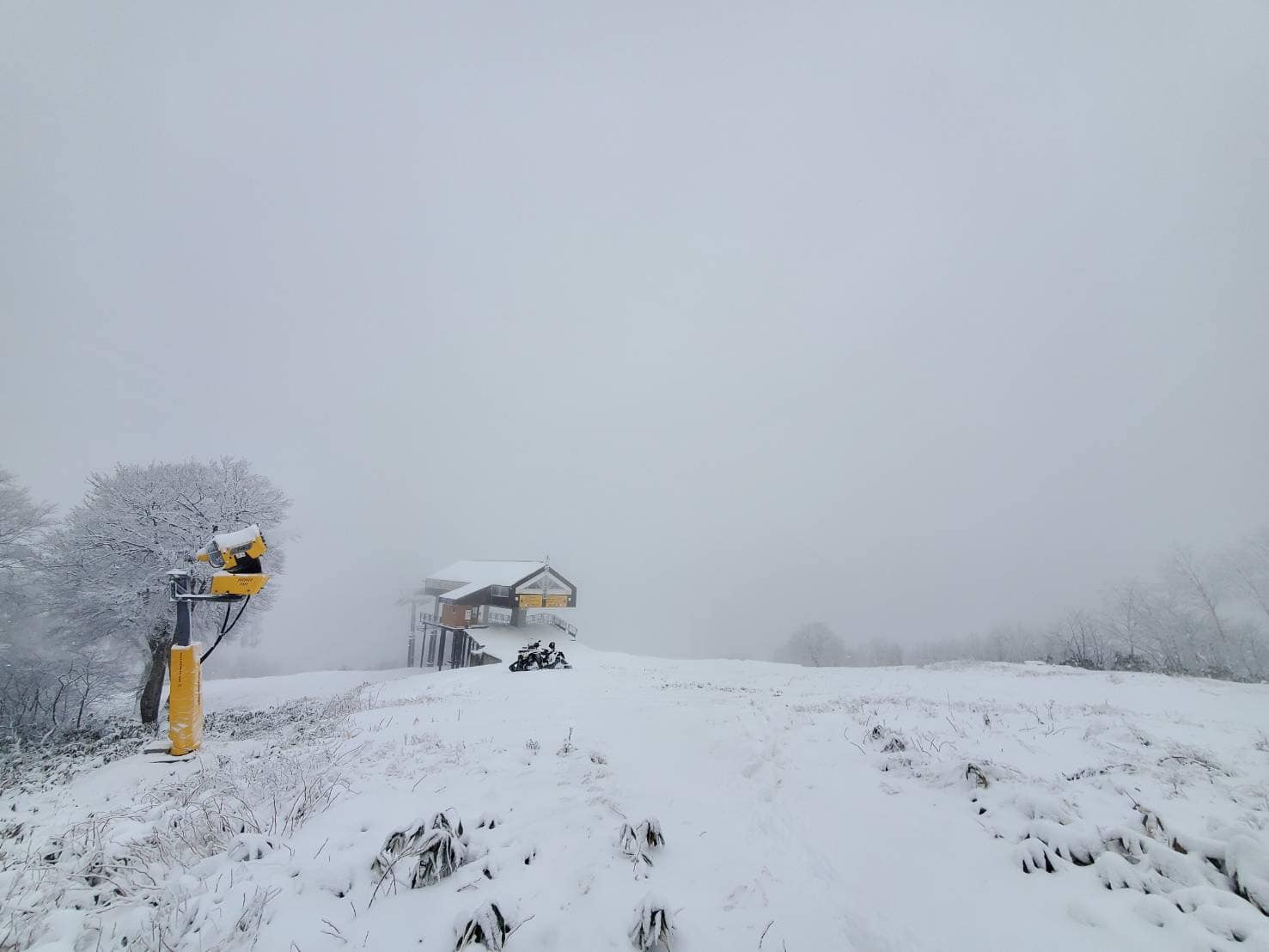
Early Signs as the current El Niño started to take hold during the southern hemisphere’s 2023 season saw Australia have a poor snow season with warmer than average temperatures (record warm winter temperatures in many cases in fact) and ski areas closing early. In the Andes the news was better, at times, with some “historic” huge multi-day snowfalls on ski slopes in Argentina and Chile, but according to local skiers it was a bit hit and miss overall with not much snowfall between these events. Chile’s El Colorado pictured above in July.
North America
North America is the most directly impacted and has the clearest El Niño trends to follow. These tend to bring heavy precipitation in the west and northwest, but unfortunately warmer weather too, so that doesn’t always mean snow. Around the Rockies (Colorado/Utah) there tends to be less of an impact either way, then over in the East and Northeast El Niño winters are known for sucking in colder weather with multiple ’Nor-easter’ storms hitting the polar Vortex to deliver a colder and snowier winter than usual. Fingers crossed. We’re in the very early days of course but so far there have not been big snowfalls anywhere really and although dozens of ski areas have opened already in Canada and the US, opening conditions are marginal, particularly on the East Coast.
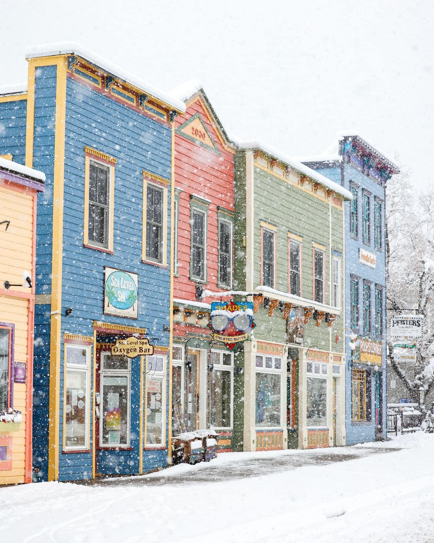
Pictured above snowfall at Crested Butte in Colorado in late October.
Japan
Although the focus of El Nino reporting has focussed on North America and Europe, Japan, of course, lies in the Pacific. Broadly speaking El Nino typically brings heavier precipitation but warmer weather to the southern half of Japan. For the north, including the island of Hokkaido, it’s closer to average, perhaps just a bit warmer and a bit more precipitation than an average season. Early signs are fairly promising with temperatures dropping and up to 30cm (a foot) of snow falling this last weekend, aa fortnight before the first of Japan’s big ski areas are expected to start opening for the season. Nozawa Onsen is pictured above at the start of this week.
Europe
Although there’s less evidence of La Niña or El Niño influencing Europe’s weather, some of the trends associated with a strong El Niño by those who believe it is good news for Europe’s skiers – cold weather in northern Europe, particularly Scandinavia, and above average snowfall in the first half of the season are perhaps more evident so far than the weather associated with El Niño in America is!
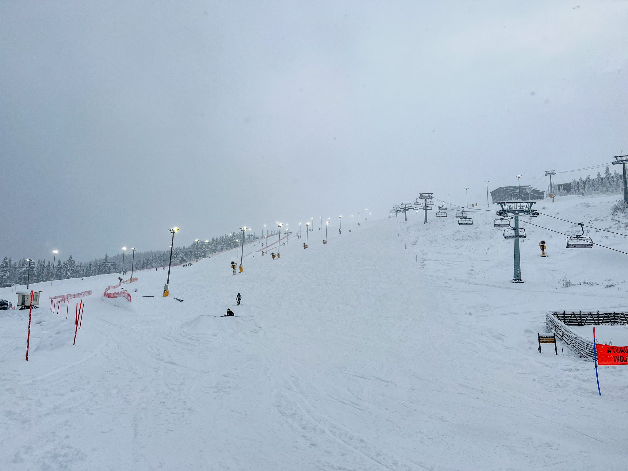
It has indeed been very cold in Scandinavia for the past month with good early conditions and temperatures as low as -25C in Lapland (Finland’s Levi above this week).
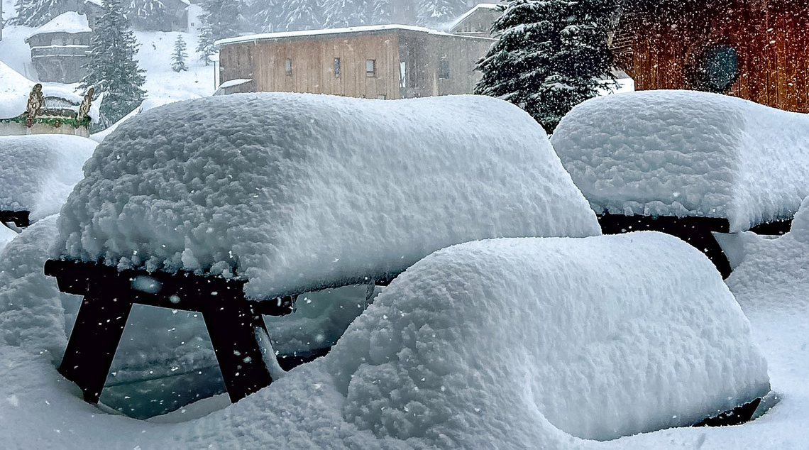
In the Alps, too, after a warm first half of autumn/fall, November has seen consistently cold temperatures and some of the biggest pre-season snowfalls in years, quickly making up ground lost up to October. Avoriaz is pictured below.
But is it El Niño? Well whatever it is, skiers are reported to be regaining confidence after the poor snowfall start to last winter in the Alps.
“It looks like this prophesied El Nino winter is starting to deliver early,” confirmed Richard Sinclair of ski holiday company SNO. “Bookings have surged as skiers, who feared another slow start to the snow, can see the terrific early-season conditions being laid down on webcams and tourist-board websites across the Alps.”
For now though, the jury is out as Charlotte Duclos from the French Aravis region comments:
“Last week has been really snowy for this early in November with snowfalls down to all Aravis’s villages, which we hope is a good omen. Obviously, the white landscapes make us want more, as the winter season launch and lifts opening are getting closer. We hope this winter will be more generous in snow than the previous one, but we will wait and see. Balme, the main La Clusaz ski mountain, is celebrating its 60th year and is set to open on December 2nd, we are really looking forward to it, and hopefully with really good snow conditions.”
Fingers crossed.
(Pic top credit Syed Qaarif Andrabi)