


Global Weekly Snow Roundup #318
Weekly Snow News for the world, updated 11 June 2026: Australia's season begins, Val d’Isère reopens and major snowfall is forecast for the Andes.

Next 3 days weather summary:Heavy rain (total 56.0mm), heaviest during Sun night. Mild temperatures (max 6°C on Sat morning, min 5°C on Sat afternoon). Wind will be generally light. | Days 4-6 weather summary:Heavy rain (total 29.0mm), heaviest during Tue night. Mild temperatures (max 7°C on Thu night, min 5°C on Tue morning). Wind will be generally light. | |||||||||||||||||
Saturday 13 | Sunday 14 | Monday 15 | Tuesday 16 | Wednesday 17 | Thursday 18 | |||||||||||||
AM | PM | night | AM | PM | night | AM | PM | night | AM | PM | night | AM | PM | night | AM | PM | night | |
t-storm risk | t-storm risk | rain shwrs | light rain | mod. rain | heavy rain | mod. rain | mod. rain | mod. rain | light rain | light rain | mod. rain | light rain | light rain | light rain | t-storm risk | t-storm risk | rain shwrs | |
km/h | ||||||||||||||||||
Snow map | 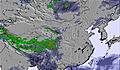 | 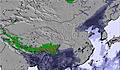 | 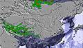 | 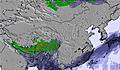 |  |  | ||||||||||||
— | — | — | — | — | — | — | — | — | — | — | — | — | — | — | — | — | — | |
2 | 3 | 3 | 3 | 7 | 17 | 7 | 6 | 8 | 1 | 2 | 7 | 2 | 3 | 4 | 3 | 4 | 3 | |
max °C | 6 | 6 | 6 | 5 | 5 | 5 | 5 | 6 | 6 | 5 | 6 | 6 | 6 | 6 | 6 | 6 | 6 | 7 |
min °C | 6 | 5 | 5 | 5 | 5 | 5 | 5 | 5 | 5 | 5 | 5 | 5 | 5 | 6 | 5 | 6 | 6 | 6 |
3 | 2 | 1 | 0 | 0 | 0 | 2 | 2 | 2 | 2 | 2 | 1 | 2 | 3 | 2 | 3 | 4 | 4 | |
87 | 87 | 83 | 95 | 94 | 98 | 95 | 95 | 90 | 86 | 84 | 87 | 93 | 84 | 87 | 86 | 91 | 69 | |
5100 | 5000 | 5050 | 5000 | 5000 | 5050 | 5150 | 5100 | 5000 | 5050 | 5050 | 5100 | 5050 | 5150 | 5050 | 5150 | 5100 | 5150 | |
5:07 | — | — | 5:09 | — | — | 5:09 | — | — | 5:09 | — | — | 5:09 | — | — | 5:09 | — | — | |
— | 6:43 | — | — | 6:43 | — | — | 6:43 | — | — | 6:44 | — | — | 6:44 | — | — | 6:44 | — | |
Go pro and carve into:
Latest snow reports near Yushan:
| Top snow depth: | — |
|---|---|
| Bottom snow depth: | — |
| Fresh snowfall depth: | — |
| Last snowfall: | 1 Apr 2023 |
| Snow Alerts | Create Alert |
0.0 | Bluebird Powder days Fresh snow, mostly sunny, light wind. |
|---|---|
0.0 | Powder days Fresh snow, limited sun, any wind. |
0.0 | Bluebird days Average snow, mostly sunny, light wind. |
The above table gives the weather forecast for Yushan at the specific elevation of 3997 m. Our sophisticated weather models allow us to provide snow forecasts for the top, middle and bottom ski stations of Yushan. To access the weather forecasts for the other elevations, use the tab navigation above the table. For a wider view of the weather, check out the Weather Map of Taiwan.
Click here to read further information on freezing levels and how we forecast our temperatures.
i move to angola the gays r nice the ski in yusan r nice and spicy the burorfjicsjiokcnjxnp
matthew belling from Angola writes:
i move to angola the gays r nice the ski in yusan r nice and spicy
the burorfjicsjiokcnjxnp

 Nearest