

Global Weekly Snow Roundup #314
Weekly Global Snow News, updated 14 May 2026: Fresh snowfall in Argentina, Australia and Lesotho signals winter’s approach, while Japan maintains the world’s deepest snowpack.

Next 4 days weather summary:A dusting of snow turning to light rain (total 3.0mm) on Mon afternoon. Freeze-thaw conditions (max 12°C on Sat afternoon, min -1°C on Mon morning). Winds increasing (calm on Fri night, fresh winds from the WSW by Mon afternoon). | Days 5-7 weather summary:Mostly dry. Freeze-thaw conditions (max 11°C on Thu afternoon, min -5°C on Mon night). Winds decreasing (fresh winds from the SW on Tue afternoon, calm by Wed night). | |||||||||||||||
Saturday 16 | Sunday 17 | Monday 18 | Tuesday 19 | Wednesday 20 | ||||||||||||
night | AM | PM | night | AM | PM | night | AM | PM | night | AM | PM | night | AM | PM | night | |
some clouds | clear | clear | clear | some clouds | cloudy | light snow | light snow | rain shwrs | clear | clear | clear | clear | clear | some clouds | some clouds | |
km/h | ||||||||||||||||
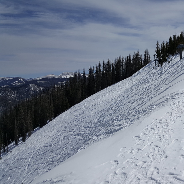
Snow map |  |  |  |  |  |  | ||||||||||
— | — | — | — | — | — | — | 2 | — | — | — | — | — | — | — | — | |
— | — | — | — | — | — | — | — | 3 | — | — | — | — | — | — | — | |
max °C | 7 | 11 | 12 | 7 | 7 | 8 | 6 | -1 | 4 | -2 | 4 | 6 | -1 | 5 | 7 | 2 |
min °C | 3 | 9 | 12 | 0 | 3 | 8 | 0 | -1 | 3 | -5 | 1 | 5 | -3 | 2 | 7 | -1 |
1 | 7 | 9 | -5 | -2 | 4 | -6 | -8 | -3 | -10 | -4 | 0 | -7 | -2 | 3 | -1 | |
40 | 24 | 17 | 30 | 41 | 29 | 38 | 57 | 52 | 62 | 42 | 26 | 52 | 33 | 20 | 47 | |
4150 | 4450 | 4750 | 4050 | 3850 | 4250 | 3850 | 3250 | 3900 | 2700 | 3600 | 4150 | 3100 | 3700 | 4200 | 3500 | |
— | 5:58 | — | — | 5:56 | — | — | 5:56 | — | — | 5:56 | — | — | 5:54 | — | — | |
— | — | 8:09 | — | — | 8:10 | — | — | 8:12 | — | — | 8:12 | — | — | 8:13 | — | |
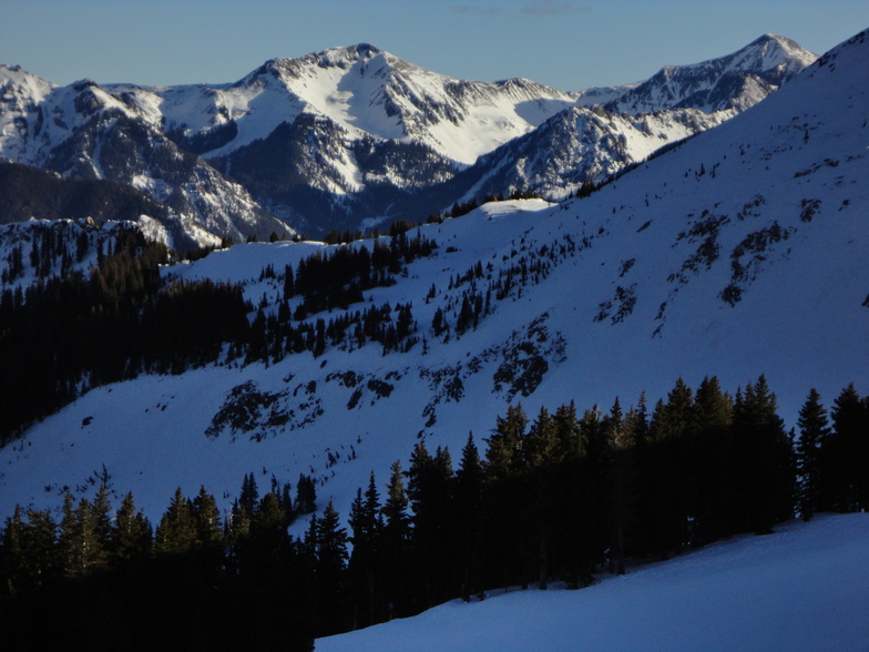
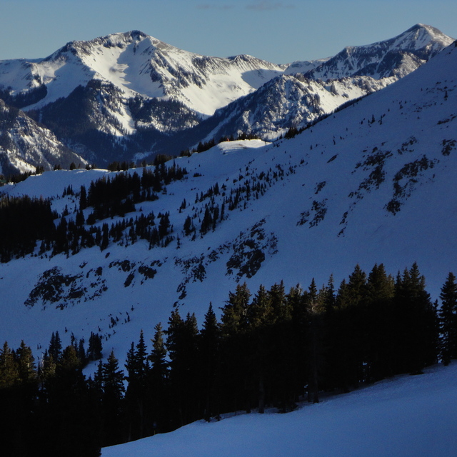
Latest snow reports near Wolf Creek Ski Area:
| Top snow depth: | — |
|---|---|
| Bottom snow depth: | — |
| Fresh snowfall depth: | — |
| Last snowfall: | 6 May 2026 |
| Snow Alerts | Create Alert |
0.4 | Bluebird Powder days Fresh snow, mostly sunny, light wind. |
|---|---|
0.1 | Powder days Fresh snow, limited sun, any wind. |
0.3 | Bluebird days Average snow, mostly sunny, light wind. |
The above table gives the weather forecast for Wolf Creek Ski Area at the specific elevation of 3384 m. Our sophisticated weather models allow us to provide snow forecasts for the top, middle and bottom ski stations of Wolf Creek Ski Area. To access the weather forecasts for the other elevations, use the tab navigation above the table. For a wider view of the weather, check out the Weather Map of United States.
Click here to read further information on freezing levels and how we forecast our temperatures.
Overall 3.3 Based on 15 votes and 3 reviews
Rode Wolfy (Wolf Creek Ski Area) w/ 24"+ and the snow was gorgeous: light, deep, and fun. The top of the entire mountain is a great playground with easy hikes to sick terrain, anything from steep glades to fun cornices to gnarly cliff hucks. But after the first 600-800 vertical feet, it becomes quite shallow in pitch and there are tons of holes or "flat-tracks". Not such a big deal for skiers but boarders are constantly skating to make it back to the lift. The glades below the rim can be fun if you keep your speed up, but considering they get the killer POW often you really have to work it, and there is no getting around the 'flat-tracks' to get you back to the lift. The Waterfall area is below the rim and has some great features but again, you will be skating or hiking out. Great snow, some great terrain, but overall lacking in a consistent vert and steep pitch to keep you smiling from top to bottom, the smile fades the further down the hill you go (unless you drop into the Waterfall area, but then it fades quickly as you hike/skate out of a hole). Cat tracks should now go uphill, and several here do. Not whining, just speaking as I find. Too much work to get out of runs, and if you don't hike the ridge it wouldn't be worth it IMHO.
snowavedave from United States writes:
Rode Wolfy (Wolf Creek Ski Area) w/ 24"+ and the snow was gorgeous: light, deep, and fun. The top of the entire mountain is a great playground with easy hikes to sick terrain, anything from steep glades to fun cornices to gnarly cliff hucks. But after the first 600-800 vertical feet, it becomes quite shallow in pitch and there are tons of holes or "flat-tracks". Not such a big deal for skiers but boarders are constantly skating to make it back to the lift.
The glades below the rim can be fun if you keep your speed up, but considering they get the killer POW often you really have to work it, and there is no getting around the 'flat-tracks' to get you back to the lift. The Waterfall area is below the rim and has some great features but again, you will be skating or hiking out.
Great snow, some great terrain, but overall lacking in a consistent vert and steep pitch to keep you smiling from top to bottom, the smile fades the further down the hill you go (unless you drop into the Waterfall area, but then it fades quickly as you hike/skate out of a hole). Cat tracks should now go uphill, and several here do.
Not whining, just speaking as I find. Too much work to get out of runs, and if you don't hike the ridge it wouldn't be worth it IMHO.
Read 2 more reviews of Wolf Creek Ski Area or submit your own


 Nearest