

Global Weekly Snow Roundup #318
Weekly Snow News for the world, updated 11 June 2026: Australia's season begins, Val d’Isère reopens and major snowfall is forecast for the Andes.

Next 3 days weather summary:Light rain (total 7.0mm), mostly falling on Thu morning. Very mild (max 16°C on Sat afternoon, min 3°C on Thu night). Wind will be generally light. | Days 4-6 weather summary:Mostly dry. Warm (max 22°C on Mon afternoon, min 6°C on Tue night). Wind will be generally light. | |||||||||||||||||
Thursday 11 | Friday 12 | Saturday 13 | Sunday 14 | Monday 15 | Tuesday 16 | |||||||||||||
AM | PM | night | AM | PM | night | AM | PM | night | AM | PM | night | AM | PM | night | AM | PM | night | |
light rain | some clouds | rain shwrs | t-storm risk | light rain | light rain | some clouds | rain shwrs | some clouds | clear | some clouds | some clouds | some clouds | some clouds | some clouds | clear | clear | clear | |
km/h | ||||||||||||||||||
Snow map | 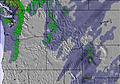 | 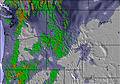 | 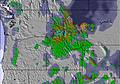 | 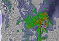 |  |  | ||||||||||||
— | — | — | — | — | — | — | — | — | — | — | — | — | — | — | — | — | — | |
1 | — | 1 | 1 | 1 | 1 | — | 2 | — | — | — | — | — | — | — | — | — | — | |
max °C | 11 | 13 | 9 | 12 | 15 | 11 | 14 | 16 | 13 | 18 | 21 | 17 | 20 | 22 | 17 | 19 | 20 | 15 |
min °C | 6 | 11 | 3 | 9 | 14 | 5 | 8 | 16 | 7 | 14 | 21 | 10 | 15 | 22 | 10 | 15 | 20 | 6 |
6 | 10 | 3 | 9 | 14 | 4 | 8 | 16 | 7 | 14 | 21 | 10 | 15 | 22 | 9 | 15 | 20 | 6 | |
58 | 44 | 72 | 51 | 33 | 85 | 51 | 40 | 57 | 32 | 27 | 52 | 37 | 32 | 54 | 33 | 28 | 77 | |
2650 | 2950 | 2700 | 2800 | 3150 | 2900 | 2900 | 3250 | 3350 | 3450 | 3950 | 3950 | 4150 | 4550 | 4350 | 3950 | 4050 | 3250 | |
4:41 | — | — | 4:41 | — | — | 4:41 | — | — | 4:41 | — | — | 4:41 | — | — | 4:41 | — | — | |
— | — | 8:53 | — | — | 8:54 | — | — | 8:54 | — | — | 8:55 | — | — | 8:55 | — | — | 8:57 | |
Go pro and carve into:
Avalanche information: Avalanche Canada
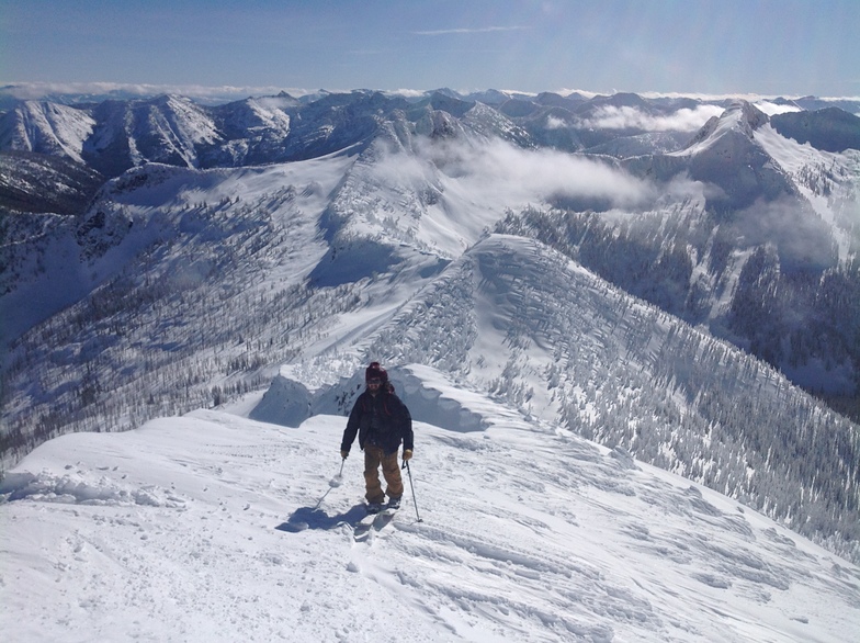
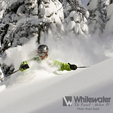
Latest snow reports near Whitewater:
| Top snow depth: | — |
|---|---|
| Bottom snow depth: | — |
| Fresh snowfall depth: | 3 cm |
| Last snowfall: | 9 Jun 2026 |
| Snow Alerts | Create Alert |
0.0 | Bluebird Powder days Fresh snow, mostly sunny, light wind. |
|---|---|
0.0 | Powder days Fresh snow, limited sun, any wind. |
0.0 | Bluebird days Average snow, mostly sunny, light wind. |
The above table gives the weather forecast for Whitewater at the specific elevation of 1605 m. Our sophisticated weather models allow us to provide snow forecasts for the top, middle and bottom ski stations of Whitewater. To access the weather forecasts for the other elevations, use the tab navigation above the table. For a wider view of the weather, check out the Weather Map of Canada.
Click here to read further information on freezing levels and how we forecast our temperatures.
Overall 3.2 Based on 86 votes and 34 reviews
I had the chance to ski Whitewater last week. I can only try to describe to you how I felt my heart open as we drove up the windy road to the base lodge. Whitewater is surely one of the last pristine untouched skiers paradises left. It's simplicity and grandness allows a person to connect with nature and challenge oneself to the limit. The divide between heaven and earth is almost indistinguishable. Everything about the environment is perfect. I thank you for honouring the integrity of the area and what Whitewater is about and hope that skiers for years to come have the opportunity to share in the sheer bliss of your heavenly hill. This is a special place on earth!
Laurie Clarke from Canada writes:
I had the chance to ski Whitewater last week. I can only try to describe to you how I felt my heart open as we drove up the windy road to the base lodge. Whitewater is surely one of the last pristine untouched skiers paradises left. It's simplicity and grandness allows a person to connect with nature and challenge oneself to the limit. The divide between heaven and earth is almost indistinguishable. Everything about the environment is perfect. I thank you for honouring the integrity of the area and what Whitewater is about and hope that skiers for years to come have the opportunity to share in the sheer bliss of your heavenly hill. This is a special place on earth!


 Nearest