

Global Weekly Snow Roundup #318
Weekly Snow News for the world, updated 11 June 2026: Australia's season begins, Val d’Isère reopens and major snowfall is forecast for the Andes.

Next 3 days weather summary:Heavy rain (total 38.0mm), heaviest during Fri night. Very mild (max 13°C on Sat afternoon, min 3°C on Fri morning). Winds increasing (light winds from the W on Fri morning, strong winds from the WNW by Sat afternoon). | Days 4-6 weather summary:Light rain (total 3.0mm), mostly falling on Mon morning. Very mild (max 15°C on Wed afternoon, min 5°C on Mon morning). Wind will be generally light. | |||||||||||||||||
Friday 12 | Saturday 13 | Sunday 14 | Monday 15 | Tuesday 16 | Wednesday 17 | |||||||||||||
AM | PM | night | AM | PM | night | AM | PM | night | AM | PM | night | AM | PM | night | AM | PM | night | |
light rain | mod. rain | heavy rain | rain shwrs | clear | rain shwrs | t-storm risk | t-storm risk | rain shwrs | rain shwrs | light rain | clear | some clouds | cloudy | some clouds | clear | some clouds | clear | |
km/h | ||||||||||||||||||
Snow map |  |  |  | 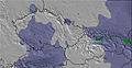 | 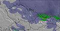 |  | ||||||||||||
— | — | — | — | — | — | — | — | — | — | — | — | — | — | — | — | — | — | |
4 | 8 | 13 | 2 | — | 3 | 1 | 4 | 3 | 1 | 2 | — | — | — | — | — | — | — | |
max °C | 4 | 6 | 7 | 10 | 13 | 12 | 9 | 11 | 8 | 6 | 8 | 7 | 9 | 11 | 9 | 12 | 15 | 13 |
min °C | 3 | 5 | 6 | 8 | 13 | 9 | 9 | 11 | 6 | 5 | 7 | 6 | 6 | 11 | 8 | 9 | 14 | 13 |
-1 | 1 | 2 | 4 | 10 | 6 | 6 | 8 | 2 | 1 | 3 | 3 | 4 | 10 | 8 | 9 | 14 | 13 | |
91 | 95 | 92 | 70 | 49 | 76 | 69 | 68 | 80 | 80 | 65 | 62 | 47 | 53 | 66 | 52 | 55 | 65 | |
2800 | 3100 | 3150 | 3150 | 3550 | 3400 | 3200 | 3300 | 3000 | 2900 | 2850 | 2850 | 3150 | 3450 | 3350 | 3700 | 3950 | 3950 | |
5:11 | — | — | 5:11 | — | — | 5:11 | — | — | 5:11 | — | — | 5:11 | — | — | 5:11 | — | — | |
— | — | 9:07 | — | — | 9:07 | — | — | 9:07 | — | — | 9:07 | — | — | 9:08 | — | — | 9:08 | |
Go pro and carve into:
Avalanche information: European Avalanche Warning Services (EAWS)
Latest snow reports near Waidring:
| Top snow depth: | — |
|---|---|
| Bottom snow depth: | — |
| Fresh snowfall depth: | — |
| Last snowfall: | 16 May 2026 |
| Snow Alerts | Create Alert |
0.0 | Bluebird Powder days Fresh snow, mostly sunny, light wind. |
|---|---|
0.0 | Powder days Fresh snow, limited sun, any wind. |
0.0 | Bluebird days Average snow, mostly sunny, light wind. |
The above table gives the weather forecast for Waidring at the specific elevation of 1900 m. Our sophisticated weather models allow us to provide snow forecasts for the top, middle and bottom ski stations of Waidring. To access the weather forecasts for the other elevations, use the tab navigation above the table. For a wider view of the weather, check out the Weather Map of Austria.
Click here to read further information on freezing levels and how we forecast our temperatures.
Overall 3.9 Based on 5 votes and 3 reviews
Steinplatte and the snow conditions are fantastic all season long. Warm and familiar hospitality with great food at Hotel Gasthof Sonnenbichl, 8 km. from Steinplatte. Visit them at hotelsonnen.com
Thomas from Hungary writes:
Steinplatte and the snow conditions are fantastic all season long.
Warm and familiar hospitality with great food at Hotel Gasthof Sonnenbichl, 8 km. from Steinplatte.
Visit them at hotelsonnen.com


 Nearest