

Global Weekly Snow Roundup #314
Weekly Global Snow News, updated 14 May 2026: Fresh snowfall in Argentina, Australia and Lesotho signals winter’s approach, while Japan maintains the world’s deepest snowpack.

Next 3 days weather summary:Light rain (total 2.0mm) at first, then becoming colder with a dusting of snow on Mon night. Freeze-thaw conditions (max 2°C on Sun afternoon, min -6°C on Sat morning). Wind will be generally light. | Days 4-6 weather summary:Some drizzle, heaviest during Tue afternoon. Very mild (max 11°C on Thu night, min 1°C on Tue morning). Wind will be generally light. | |||||||||||||||||
Saturday 16 | Sunday 17 | Monday 18 | Tuesday 19 | Wednesday 20 | Thursday 21 | |||||||||||||
AM | PM | night | AM | PM | night | AM | PM | night | AM | PM | night | AM | PM | night | AM | PM | night | |
snow shwrs | snow shwrs | clear | some clouds | some clouds | snow shwrs | light snow | light snow | light snow | cloudy | light rain | some clouds | clear | some clouds | some clouds | some clouds | clear | clear | |
km/h | ||||||||||||||||||
Snow map |  |  |  |  |  |  | ||||||||||||
— | — | — | — | — | — | — | 1 | 1 | — | — | — | — | — | — | — | — | — | |
— | — | — | — | — | — | — | 2 | — | — | 1 | — | — | — | — | — | — | — | |
max °C | -5 | -2 | 0 | 0 | 2 | 2 | 1 | 2 | 1 | 1 | 3 | 4 | 4 | 7 | 8 | 8 | 10 | 11 |
min °C | -6 | -5 | -2 | -1 | 2 | 1 | 0 | 1 | 0 | 1 | 2 | 3 | 4 | 6 | 7 | 8 | 9 | 10 |
-14 | -13 | -8 | -3 | 0 | -1 | -3 | -3 | -3 | -2 | -2 | -2 | -1 | 3 | 4 | 5 | 7 | 8 | |
89 | 70 | 48 | 51 | 76 | 70 | 77 | 78 | 79 | 88 | 88 | 70 | 73 | 65 | 51 | 46 | 43 | 31 | |
1300 | 1850 | 2000 | 2200 | 2450 | 2350 | 2300 | 2450 | 2350 | 2450 | 2800 | 3000 | 3150 | 3450 | 3750 | 3900 | 4050 | 4200 | |
6:07 | — | — | 6:07 | — | — | 6:05 | — | — | 6:03 | — | — | 6:03 | — | — | 6:01 | — | — | |
— | — | 9:00 | — | — | 9:00 | — | — | 9:02 | — | — | 9:04 | — | — | 9:05 | — | — | 9:06 | |
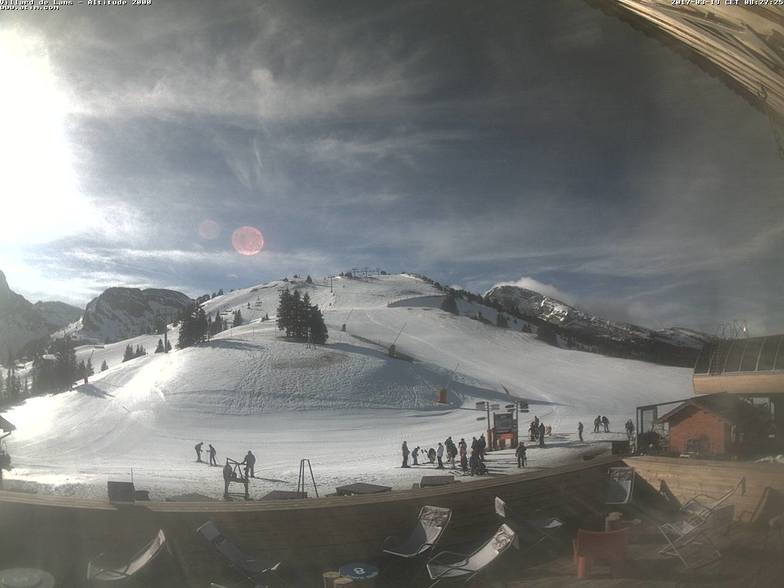
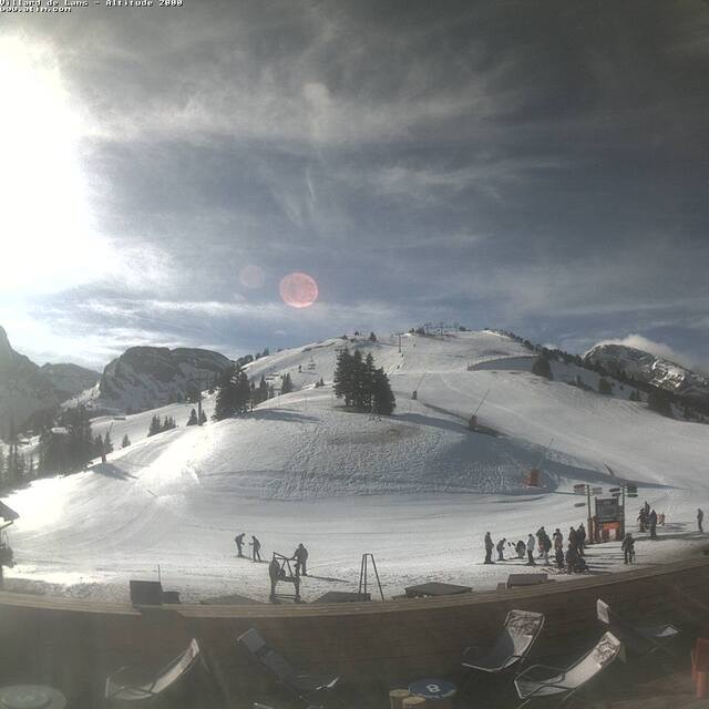
Latest snow reports near Villard-de-Lans:
| Top snow depth: | — |
|---|---|
| Bottom snow depth: | — |
| Fresh snowfall depth: | 9 cm |
| Last snowfall: | 15 May 2026 |
| Snow Alerts | Create Alert |
0.1 | Bluebird Powder days Fresh snow, mostly sunny, light wind. |
|---|---|
0.2 | Powder days Fresh snow, limited sun, any wind. |
0.2 | Bluebird days Average snow, mostly sunny, light wind. |
The above table gives the weather forecast for Villard-de-Lans at the specific elevation of 2171 m. Our sophisticated weather models allow us to provide snow forecasts for the top, middle and bottom ski stations of Villard-de-Lans. To access the weather forecasts for the other elevations, use the tab navigation above the table. For a wider view of the weather, check out the Weather Map of France.
Click here to read further information on freezing levels and how we forecast our temperatures.
Overall 4.2 Based on 18 votes and 10 reviews
Une station formidable ( neige, paysage ) mais une gestion déplorable par defaut de moyen. Beaucoup de remonté ouvre très tardivement car les responsables de la station font des économie de personnel. Il ouvre tout en week end mais la semaine encore une fois, le directeur prend ses clients pour des pigeons en ouvrant le moins de RM possible.
charle darlin from France writes:
Une station formidable ( neige, paysage ) mais une gestion déplorable par defaut de moyen. Beaucoup de remonté ouvre très tardivement car les responsables de la station font des économie de personnel. Il ouvre tout en week end mais la semaine encore une fois, le directeur prend ses clients pour des pigeons en ouvrant le moins de RM possible.


 Nearest