

Global Weekly Snow Roundup #314
Weekly Global Snow News, updated 14 May 2026: Fresh snowfall in Argentina, Australia and Lesotho signals winter’s approach, while Japan maintains the world’s deepest snowpack.

Next 3 days weather summary:Moderate rain (total 18.0mm), heaviest on Mon afternoon. Freeze-thaw conditions (max 11°C on Sun afternoon, min -1°C on Sat morning). Wind will be generally light. | Days 4-6 weather summary:Light rain (total 2.0mm), mostly falling on Tue afternoon. Very mild (max 19°C on Thu afternoon, min 4°C on Tue night). Wind will be generally light. | |||||||||||||||||
Saturday 16 | Sunday 17 | Monday 18 | Tuesday 19 | Wednesday 20 | Thursday 21 | |||||||||||||
AM | PM | night | AM | PM | night | AM | PM | night | AM | PM | night | AM | PM | night | AM | PM | night | |
snow shwrs | light rain | rain shwrs | some clouds | light rain | light rain | light rain | mod. rain | light rain | cloudy | light rain | cloudy | clear | some clouds | clear | clear | some clouds | clear | |
km/h | ||||||||||||||||||
Snow map |  |  |  |  |  |  | ||||||||||||
— | — | — | — | — | — | — | — | — | — | — | — | — | — | — | — | — | — | |
— | 2 | 1 | — | 2 | 4 | 1 | 6 | 2 | — | 2 | — | — | — | — | — | — | — | |
max °C | 3 | 6 | 4 | 8 | 11 | 6 | 8 | 8 | 7 | 9 | 10 | 8 | 14 | 16 | 13 | 16 | 19 | 15 |
min °C | -1 | 5 | -1 | 5 | 9 | 5 | 6 | 8 | 4 | 6 | 9 | 4 | 8 | 16 | 7 | 10 | 19 | 9 |
-5 | 3 | -1 | 5 | 9 | 5 | 6 | 8 | 3 | 6 | 8 | 2 | 7 | 16 | 6 | 10 | 19 | 9 | |
71 | 67 | 80 | 53 | 82 | 90 | 76 | 87 | 92 | 74 | 91 | 84 | 56 | 56 | 79 | 37 | 40 | 52 | |
1650 | 2000 | 1700 | 2400 | 2550 | 2250 | 2400 | 2450 | 2250 | 2600 | 2750 | 3050 | 3100 | 3350 | 3600 | 3650 | 3850 | 4050 | |
6:01 | — | — | 6:01 | — | — | 6:00 | — | — | 5:58 | — | — | 5:58 | — | — | 5:56 | — | — | |
— | — | 8:55 | — | — | 8:57 | — | — | 8:58 | — | — | 8:59 | — | — | 9:00 | — | — | 9:00 | |
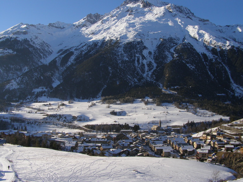
Latest snow reports near Val Cenis:
| Top snow depth: | — |
|---|---|
| Bottom snow depth: | — |
| Fresh snowfall depth: | 7 cm |
| Last snowfall: | 15 May 2026 |
| Snow Alerts | Create Alert |
0.0 | Bluebird Powder days Fresh snow, mostly sunny, light wind. |
|---|---|
0.0 | Powder days Fresh snow, limited sun, any wind. |
0.0 | Bluebird days Average snow, mostly sunny, light wind. |
The above table gives the weather forecast for Val Cenis at the specific elevation of 1400 m. Our sophisticated weather models allow us to provide snow forecasts for the top, middle and bottom ski stations of Val Cenis. To access the weather forecasts for the other elevations, use the tab navigation above the table. For a wider view of the weather, check out the Weather Map of France.
Click here to read further information on freezing levels and how we forecast our temperatures.
Overall 4.2 Based on 31 votes and 11 reviews
Val Cenis it was but now it's 'Grand Cenis' as there is a new link to Termignon which is well laid back and a great village to stay; French proper and that's it! Amazing scenery on the slopes and great characters in the village. Try Le Petite Farme, Marines bar and real France with the best Genepi in the Lion or go to France, not package holiday crap! Hugo.
hugo from France writes:
Val Cenis it was but now it's 'Grand Cenis' as there is a new link to Termignon which is well laid back and a great village to stay; French proper and that's it!
Amazing scenery on the slopes and great characters in the village. Try Le Petite Farme, Marines bar and real France with the best Genepi in the Lion or go to France, not package holiday crap!
Hugo.


 Nearest