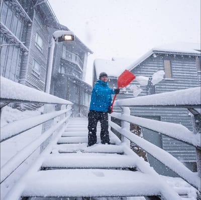
"March Madness" As Snowfall Hits Australia In Early Autumn
Winter made an early-season entrance in Australia overnight, with a polar blast from the Antarctic dumping up to 15cm of fresh snow on the slopes as temperatures tumbled to around -2.C.


Val d'Ultimo/Schwemmalm Weather (Next 3 days): The snow forecast for Val d'Ultimo/Schwemmalm is: Mostly dry. Freeze-thaw conditions (max 1°C on Sat afternoon, min -7°C on Wed night). Wind will be generally light.
Val d'Ultimo/Schwemmalm Weather (Days 4-6): Some drizzle, heaviest during Tue afternoon. Freeze-thaw conditions (max 3°C on Sun afternoon, min -1°C on Sat night). Wind will be generally light.
| Resort | Snow Depth | Temp. (°C) | Wind (km/h) | Weather | ||
|---|---|---|---|---|---|---|
| Top Lift: | 1.0 m | -6 | ||||
| Middle Lift: | -5 | |||||
| Bottom Lift: | 0.5 m | -5 |

Thursday 2 | Friday 3 | Saturday 4 | Sunday 5 | Monday 6 | ||||||||||||
night | AM | PM | night | AM | PM | night | AM | PM | night | AM | PM | night | AM | PM | night | |
clear | some clouds | cloudy | clear | clear | clear | clear | clear | some clouds | some clouds | clear | some clouds | some clouds | some clouds | some clouds | snow shwrs | |
km/h | ||||||||||||||||
Snow map |  |  |  |  |  |  | ||||||||||
— | — | — | — | — | — | — | — | — | — | — | — | — | — | — | — | |
— | — | — | — | — | — | — | — | — | — | — | — | — | — | — | — | |
max °C | -6 | -4 | -4 | -6 | -4 | -3 | -3 | -1 | 1 | 0 | 2 | 3 | 2 | 2 | 3 | 2 |
min °C | -7 | -5 | -5 | -6 | -6 | -3 | -4 | -3 | 0 | -1 | 0 | 3 | 1 | 1 | 3 | 1 |
-11 | -10 | -9 | -11 | -10 | -6 | -7 | -6 | 0 | -3 | -2 | 3 | -1 | -1 | 3 | 1 | |
39 | 44 | 84 | 64 | 53 | 63 | 35 | 53 | 69 | 66 | 39 | 49 | 63 | 43 | 72 | 64 | |
900 | 2000 | 2100 | 1050 | 2050 | 2300 | 1500 | 2450 | 2700 | 2450 | 2950 | 3050 | 2800 | 2900 | 2950 | 2800 | |
— | 6:54 | — | — | 6:52 | — | — | 6:50 | — | — | 6:48 | — | — | 6:47 | — | — | |
— | — | 7:45 | — | — | 7:46 | — | — | 7:47 | — | — | 7:49 | — | — | 7:51 | — | |
Mostly dry. Freeze-thaw conditions (max 1°C on Sat afternoon, min -7°C on Wed night). Wind will be generally light.
Some drizzle, heaviest during Tue afternoon. Freeze-thaw conditions (max 3°C on Sun afternoon, min -1°C on Sat night). Wind will be generally light.
Latest snow reports near Val d'Ultimo/Schwemmalm:
Snowing at Obergurgl. from Obergurgl
| Top snow depth: | 95 cm |
|---|---|
| Bottom snow depth: | 50 cm |
| Fresh snowfall depth: | — |
| Last snowfall: | 30 Mar 2026 |
| Snow Alerts | Create Alert |
0.6 | Bluebird Powder days Fresh snow, mostly sunny, light wind. |
|---|---|
1.3 | Powder days Fresh snow, limited sun, any wind. |
2.0 | Bluebird days Average snow, mostly sunny, light wind. |
The above table gives the weather forecast for Val d'Ultimo/Schwemmalm at the specific elevation of 2625 m. Our sophisticated weather models allow us to provide snow forecasts for the top, middle and bottom ski stations of Val d'Ultimo/Schwemmalm. To access the weather forecasts for the other elevations, use the tab navigation above the table. For a wider view of the weather, check out the Weather Map of Italy.
Click here to read further information on freezing levels and how we forecast our temperatures.
Resort name is also written as Ultental-Schwemmalm.


 Nearest