

Global Weekly Snow Roundup #314
Weekly Global Snow News, updated 14 May 2026: Fresh snowfall in Argentina, Australia and Lesotho signals winter’s approach, while Japan maintains the world’s deepest snowpack.

Next 3 days weather summary:Mostly dry. Freeze-thaw conditions (max 2°C on Sat morning, min -1°C on Sun night). Wind will be generally light. | Days 4-6 weather summary:Mostly dry. Freeze-thaw conditions (max 6°C on Thu afternoon, min 0°C on Tue morning). Wind will be generally light. | |||||||||||||||||
Saturday 16 | Sunday 17 | Monday 18 | Tuesday 19 | Wednesday 20 | Thursday 21 | |||||||||||||
AM | PM | night | AM | PM | night | AM | PM | night | AM | PM | night | AM | PM | night | AM | PM | night | |
clear | clear | clear | clear | clear | clear | clear | some clouds | clear | clear | clear | clear | clear | clear | clear | clear | some clouds | clear | |
km/h | ||||||||||||||||||
Snow map |  |  |  |  |  |  | ||||||||||||
— | — | — | — | — | — | — | — | — | — | — | — | — | — | — | — | — | — | |
— | — | — | — | — | — | — | — | — | — | — | — | — | — | — | — | — | — | |
max °C | 2 | 1 | 1 | 0 | 0 | 0 | 0 | 0 | -1 | 0 | 1 | 2 | 3 | 4 | 5 | 5 | 6 | 6 |
min °C | 2 | 1 | 0 | 0 | 0 | -1 | -1 | 0 | -1 | 0 | 1 | 2 | 3 | 4 | 4 | 5 | 5 | 5 |
-2 | -3 | -4 | -5 | -4 | -5 | -5 | -2 | -1 | 0 | 1 | 2 | 2 | 4 | 2 | 3 | 2 | 1 | |
23 | 33 | 30 | 45 | 56 | 51 | 59 | 56 | 56 | 45 | 43 | 30 | 17 | 28 | 15 | 12 | 22 | 11 | |
2650 | 2600 | 2550 | 2250 | 2350 | 2250 | 2100 | 2350 | 2200 | 2300 | 2500 | 2800 | 3150 | 3300 | 3400 | 3500 | 3550 | 3700 | |
7:13 | — | — | 7:15 | — | — | 7:16 | — | — | 7:16 | — | — | 7:18 | — | — | 7:18 | — | — | |
— | 5:13 | — | — | 5:12 | — | — | 5:10 | — | — | 5:10 | — | — | 5:09 | — | — | 5:08 | — | |
Latest snow reports near Turoa:
| Top snow depth: | 0 cm |
|---|---|
| Bottom snow depth: | 0 cm |
| Fresh snowfall depth: | — |
| Last snowfall: | 21 Apr 2026 |
| Snow Alerts | Create Alert |
0.5 | Bluebird Powder days Fresh snow, mostly sunny, light wind. |
|---|---|
0.8 | Powder days Fresh snow, limited sun, any wind. |
1.1 | Bluebird days Average snow, mostly sunny, light wind. |
The above table gives the weather forecast for Turoa at the specific elevation of 2322 m. Our sophisticated weather models allow us to provide snow forecasts for the top, middle and bottom ski stations of Turoa. To access the weather forecasts for the other elevations, use the tab navigation above the table. For a wider view of the weather, check out the Weather Map of New Zealand.
Click here to read further information on freezing levels and how we forecast our temperatures.
Overall 3.6 Based on 60 votes and 40 reviews
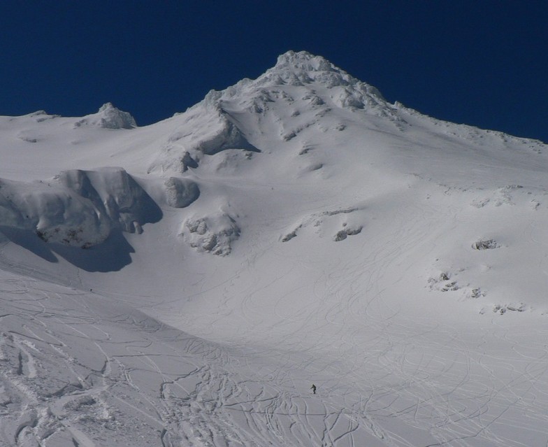
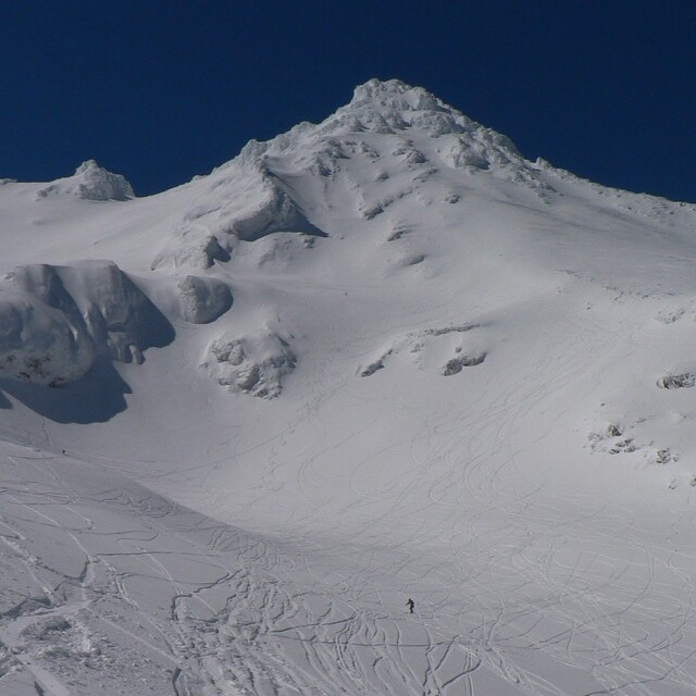
Ruapehu is a volcano which means it has wicked terrain, Turoa on the south side is awesome. There is loads of off-trail terrain to explore with plenty of fun and interesting on trail runs. It is also a great spot for learning as there are lots of runs and some areas where it is quite wide. They also have a park (or parks if you're lucky) set up most of the time. It is a tricky maunga (mountain) to plan for as the weather can change at any time. It's best to stay in the area for a week or plan trips last minute (literally the night before) to score epic days.
April from New Zealand writes:
Ruapehu is a volcano which means it has wicked terrain, Turoa on the south side is awesome.
There is loads of off-trail terrain to explore with plenty of fun and interesting on trail runs.
It is also a great spot for learning as there are lots of runs and some areas where it is quite wide. They also have a park (or parks if you're lucky) set up most of the time.
It is a tricky maunga (mountain) to plan for as the weather can change at any time. It's best to stay in the area for a week or plan trips last minute (literally the night before) to score epic days.


 Nearest