


Global Weekly Snow Roundup #314
Weekly Global Snow News, updated 14 May 2026: Fresh snowfall in Argentina, Australia and Lesotho signals winter’s approach, while Japan maintains the world’s deepest snowpack.

Next 3 days weather summary:Light rain (total 3.0mm), mostly falling on Fri afternoon. Very mild (max 16°C on Sat afternoon, min 8°C on Fri afternoon). Winds increasing (calm on Fri afternoon, strong winds from the WSW by Sat night). | Days 4-6 weather summary:Heavy rain (total 22.0mm), heaviest during Wed night. Warm (max 24°C on Tue afternoon, min 5°C on Thu morning). Winds decreasing (strong winds from the W on Tue night, light winds from the WNW by Wed night). | ||||||||||||||||
Fri 15 | Saturday 16 | Sunday 17 | Monday 18 | Tuesday 19 | Wednesday 20 | ||||||||||||
PM | night | AM | PM | night | AM | PM | night | AM | PM | night | AM | PM | night | AM | PM | night | |
light rain | some clouds | some clouds | some clouds | rain shwrs | clear | some clouds | some clouds | cloudy | some clouds | some clouds | rain shwrs | some clouds | rain shwrs | risk thun- der | risk thun- der | heavy rain | |
km/h | |||||||||||||||||
Snow map | 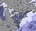 |  |  |  |  |  | |||||||||||
— | — | — | — | — | — | — | — | — | — | — | — | — | — | — | — | — | |
1 | — | — | — | 2 | — | — | — | — | — | — | 1 | — | 1 | 3 | 3 | 14 | |
max °C | 8 | 8 | 11 | 16 | 14 | 13 | 15 | 12 | 16 | 22 | 20 | 20 | 24 | 21 | 19 | 21 | 18 |
min °C | 8 | 8 | 9 | 14 | 12 | 12 | 14 | 10 | 14 | 18 | 18 | 19 | 23 | 18 | 18 | 21 | 10 |
7 | 7 | 7 | 12 | 9 | 9 | 12 | 7 | 13 | 17 | 17 | 18 | 23 | 17 | 17 | 21 | 7 | |
90 | 91 | 51 | 55 | 82 | 70 | 68 | 71 | 66 | 64 | 80 | 69 | 55 | 81 | 82 | 71 | 98 | |
2400 | 2800 | 3150 | 3450 | 3450 | 2800 | 3400 | 3750 | 3700 | 4150 | 4150 | 4250 | 4200 | 4100 | 4050 | 3800 | 3650 | |
— | — | 5:24 | — | — | 5:22 | — | — | 5:22 | — | — | 5:20 | — | — | 5:20 | — | — | |
— | 8:09 | — | — | 8:12 | — | — | 8:13 | — | — | 8:14 | — | — | 8:15 | — | — | 8:15 | |
Latest snow reports near Sugarbush:
| Top snow depth: | 0 cm |
|---|---|
| Bottom snow depth: | 0 cm |
| Fresh snowfall depth: | — |
| Last snowfall: | 2 May 2026 |
| Snow Alerts | Create Alert |
0.0 | Bluebird Powder days Fresh snow, mostly sunny, light wind. |
|---|---|
0.1 | Powder days Fresh snow, limited sun, any wind. |
0.1 | Bluebird days Average snow, mostly sunny, light wind. |
The above table gives the weather forecast for Sugarbush at the specific elevation of 856 m. Our sophisticated weather models allow us to provide snow forecasts for the top, middle and bottom ski stations of Sugarbush. To access the weather forecasts for the other elevations, use the tab navigation above the table. For a wider view of the weather, check out the Weather Map of United States.
Click here to read further information on freezing levels and how we forecast our temperatures.
Overall 4.1 Based on 20 votes and 10 reviews
There are several areas throughout the northeast with more artificial snow, more restaurants and more places to shop, but none are as beautiful as Sugarbush and it's neighbor, Mad River Glen. While plenty of trails have snow-making, it's the abundance of natural snow trails and skiable woods that distinguish Sugarbush from the rest. The conditions on natural snow trails are more variable, of course, but they haven't been widened, bulldozed and spoiled with equipment. It's a tradeoff that's particularly evident when you ski at Sugarbush. The local towns of Warren and Waitsfield offer a similar contrast with other resort areas. There's no big walkable concentration of shops and restaurants here, but there's no traffic or even a single traffic light either. The Mad River Valley is quintessential Vermont with all its natural splendor and quirks.
David Ross from United States writes:
There are several areas throughout the northeast with more artificial snow, more restaurants and more places to shop, but none are as beautiful as Sugarbush and it's neighbor, Mad River Glen. While plenty of trails have snow-making, it's the abundance of natural snow trails and skiable woods that distinguish Sugarbush from the rest. The conditions on natural snow trails are more variable, of course, but they haven't been widened, bulldozed and spoiled with equipment. It's a tradeoff that's particularly evident when you ski at Sugarbush. The local towns of Warren and Waitsfield offer a similar contrast with other resort areas. There's no big walkable concentration of shops and restaurants here, but there's no traffic or even a single traffic light either. The Mad River Valley is quintessential Vermont with all its natural splendor and quirks.


 Nearest