


Global Weekly Snow Roundup #314
Weekly Global Snow News, updated 14 May 2026: Fresh snowfall in Argentina, Australia and Lesotho signals winter’s approach, while Japan maintains the world’s deepest snowpack.

Next 4 days weather summary:Light rain (total 4.0mm), mostly falling on Sun night. Warm (max 21°C on Sun afternoon, min 13°C on Fri night). Wind will be generally light. | Days 5-7 weather summary:Moderate rain (total 10.0mm), heaviest on Wed night. Warm (max 21°C on Tue afternoon, min 15°C on Thu morning). Winds decreasing (fresh winds from the S on Mon night, calm by Wed night). | |||||||||||||||
Saturday 16 | Sunday 17 | Monday 18 | Tuesday 19 | Wednesday 20 | ||||||||||||
night | AM | PM | night | AM | PM | night | AM | PM | night | AM | PM | night | AM | PM | night | |
clear | clear | some clouds | cloudy | cloudy | some clouds | rain shwrs | clear | clear | clear | clear | clear | some clouds | some clouds | some clouds | rain shwrs | |
km/h | ||||||||||||||||
Snow map | 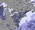 |  |  |  |  |  | ||||||||||
— | — | — | — | — | — | — | — | — | — | — | — | — | — | — | — | |
— | — | — | — | — | — | 4 | — | — | — | — | — | — | — | — | 3 | |
max °C | 15 | 16 | 19 | 17 | 18 | 21 | 18 | 18 | 21 | 19 | 19 | 21 | 19 | 19 | 21 | 18 |
min °C | 13 | 15 | 19 | 16 | 16 | 21 | 17 | 17 | 20 | 17 | 18 | 21 | 18 | 18 | 20 | 17 |
13 | 15 | 19 | 16 | 16 | 21 | 16 | 16 | 20 | 16 | 18 | 21 | 18 | 18 | 20 | 17 | |
32 | 47 | 48 | 54 | 54 | 40 | 66 | 68 | 45 | 51 | 42 | 38 | 48 | 48 | 57 | 68 | |
4050 | 4200 | 3900 | 4150 | 4100 | 4050 | 4200 | 4200 | 4050 | 4350 | 4300 | 4200 | 4200 | 4100 | 4050 | 4150 | |
— | 6:20 | — | — | 6:18 | — | — | 6:18 | — | — | 6:18 | — | — | 6:16 | — | — | |
— | — | — | 8:27 | — | — | 8:27 | — | — | 8:28 | — | — | 8:29 | — | — | 8:30 | |
Latest snow reports near Sugar Mountain:
| Top snow depth: | — |
|---|---|
| Bottom snow depth: | — |
| Fresh snowfall depth: | — |
| Last snowfall: | 19 Apr 2026 |
| Snow Alerts | Create Alert |
0.0 | Bluebird Powder days Fresh snow, mostly sunny, light wind. |
|---|---|
0.0 | Powder days Fresh snow, limited sun, any wind. |
0.0 | Bluebird days Average snow, mostly sunny, light wind. |
The above table gives the weather forecast for Sugar Mountain at the specific elevation of 1432 m. Our sophisticated weather models allow us to provide snow forecasts for the top, middle and bottom ski stations of Sugar Mountain. To access the weather forecasts for the other elevations, use the tab navigation above the table. For a wider view of the weather, check out the Weather Map of United States.
Click here to read further information on freezing levels and how we forecast our temperatures.
Overall 2.4 Based on 5 votes and 5 reviews
I was sent this web address to finally express my absolute disgust for what has become a "culture" at Sugar Ski Area in NC. The gross discrepancies in base snow depth reported by this owner has gone on for years and there is little anyone has done to stop this outrageous behavior. Example? January 2024. If you look at their website they are reporting a base of up to 70 inches! Are you kidding? My go-to Colorado resort is reporting a base of only 12 inches. Honest! a base of 70 inches would be many of the largest ski areas in Colorado, Utah and Cali combined! Consider a young family, perhaps new to skiing decides to go to Sugar Ski Area. The huge expense associated with a ski vacation is well known. Now to get to Sugar and see grass, especially on the tube sliding hill. Almost the snow has been man made and it is skimpy at best. 70 inches? It's deceitful and should not be allowed to continue year after year. If you call the area you will quickly learn that the staff is under orders not to divulge any info that may lead to the truth as to current conditions. I appreciate this forum to report this outrage. If you are a newbie to skiing, stay away! The nearby hill of Beech is not much better in the honesty department. Want to go skiing? Never Sugar Ski Area.
Oldest Dude from United States writes:
I was sent this web address to finally express my absolute disgust for what has become a "culture" at Sugar Ski Area in NC. The gross discrepancies in base snow depth reported by this owner has gone on for years and there is little anyone has done to stop this outrageous behavior. Example? January 2024. If you look at their website they are reporting a base of up to 70 inches! Are you kidding? My go-to Colorado resort is reporting a base of only 12 inches. Honest!
a base of 70 inches would be many of the largest ski areas in Colorado, Utah and Cali combined!
Consider a young family, perhaps new to skiing decides to go to Sugar Ski Area. The huge expense associated with a ski vacation is well known. Now to get to Sugar and see grass, especially on the tube sliding hill. Almost the snow has been man made and it is skimpy at best. 70 inches? It's deceitful and should not be allowed to continue year after year. If you call the area you will quickly learn that the staff is under orders not to divulge any info that may lead to the truth as to current conditions.
I appreciate this forum to report this outrage. If you are a newbie to skiing, stay away! The nearby hill of Beech is not much better in the honesty department.
Want to go skiing? Never Sugar Ski Area.


 Nearest