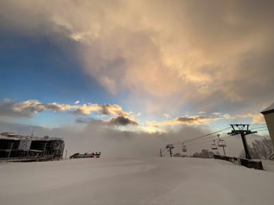
Japan Weekly Snow Roundup #304
Weekly Snow News for Japan, updated 4 March 2026: Japan's ski season transitions to spring, with Hokkaido's powder still reliable but Honshu seeing warmer temperatures, rain, and softening snow.


Steinberg am Rofan Weather (Next 3 days): The snow forecast for Steinberg am Rofan is: Mostly dry. Very mild (max 11°C on Fri morning, min 6°C on Thu night). Wind will be generally light.
Steinberg am Rofan Weather (Days 4-6): Light rain (total 9.0mm), mostly falling on Mon afternoon. Very mild (max 10°C on Mon afternoon, min 5°C on Tue night). Wind will be generally light.
| Resort | Snow Depth | Temp. (°C) | Wind (km/h) | Weather | ||
|---|---|---|---|---|---|---|
| Top Lift: | 0.0 m | 7 | ||||
| Bottom Lift: | 0.0 m | 2 |

Friday 6 | Saturday 7 | Sunday 8 | Monday 9 | Tuesday 10 | ||||||||||||
night | AM | PM | night | AM | PM | night | AM | PM | night | AM | PM | night | AM | PM | night | |
some clouds | clear | clear | clear | clear | clear | clear | some clouds | some clouds | some clouds | cloudy | rain shwrs | some clouds | rain shwrs | rain shwrs | light rain | |
km/h | ||||||||||||||||
Snow map |  |  |  |  |  |  | ||||||||||
— | — | — | — | — | — | — | — | — | — | — | — | — | — | — | — | |
— | — | — | — | — | — | — | — | — | — | — | 2 | — | 1 | 2 | 2 | |
max °C | 7 | 11 | 11 | 8 | 11 | 11 | 7 | 10 | 9 | 7 | 8 | 10 | 7 | 10 | 9 | 7 |
min °C | 6 | 9 | 9 | 6 | 8 | 8 | 6 | 7 | 8 | 6 | 7 | 8 | 6 | 7 | 8 | 5 |
4 | 8 | 9 | 5 | 8 | 8 | 6 | 7 | 8 | 5 | 7 | 8 | 5 | 7 | 8 | 5 | |
49 | 36 | 41 | 55 | 54 | 50 | 74 | 67 | 68 | 75 | 63 | 55 | 62 | 63 | 63 | 73 | |
2650 | 2650 | 2750 | 2750 | 2600 | 2700 | 2400 | 2350 | 2400 | 2250 | 2100 | 2300 | 2200 | 2150 | 2300 | 2100 | |
— | 6:43 | — | — | 6:41 | — | — | 6:39 | — | — | 6:37 | — | — | 6:35 | — | — | |
— | — | 6:04 | — | — | 6:05 | — | — | 6:07 | — | — | 6:07 | — | — | 6:09 | — | |
Mostly dry. Very mild (max 11°C on Fri morning, min 6°C on Thu night). Wind will be generally light.
Light rain (total 9.0mm), mostly falling on Mon afternoon. Very mild (max 10°C on Mon afternoon, min 5°C on Tue night). Wind will be generally light.
Latest snow reports near Steinberg am Rofan:
TODAY: Retro Week (2.–7.) in Itter & Hopfgarten with LIVE MUSIC at various huts. -> Need a retro outfit? You'll find what you're looking for at the pop-up store at KRAFTalm. There will also be LIVE MUSIC in Westendorf, Ellmau + Söll and a ski touring evening in Ellmau TOMORROW, Friday: Early bird start from 7:30 a.m. in SkiWelt Westendorf + Brixen WED-SAT: NIGHT SKIING in Söll | NIGHT TOBOGGANING in Söll + Going from Westendorf
| Top snow depth: | 0 cm |
|---|---|
| Bottom snow depth: | 0 cm |
| Fresh snowfall depth: | — |
| Last snowfall: | 23 Feb 2026 |
| Snow Alerts | Create Alert |
0.1 | Bluebird Powder days Fresh snow, mostly sunny, light wind. |
|---|---|
0.8 | Powder days Fresh snow, limited sun, any wind. |
0.2 | Bluebird days Average snow, mostly sunny, light wind. |
The above table gives the weather forecast for Steinberg am Rofan at the specific elevation of 1150 m. Our sophisticated weather models allow us to provide snow forecasts for the top, middle and bottom ski stations of Steinberg am Rofan. To access the weather forecasts for the other elevations, use the tab navigation above the table. For a wider view of the weather, check out the Weather Map of Austria.
Click here to read further information on freezing levels and how we forecast our temperatures.


 Nearest