

Global Weekly Snow Roundup #314
Weekly Global Snow News, updated 14 May 2026: Fresh snowfall in Argentina, Australia and Lesotho signals winter’s approach, while Japan maintains the world’s deepest snowpack.

Next 3 days weather summary:A dusting of snow giving way to moderate rain (total 17.0mm) heaviest on Mon night. Freeze-thaw conditions (max 7°C on Mon afternoon, min -3°C on Sat morning). Wind will be generally light. | Days 4-6 weather summary:Heavy rain (total 25.0mm), heaviest during Tue night. Very mild (max 10°C on Thu afternoon, min 3°C on Tue morning). Wind will be generally light. | |||||||||||||||||
Saturday 16 | Sunday 17 | Monday 18 | Tuesday 19 | Wednesday 20 | Thursday 21 | |||||||||||||
AM | PM | night | AM | PM | night | AM | PM | night | AM | PM | night | AM | PM | night | AM | PM | night | |
light snow | light snow | snow shwrs | clear | light rain | rain shwrs | some clouds | risk thun- der | heavy rain | light rain | light rain | light rain | light rain | rain shwrs | mod. rain | light rain | rain shwrs | rain shwrs | |
km/h | ||||||||||||||||||
Snow map |  |  |  |  |  |  | ||||||||||||
3 | 1 | — | — | — | — | — | — | — | — | — | — | — | — | — | — | — | — | |
— | — | — | — | 1 | 1 | — | 3 | 12 | 1 | 2 | 5 | 3 | 3 | 6 | 2 | 2 | 1 | |
max °C | -2 | -1 | 0 | 2 | 5 | 5 | 5 | 7 | 3 | 5 | 6 | 5 | 5 | 6 | 6 | 6 | 10 | 8 |
min °C | -3 | -1 | 0 | 0 | 4 | 4 | 4 | 6 | 2 | 3 | 5 | 4 | 5 | 4 | 5 | 5 | 8 | 8 |
-9 | -4 | -3 | -2 | 4 | 4 | 4 | 5 | 0 | 3 | 3 | 4 | 2 | 0 | 2 | 2 | 7 | 7 | |
98 | 96 | 80 | 67 | 64 | 67 | 66 | 76 | 87 | 80 | 84 | 94 | 93 | 88 | 88 | 84 | 65 | 84 | |
1350 | 1600 | 1700 | 1950 | 2250 | 2300 | 2400 | 2500 | 2200 | 2400 | 2550 | 2500 | 2450 | 2600 | 2550 | 2600 | 2950 | 3000 | |
5:33 | — | — | 5:33 | — | — | 5:31 | — | — | 5:30 | — | — | 5:28 | — | — | 5:28 | — | — | |
— | — | 8:43 | — | — | 8:45 | — | — | 8:45 | — | — | 8:46 | — | — | 8:47 | — | — | 8:50 | |
Latest snow reports near Spitzingsee:
| Top snow depth: | 0 cm |
|---|---|
| Bottom snow depth: | 0 cm |
| Fresh snowfall depth: | 9 cm |
| Last snowfall: | 15 May 2026 |
| Snow Alerts | Create Alert |
0.0 | Bluebird Powder days Fresh snow, mostly sunny, light wind. |
|---|---|
0.3 | Powder days Fresh snow, limited sun, any wind. |
0.0 | Bluebird days Average snow, mostly sunny, light wind. |
The above table gives the weather forecast for Spitzingsee at the specific elevation of 1693 m. Our sophisticated weather models allow us to provide snow forecasts for the top, middle and bottom ski stations of Spitzingsee. To access the weather forecasts for the other elevations, use the tab navigation above the table. For a wider view of the weather, check out the Weather Map of Germany.
Click here to read further information on freezing levels and how we forecast our temperatures.
Overall 3.2 Based on 10 votes and 1 review
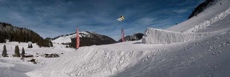
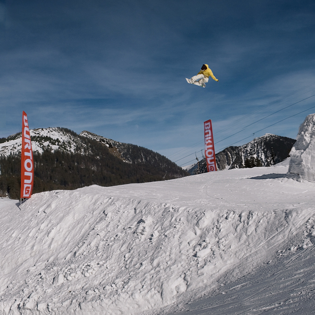
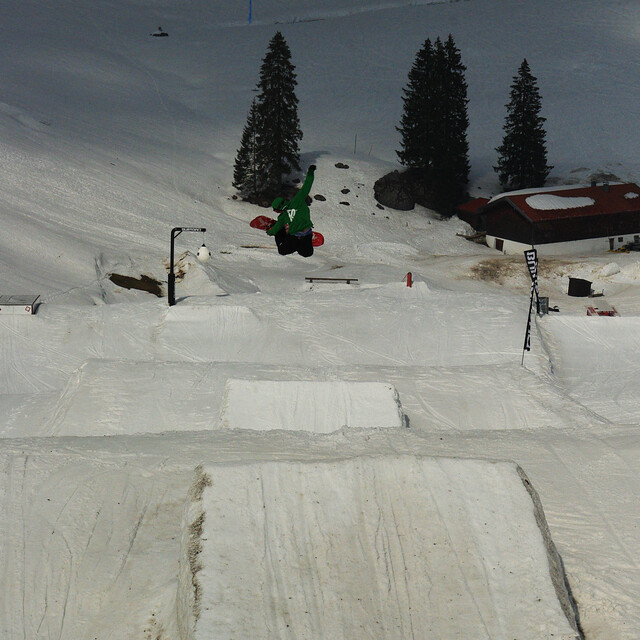
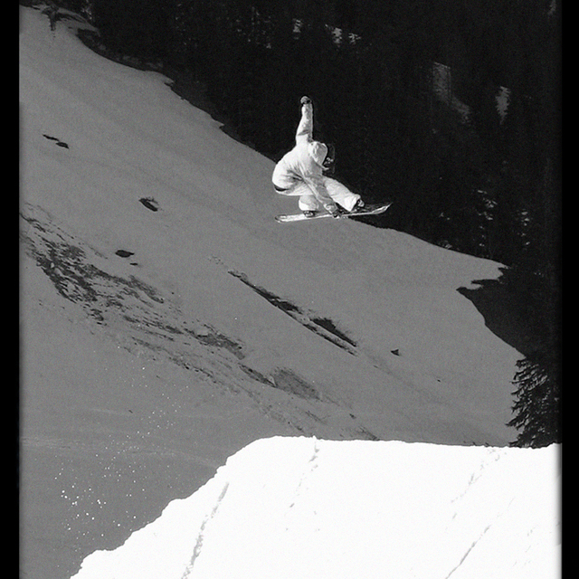
As Spitzingsee is only 40 minutes from the centre of Munich it´s getting crowded on week-ends. But they got 2 new big chair lift´s that work pretty well. However, be aware of heavy traffic-jams all the way from/to Munich. It is the first mountain range getting hit from the snow clouds arriving from the north, unloading large amounts of snow regularly and offsetting the lack of altitude (this fits for all German alpine resorts. At mid-winter usually the 2000m high Nebelhorn near Oberstdorf f.e. offers more snow than the 3000m high Sölden area located south in Austria). Spitzingsee isn´t very big but works well for a 1 or 2 day trip. If you´re planning to stay longer think about buying the 'Alpenplus card' covering all nearby resorts, even some smaller Austrian spots. Unusual for a resort of this size, Spitzingsee offers a very good snow park for all levels, even pros find they are challenged on well shaped 20+ meter jumps. Expect a big variation of jumps and rails, but no half-pipe.
ridR from Germany writes:
As Spitzingsee is only 40 minutes from the centre of Munich it´s getting crowded on week-ends. But they got 2 new big chair lift´s that work pretty well. However, be aware of heavy traffic-jams all the way from/to Munich.
It is the first mountain range getting hit from the snow clouds arriving from the north, unloading large amounts of snow regularly and offsetting the lack of altitude (this fits for all German alpine resorts. At mid-winter usually the 2000m high Nebelhorn near Oberstdorf f.e. offers more snow than the 3000m high Sölden area located south in Austria).
Spitzingsee isn´t very big but works well for a 1 or 2 day trip. If you´re planning to stay longer think about buying the 'Alpenplus card' covering all nearby resorts, even some smaller Austrian spots.
Unusual for a resort of this size, Spitzingsee offers a very good snow park for all levels, even pros find they are challenged on well shaped 20+ meter jumps. Expect a big variation of jumps and rails, but no half-pipe.


 Nearest