

Global Weekly Snow Roundup #314
Weekly Global Snow News, updated 14 May 2026: Fresh snowfall in Argentina, Australia and Lesotho signals winter’s approach, while Japan maintains the world’s deepest snowpack.

Next 4 days weather summary:A dusting of new snow. Temperatures will be below freezing (max -1°C on Sun afternoon, min -9°C on Fri night). Wind will be generally light. | Days 5-7 weather summary:A dusting of new snow. Freeze-thaw conditions (max 7°C on Thu afternoon, min -3°C on Mon night). Wind will be generally light. | |||||||||||||||
Saturday 16 | Sunday 17 | Monday 18 | Tuesday 19 | Wednesday 20 | ||||||||||||
night | AM | PM | night | AM | PM | night | AM | PM | night | AM | PM | night | AM | PM | night | |
light snow | some clouds | light snow | some clouds | some clouds | light snow | light snow | light snow | light snow | light snow | some clouds | some clouds | cloudy | cloudy | some clouds | some clouds | |
km/h | ||||||||||||||||
Snow map |  |  |  |  |  |  | ||||||||||
— | — | — | — | — | — | 2 | — | 2 | 1 | — | — | — | — | — | — | |
— | — | — | — | — | — | — | — | — | — | — | — | — | — | — | — | |
max °C | -9 | -8 | -6 | -4 | -3 | -1 | -2 | -3 | -2 | -2 | 0 | 1 | 1 | 1 | 2 | 2 |
min °C | -9 | -9 | -6 | -6 | -4 | -1 | -4 | -4 | -2 | -3 | -1 | 0 | 0 | 1 | 2 | 1 |
-17 | -17 | -12 | -10 | -4 | -3 | -4 | -4 | -5 | -6 | -4 | -4 | -4 | -3 | -1 | -3 | |
83 | 76 | 83 | 52 | 67 | 84 | 96 | 90 | 92 | 96 | 91 | 89 | 69 | 51 | 75 | 53 | |
1350 | 1800 | 2100 | 1650 | 2450 | 2650 | 2250 | 2450 | 2600 | 2350 | 2750 | 2950 | 2850 | 3000 | 3050 | 3250 | |
— | 6:03 | — | — | 6:03 | — | — | 6:01 | — | — | 6:01 | — | — | 6:00 | — | — | |
— | — | — | 8:55 | — | — | 8:57 | — | — | 8:58 | — | — | 8:59 | — | — | 9:00 | |
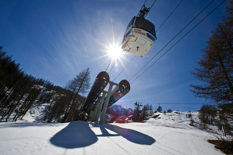
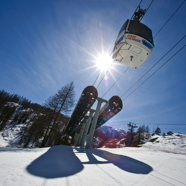
Latest snow reports near Serre Chevalier:
| Top snow depth: | — |
|---|---|
| Bottom snow depth: | — |
| Fresh snowfall depth: | 5 cm |
| Last snowfall: | 14 May 2026 |
| Snow Alerts | Create Alert |
0.4 | Bluebird Powder days Fresh snow, mostly sunny, light wind. |
|---|---|
0.6 | Powder days Fresh snow, limited sun, any wind. |
0.4 | Bluebird days Average snow, mostly sunny, light wind. |
The above table gives the weather forecast for Serre Chevalier at the specific elevation of 2800 m. Our sophisticated weather models allow us to provide snow forecasts for the top, middle and bottom ski stations of Serre Chevalier. To access the weather forecasts for the other elevations, use the tab navigation above the table. For a wider view of the weather, check out the Weather Map of France.
Click here to read further information on freezing levels and how we forecast our temperatures.
Overall 4.3 Based on 58 votes and 57 reviews
This is the third time we have visited Serre Chevalier for a long stay, this time for 8 weeks. Why do we come back? Because the snow is excellent despite it being relatively low, the pistes are well groomed and we love all the tree lined red runs particularly at Monetier. In January you can often have the whole run to yourself. Briancon is a lovely medieval town to visit as well, although the skiing on that side is not as good as it gets the sun & can be icy.
Kim Cant from United Kingdom writes:
This is the third time we have visited Serre Chevalier for a long stay, this time for 8 weeks. Why do we come back? Because the snow is excellent despite it being relatively low, the pistes are well groomed and we love all the tree lined red runs particularly at Monetier. In January you can often have the whole run to yourself. Briancon is a lovely medieval town to visit as well, although the skiing on that side is not as good as it gets the sun & can be icy.


 Nearest