
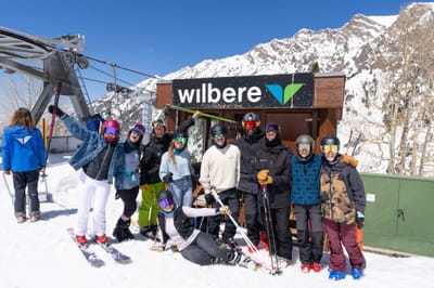
Ski Lessons by SkiBro
BOOK NOW
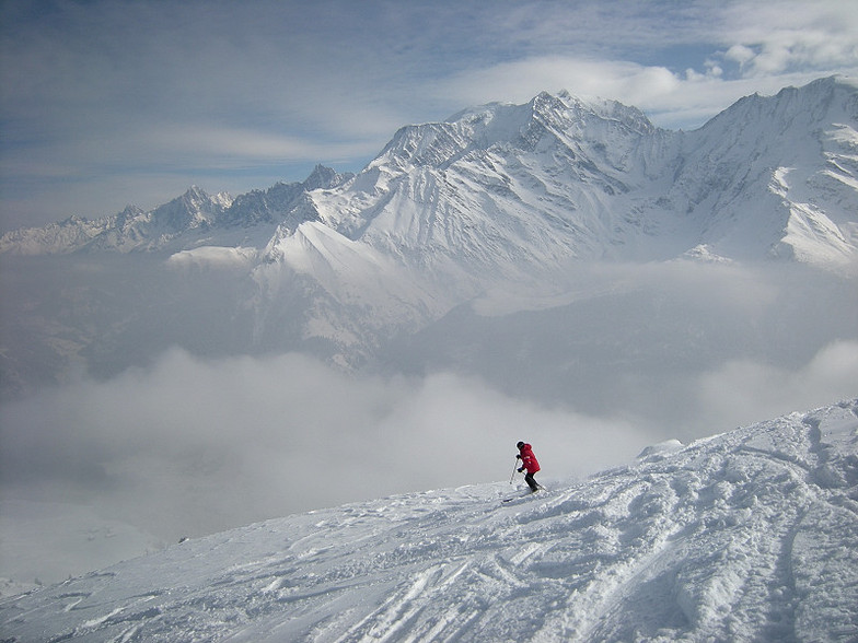
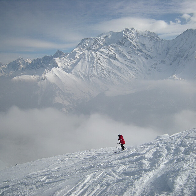
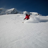
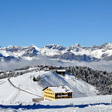
Ski lessons in Saint Gervais
Book now


Saint Gervais Weather (Next 3 days): The snow forecast for Saint Gervais is: A dusting of new snow. Temperatures will be below freezing (max -1°C on Fri afternoon, min -9°C on Wed morning). Wind will be generally light.
Saint Gervais Weather (Days 4-6): Some drizzle, heaviest during Mon night. Freeze-thaw conditions (max 5°C on Mon afternoon, min -2°C on Sat morning). Wind will be generally light.
| Resort | Snow Depth | Temp. (°C) | Wind (km/h) | Weather | ||
|---|---|---|---|---|---|---|
| Top Lift: | -10 | |||||
| Middle Lift: | -7 | |||||
| Bottom Lift: | -6 |
Latest snow reports near Saint Gervais:
Resort closed for the season. See you this summer! from La Giettaz en Aravis
Snowing at a moderate rate at Flaine. No wind here. Cold. There is a dusting of fresh snow. Lifts are closed. No pistes are open. Powder snow off-piste! from Flaine

Wednesday 24 | Thursday 25 | Friday 26 | Saturday 27 | Sunday 28 | Monday 29 | Tuesday 30 | |||||||||||||||
AM | PM | night | AM | PM | night | AM | PM | night | AM | PM | night | AM | PM | night | AM | PM | night | AM | PM | night | |
light snow | light snow | snow shwrs | some clouds | some clouds | some clouds | cloudy | light snow | light snow | some clouds | cloudy | cloudy | cloudy | cloudy | cloudy | some clouds | cloudy | rain shwrs | some clouds | light rain | rain shwrs | |
km/h | |||||||||||||||||||||
Snow map |  |  |  |  |  |  |  | ||||||||||||||
— | 1.0 | 2.0 | — | — | — | — | 1.0 | — | — | — | — | — | — | — | — | — | — | — | — | — | |
— | — | — | — | — | — | — | — | — | — | — | — | — | — | — | — | — | 1.0 | — | 2.0 | 1.0 | |
max°C | -9 | -7 | -8 | -6 | -4 | -4 | -3 | -1 | -2 | 0 | 1 | 0 | 1 | 2 | 2 | 3 | 5 | 3 | 4 | 5 | 4 |
min°C | -9 | -8 | -9 | -8 | -5 | -5 | -4 | -2 | -3 | -2 | 0 | -1 | 1 | 2 | 1 | 2 | 4 | 2 | 3 | 4 | 3 |
-14 | -12 | -12 | -8 | -8 | -9 | -7 | -4 | -6 | -6 | -3 | -5 | -3 | -1 | -2 | -1 | 2 | -1 | 0 | 2 | 0 | |
63 | 91 | 79 | 33 | 56 | 51 | 70 | 81 | 70 | 57 | 71 | 62 | 63 | 81 | 76 | 55 | 64 | 76 | 70 | 84 | 80 | |
1050 | 1450 | 850 | 1300 | 1900 | 1500 | 2000 | 2200 | 1700 | 2300 | 2450 | 2350 | 2600 | 2650 | 2750 | 2800 | 2900 | 2900 | 2900 | 2950 | 2850 | |
6:30 | — | — | 6:28 | — | — | 6:26 | — | — | 6:26 | — | — | 6:24 | — | — | 6:22 | — | — | 6:20 | — | — | |
— | — | 8:31 | — | — | 8:32 | — | — | 8:34 | — | — | 8:36 | — | — | 8:37 | — | — | 8:37 | — | — | 8:39 | |
A dusting of new snow. Temperatures will be below freezing (max -1°C on Fri afternoon, min -9°C on Wed morning). Wind will be generally light.
Some drizzle, heaviest during Mon night. Freeze-thaw conditions (max 5°C on Mon afternoon, min -2°C on Sat morning). Wind will be generally light.
Latest snow reports near Saint Gervais:
Resort closed for the season. See you this summer! from La Giettaz en Aravis
Snowing at a moderate rate at Flaine. No wind here. Cold. There is a dusting of fresh snow. Lifts are closed. No pistes are open. Powder snow off-piste! from Flaine
| Top snow depth: | — |
|---|---|
| Bottom snow depth: | — |
| Fresh snowfall depth: | 7 cm |
| Last snowfall: | 23 Apr 2024 |
| Snow Alerts | Create Alert |
0.2 | Bluebird Powder days Fresh snow, mostly sunny, light wind. |
|---|---|
1.3 | Powder days Fresh snow, limited sun, any wind. |
0.2 | Bluebird days Average snow, mostly sunny, light wind. |


The above table gives the weather forecast for Saint Gervais at the specific elevation of 2350 m. Our sophisticated weather models allow us to provide snow forecasts for the top, middle and bottom ski stations of Saint Gervais. To access the weather forecasts for the other elevations, use the tab navigation above the table. For a wider view of the weather, check out the Weather Map of France.
Click here to read further information on freezing levels and how we forecast our temperatures.
Overall 4.3 Based on 36 votes and 21 reviews
A few years ago, having spent several chalet/hotel holidays in Megeve, we switched over to St Gervais. There is a wide mix of private, chalet, B&B and hotel options without the Megeve price tag. Plenty of restaurants and shops for self-catering. It is also a little nearer to Geneva and even a private transfer (for two) is not much more than car hire (and considerably less stressful). Access is easy and we have always rented at the top of the gondola for convenience, although there is a local ski bus circulating the town. The only downside is that Megeve is the centre of the ski area and getting across to Combloux/Jaillet takes a little while. But is well worth it.
M Blackwell from United Kingdom writes:
A few years ago, having spent several chalet/hotel holidays in Megeve, we switched over to St Gervais. There is a wide mix of private, chalet, B&B and hotel options without the Megeve price tag. Plenty of restaurants and shops for self-catering. It is also a little nearer to Geneva and even a private transfer (for two) is not much more than car hire (and considerably less stressful). Access is easy and we have always rented at the top of the gondola for convenience, although there is a local ski bus circulating the town. The only downside is that Megeve is the centre of the ski area and getting across to Combloux/Jaillet takes a little while. But is well worth it.
The Saint Gervais skiing weather widget is available to embed on external websites free of charge. It provides a daily summary of our Saint Gervais snow forecast and current weather conditions. Simply go to the feed configuration page and follow the 3 simple steps to grab the custom html code snippet and paste it into your own site. You can choose the snow forecast elevation (summit, mid-mountain or bottom lift) and metric/imperial units for the snow forecast feed to suit your own website…. Click here to get the code.
View detailed snow forecast for Saint Gervais at:
snow-forecast.com


 Nearest