

Global Weekly Snow Roundup #314
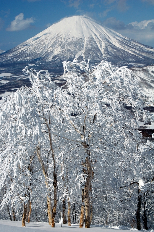
Weekly Global Snow News, updated 14 May 2026: Fresh snowfall in Argentina, Australia and Lesotho signals winter’s approach, while Japan maintains the world’s deepest snowpack.

Next 3 days weather summary:Mostly dry. Very mild (max 15°C on Sat afternoon, min 8°C on Sun night). Winds increasing (calm on Sun morning, fresh winds from the WSW by Mon afternoon). | Days 4-6 weather summary:Mostly dry. Very mild (max 12°C on Wed morning, min 8°C on Tue night). Wind will be generally light. | ||||||||||||||||
Sat 16 | Sunday 17 | Monday 18 | Tuesday 19 | Wednesday 20 | Thursday 21 | ||||||||||||
PM | night | AM | PM | night | AM | PM | night | AM | PM | night | AM | PM | night | AM | PM | night | |
clear | some clouds | clear | some clouds | some clouds | some clouds | some clouds | some clouds | some clouds | cloudy | some clouds | some clouds | clear | clear | some clouds | some clouds | some clouds | |
km/h | |||||||||||||||||
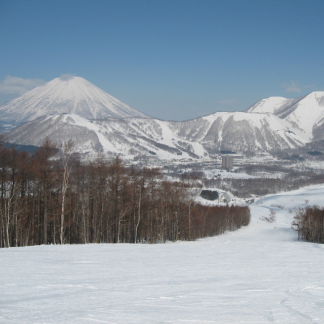
Snow map | 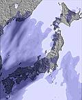 | 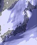 | 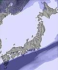 | 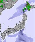 | 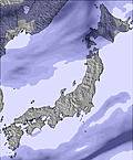 |  | |||||||||||
— | — | — | — | — | — | — | — | — | — | — | — | — | — | — | — | — | |
— | — | — | — | — | — | — | — | — | — | — | — | — | — | — | — | — | |
max °C | 15 | 12 | 12 | 11 | 10 | 12 | 13 | 12 | 11 | 10 | 9 | 12 | 12 | 10 | 12 | 12 | 9 |
min °C | 13 | 9 | 11 | 9 | 8 | 12 | 13 | 10 | 11 | 10 | 8 | 11 | 11 | 9 | 12 | 11 | 9 |
11 | 7 | 10 | 7 | 5 | 9 | 10 | 7 | 8 | 7 | 7 | 11 | 11 | 8 | 11 | 10 | 6 | |
68 | 82 | 63 | 77 | 75 | 63 | 54 | 87 | 80 | 66 | 50 | 50 | 49 | 40 | 33 | 57 | 38 | |
3550 | 3350 | 4000 | 4000 | 3250 | 3500 | 3700 | 3650 | 2850 | 2900 | 2800 | 2600 | 2550 | 2600 | 2800 | 2950 | 3000 | |
— | — | 4:11 | — | — | 4:11 | — | — | 4:09 | — | — | 4:09 | — | — | 4:07 | — | — | |
6:52 | — | — | 6:52 | — | — | 6:53 | — | — | 6:54 | — | — | 6:55 | — | — | 6:57 | — | |
Latest snow reports near Rusutsu Resort:
| Top snow depth: | 0 cm |
|---|---|
| Bottom snow depth: | 0 cm |
| Fresh snowfall depth: | — |
| Last snowfall: | 4 May 2026 |
| Snow Alerts | Create Alert |
0.1 | Bluebird Powder days Fresh snow, mostly sunny, light wind. |
|---|---|
0.0 | Powder days Fresh snow, limited sun, any wind. |
0.0 | Bluebird days Average snow, mostly sunny, light wind. |
The above table gives the weather forecast for Rusutsu Resort at the specific elevation of 994 m. Our sophisticated weather models allow us to provide snow forecasts for the top, middle and bottom ski stations of Rusutsu Resort. To access the weather forecasts for the other elevations, use the tab navigation above the table. For a wider view of the weather, check out the Weather Map of Japan.
Click here to read further information on freezing levels and how we forecast our temperatures.
Overall 3.8 Based on 23 votes and 12 reviews
Rusutsu used to offer a great family ski environment with no apres. Over the years it has increasingly gotten busier with bus loads of rude Europeans and ugly Australians doing day trips from Niseko which was really noticeable in 2014. Where once you could get fresh tracks lasting days it is now tracked within 1/2 day. For those chasing a quieter resort their are better options. In comparison to other international resorts it still can offer an excellent trip. Everyone just needs to relax a little and take a leaf from the locals and have some respect for others.
Rueben from Australia writes:
Rusutsu used to offer a great family ski environment with no apres. Over the years it has increasingly gotten busier with bus loads of rude Europeans and ugly Australians doing day trips from Niseko which was really noticeable in 2014. Where once you could get fresh tracks lasting days it is now tracked within 1/2 day.
For those chasing a quieter resort their are better options.
In comparison to other international resorts it still can offer an excellent trip. Everyone just needs to relax a little and take a leaf from the locals and have some respect for others.


 Nearest