

Global Weekly Snow Roundup #314
Weekly Global Snow News, updated 14 May 2026: Fresh snowfall in Argentina, Australia and Lesotho signals winter’s approach, while Japan maintains the world’s deepest snowpack.

Next 3 days weather summary:Mostly dry. Mild temperatures (max 5°C on Sat morning, min 2°C on Mon afternoon). Wind will be generally light. | Days 4-6 weather summary:Mostly dry. Temperatures will be slightly above freezing (max 4°C on Wed morning, min 2°C on Thu morning). Winds increasing (light winds from the NW on Tue morning, strong winds from the NW by Thu night). | |||||||||||||||||
Saturday 16 | Sunday 17 | Monday 18 | Tuesday 19 | Wednesday 20 | Thursday 21 | |||||||||||||
AM | PM | night | AM | PM | night | AM | PM | night | AM | PM | night | AM | PM | night | AM | PM | night | |
clear | clear | clear | clear | clear | clear | clear | clear | clear | some clouds | cloudy | cloudy | cloudy | some clouds | cloudy | cloudy | cloudy | cloudy | |
km/h | ||||||||||||||||||
Snow map |  |  |  |  |  |  | ||||||||||||
— | — | — | — | — | — | — | — | — | — | — | — | — | — | — | — | — | — | |
— | — | — | — | — | — | — | — | — | — | — | — | — | — | — | — | — | — | |
max °C | 5 | 5 | 5 | 4 | 4 | 3 | 3 | 3 | 3 | 3 | 3 | 3 | 4 | 3 | 3 | 2 | 2 | 2 |
min °C | 5 | 4 | 4 | 4 | 3 | 3 | 3 | 2 | 2 | 3 | 3 | 3 | 3 | 3 | 3 | 2 | 2 | 2 |
5 | 4 | 4 | 4 | 3 | 1 | 1 | 0 | 0 | 0 | -1 | -1 | -1 | -2 | -2 | -3 | -4 | -4 | |
15 | 19 | 19 | 19 | 26 | 33 | 20 | 20 | 26 | 12 | 16 | 23 | 24 | 31 | 24 | 36 | 55 | 93 | |
3000 | 3000 | 3000 | 2900 | 2800 | 2650 | 2600 | 2550 | 2500 | 2600 | 2650 | 2950 | 3150 | 3200 | 2800 | 2550 | 2550 | 2550 | |
7:56 | — | — | 7:56 | — | — | 7:58 | — | — | 7:58 | — | — | 8:00 | — | — | 8:00 | — | — | |
— | 5:24 | — | — | 5:23 | — | — | 5:22 | — | — | 5:22 | — | — | 5:21 | — | — | 5:20 | — | |
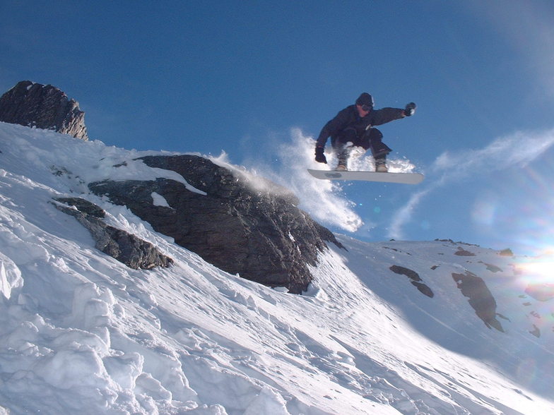
Latest snow reports near Remarkables:
| Top snow depth: | 0 cm |
|---|---|
| Bottom snow depth: | 0 cm |
| Fresh snowfall depth: | — |
| Last snowfall: | 10 May 2026 |
| Snow Alerts | Create Alert |
0.7 | Bluebird Powder days Fresh snow, mostly sunny, light wind. |
|---|---|
1.5 | Powder days Fresh snow, limited sun, any wind. |
0.9 | Bluebird days Average snow, mostly sunny, light wind. |

The above table gives the weather forecast for Remarkables at the specific elevation of 1990 m. Our sophisticated weather models allow us to provide snow forecasts for the top, middle and bottom ski stations of Remarkables. To access the weather forecasts for the other elevations, use the tab navigation above the table. For a wider view of the weather, check out the Weather Map of New Zealand.
Click here to read further information on freezing levels and how we forecast our temperatures.
Overall 3.5 Based on 29 votes and 10 reviews
Wow, just reading through some of these reviews and they seem very harsh. We have been here the past 3 years from Melbourne and the staff and runs are awesome by comparison to our 'most of the time' conditions in Victoria. Yes, it takes a bit of time to organise gear on the 1st day but, seriously, you only have to do it once and not lug it to your accommodation (which is what you do in Vic); imagine lugging you gear and getting your kids to do the same across country to the chalet!! Love the runs, love the people working up there on Cardrona and Remarks... always found the instructors to be awesome and I guess the restaurant staff muck around but, yep... its a drudge having done it myself. Some can keep up the attitude, some can't. First world problem. Just enjoy and get out there!
Kate from Australia writes:
Wow, just reading through some of these reviews and they seem very harsh. We have been here the past 3 years from Melbourne and the staff and runs are awesome by comparison to our 'most of the time' conditions in Victoria. Yes, it takes a bit of time to organise gear on the 1st day but, seriously, you only have to do it once and not lug it to your accommodation (which is what you do in Vic); imagine lugging you gear and getting your kids to do the same across country to the chalet!! Love the runs, love the people working up there on Cardrona and Remarks... always found the instructors to be awesome and I guess the restaurant staff muck around but, yep... its a drudge having done it myself. Some can keep up the attitude, some can't. First world problem. Just enjoy and get out there!


 Nearest