

Global Weekly Snow Roundup #314
Weekly Global Snow News, updated 14 May 2026: Fresh snowfall in Argentina, Australia and Lesotho signals winter’s approach, while Japan maintains the world’s deepest snowpack.

Next 3 days weather summary:Moderate rain (total 13.0mm), heaviest on Mon afternoon. Freeze-thaw conditions (max 12°C on Sun afternoon, min -1°C on Sat night). Wind will be generally light. | Days 4-6 weather summary:Light rain (total 3.0mm), mostly falling on Tue afternoon. Warm (max 20°C on Thu afternoon, min 5°C on Tue night). Wind will be generally light. | |||||||||||||||||
Saturday 16 | Sunday 17 | Monday 18 | Tuesday 19 | Wednesday 20 | Thursday 21 | |||||||||||||
AM | PM | night | AM | PM | night | AM | PM | night | AM | PM | night | AM | PM | night | AM | PM | night | |
clear | light rain | clear | some clouds | rain shwrs | rain shwrs | rain shwrs | light rain | light rain | some clouds | light rain | rain shwrs | clear | some clouds | rain shwrs | some clouds | some clouds | clear | |
km/h | ||||||||||||||||||
Snow map |  |  |  |  |  |  | ||||||||||||
— | — | — | — | — | — | — | — | — | — | — | — | — | — | — | — | — | — | |
— | 1 | — | — | 1 | 2 | 1 | 4 | 4 | — | 1 | 1 | — | — | 1 | — | — | — | |
max °C | 5 | 8 | 5 | 10 | 12 | 9 | 9 | 10 | 8 | 10 | 10 | 10 | 15 | 18 | 14 | 17 | 20 | 16 |
min °C | 0 | 7 | -1 | 5 | 11 | 4 | 6 | 9 | 5 | 6 | 10 | 5 | 8 | 17 | 7 | 10 | 19 | 9 |
-4 | 5 | -4 | 5 | 10 | 4 | 6 | 8 | 5 | 6 | 10 | 3 | 7 | 17 | 6 | 10 | 19 | 9 | |
53 | 54 | 84 | 48 | 48 | 83 | 62 | 71 | 96 | 67 | 79 | 85 | 46 | 52 | 82 | 36 | 45 | 66 | |
1900 | 2200 | 1650 | 2450 | 2650 | 2250 | 2450 | 2500 | 2300 | 2650 | 2850 | 3200 | 3200 | 3450 | 3700 | 3800 | 3900 | 4050 | |
6:05 | — | — | 6:03 | — | — | 6:03 | — | — | 6:01 | — | — | 6:01 | — | — | 6:00 | — | — | |
— | — | 8:55 | — | — | 8:57 | — | — | 8:58 | — | — | 8:59 | — | — | 9:00 | — | — | 9:00 | |
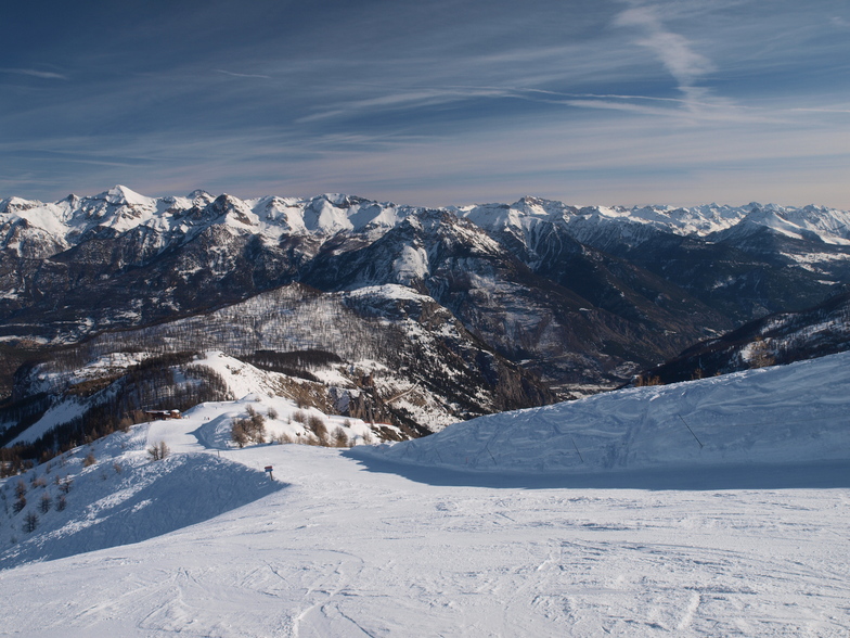
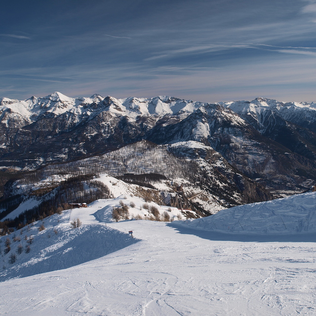
Latest snow reports near Puy St Vincent:
| Top snow depth: | — |
|---|---|
| Bottom snow depth: | — |
| Fresh snowfall depth: | 6 cm |
| Last snowfall: | 15 May 2026 |
| Snow Alerts | Create Alert |
0.0 | Bluebird Powder days Fresh snow, mostly sunny, light wind. |
|---|---|
0.0 | Powder days Fresh snow, limited sun, any wind. |
0.0 | Bluebird days Average snow, mostly sunny, light wind. |
The above table gives the weather forecast for Puy St Vincent at the specific elevation of 1400 m. Our sophisticated weather models allow us to provide snow forecasts for the top, middle and bottom ski stations of Puy St Vincent. To access the weather forecasts for the other elevations, use the tab navigation above the table. For a wider view of the weather, check out the Weather Map of France.
Click here to read further information on freezing levels and how we forecast our temperatures.
Overall 4.2 Based on 30 votes and 15 reviews
Just back from a second year's Christmas skiing at PSV (Puy St Vincent). Stayed at Chalet Dame Blanche (1800m). Excellent position at the edge of a red run down to main 1600 hub, and quite easy to walk to access easier pistes down. Snow depth, Christmas 2012, was phenomenal and resort fully open, but runs a bit icy. Less snow depth, Christmas 2013, and consequently not all of resort open, resulting in some queuing, but nothing excessive. Fresh powder on Christmas day transformed the place! As a family of intermediate and beginners we have yet to out-grow the place and its stunning scenery. Fantastic family feel to resort; if you want bars and clubbing then look elsewhere. Instead, you get a friendly atmosphere; 60 instructors dressed in Santa outfits doing a torch lit procession down the mountain on Christmas eve!
Ewen from United Kingdom writes:
Just back from a second year's Christmas skiing at PSV (Puy St Vincent). Stayed at Chalet Dame Blanche (1800m). Excellent position at the edge of a red run down to main 1600 hub, and quite easy to walk to access easier pistes down.
Snow depth, Christmas 2012, was phenomenal and resort fully open, but runs a bit icy. Less snow depth, Christmas 2013, and consequently not all of resort open, resulting in some queuing, but nothing excessive. Fresh powder on Christmas day transformed the place! As a family of intermediate and beginners we have yet to out-grow the place and its stunning scenery.
Fantastic family feel to resort; if you want bars and clubbing then look elsewhere. Instead, you get a friendly atmosphere; 60 instructors dressed in Santa outfits doing a torch lit procession down the mountain on Christmas eve!


 Nearest