


Global Weekly Snow Roundup #314
Weekly Global Snow News, updated 14 May 2026: Fresh snowfall in Argentina, Australia and Lesotho signals winter’s approach, while Japan maintains the world’s deepest snowpack.

Next 3 days weather summary:Light rain (total 8.0mm), mostly falling on Sun night. Mild temperatures (max 8°C on Mon afternoon, min 1°C on Sat morning). Wind will be generally light. | Days 4-6 weather summary:Mostly dry. Very mild (max 15°C on Thu afternoon, min 6°C on Tue morning). Wind will be generally light. | |||||||||||||||||
Saturday 16 | Sunday 17 | Monday 18 | Tuesday 19 | Wednesday 20 | Thursday 21 | |||||||||||||
AM | PM | night | AM | PM | night | AM | PM | night | AM | PM | night | AM | PM | night | AM | PM | night | |
clear | clear | some clouds | cloudy | light rain | light rain | some clouds | some clouds | some clouds | clear | cloudy | some clouds | clear | clear | clear | clear | clear | clear | |
km/h | ||||||||||||||||||
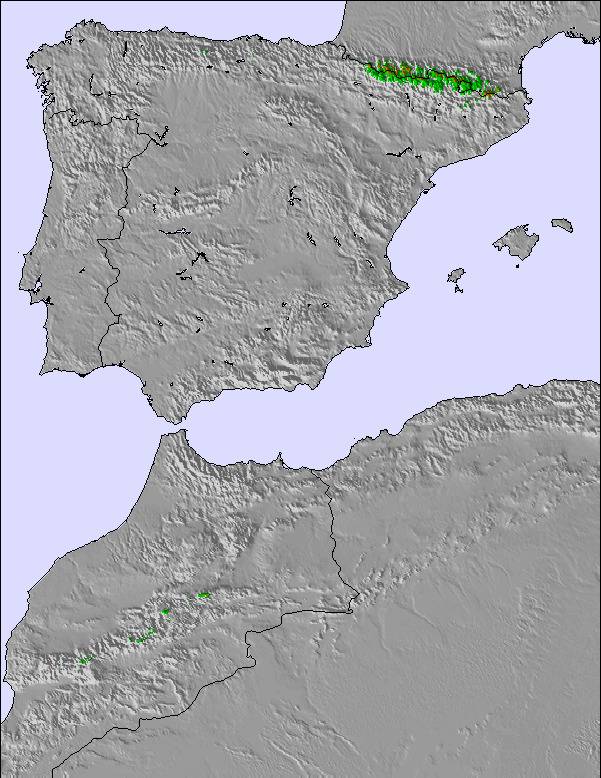
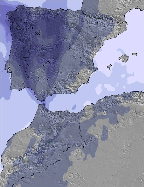
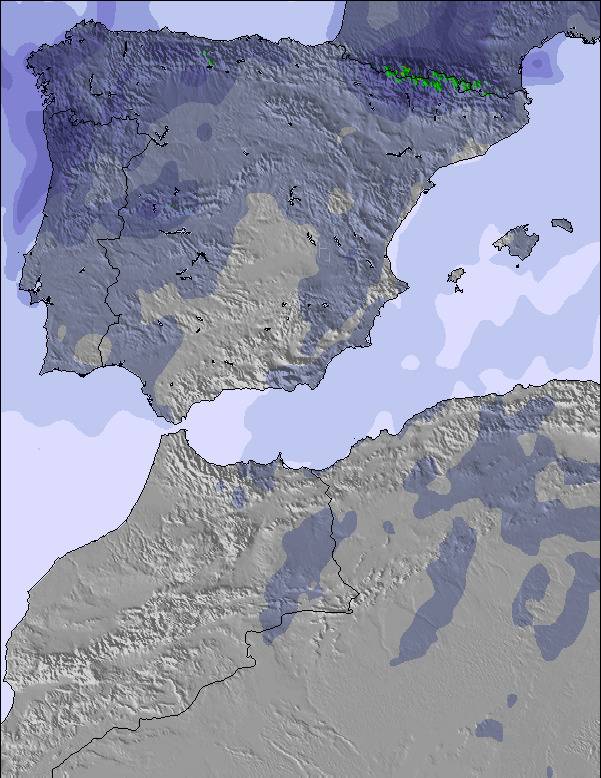
Snow map | 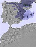 | 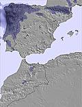 | 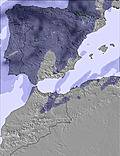 | 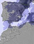 | 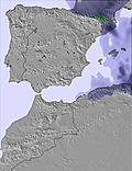 | 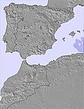 | ||||||||||||
— | — | — | — | — | — | — | — | — | — | — | — | — | — | — | — | — | — | |
— | — | — | — | 4 | 4 | — | — | — | — | — | — | — | — | — | — | — | — | |
max °C | 3 | 5 | 5 | 3 | 5 | 4 | 5 | 8 | 7 | 7 | 10 | 10 | 11 | 14 | 14 | 12 | 15 | 15 |
min °C | 1 | 4 | 3 | 2 | 4 | 3 | 4 | 7 | 6 | 6 | 9 | 10 | 10 | 13 | 12 | 12 | 14 | 13 |
-4 | 2 | 0 | 0 | 2 | 0 | 1 | 4 | 2 | 4 | 8 | 9 | 10 | 12 | 11 | 12 | 14 | 13 | |
44 | 55 | 56 | 74 | 73 | 72 | 44 | 63 | 61 | 65 | 68 | 58 | 39 | 38 | 44 | 41 | 41 | 46 | |
2950 | 2750 | 2650 | 2500 | 2750 | 2650 | 2850 | 3000 | 3150 | 3300 | 3300 | 3550 | 4000 | 3900 | 3950 | 3950 | 3900 | 3850 | |
6:58 | — | — | 6:56 | — | — | 6:56 | — | — | 6:54 | — | — | 6:54 | — | — | 6:54 | — | — | |
— | — | 9:25 | — | — | 9:27 | — | — | 9:28 | — | — | 9:29 | — | — | 9:30 | — | — | 9:30 | |
Latest snow reports near Puerto de Navacerrada:
| Top snow depth: | — |
|---|---|
| Bottom snow depth: | — |
| Fresh snowfall depth: | 1 cm |
| Last snowfall: | 15 May 2026 |
| Snow Alerts | Create Alert |
0.0 | Bluebird Powder days Fresh snow, mostly sunny, light wind. |
|---|---|
0.3 | Powder days Fresh snow, limited sun, any wind. |
0.1 | Bluebird days Average snow, mostly sunny, light wind. |
The above table gives the weather forecast for Puerto de Navacerrada at the specific elevation of 2178 m. Our sophisticated weather models allow us to provide snow forecasts for the top, middle and bottom ski stations of Puerto de Navacerrada. To access the weather forecasts for the other elevations, use the tab navigation above the table. For a wider view of the weather, check out the Weather Map of Spain.
Click here to read further information on freezing levels and how we forecast our temperatures.
Overall 2.7 Based on 10 votes and 8 reviews
De entre las tres opciones de pista de Madrid: 1. es la más alpina, sin duda alguna. 2. sus remontes te suben a puntos desde los que hacer freeride (es única en esto). 3. la atención de sus trabajadores es excelente. 4. sus precios, ajustados, aunque siguen siendo caros. 5. La pista del Bosque es una de las mejores de España. Pero tampoco quiero convencer de nada, la aproximación es horrible (atascos, párking,...) y creo que cuantos menos vayamos, mejor estaremos... Por otro lado, sin entrar en polémicas absurdas, creo que poner vallas de madera para formar ventisqueros no es una agresión tremenda al medio ambiente (¿no os parece incomparable con el vallado estrepitoso de campo de concentración que tiene Valdesquí, por ejemplo, o las instalaciones de Xanadú?). El conjunto de la estación tiene una integración ejemplar en el entorno, y creo que los gestores de esta estación son los primeros interesados en que en sus laderas rebose naturaleza y no haya restos de comidas, papeles, basuras,... No tengo nostalgia. La estoy haciendo.
jose from Spain writes:
De entre las tres opciones de pista de Madrid:
1. es la más alpina, sin duda alguna.
2. sus remontes te suben a puntos desde los que hacer freeride (es única en esto).
3. la atención de sus trabajadores es excelente.
4. sus precios, ajustados, aunque siguen siendo caros.
5. La pista del Bosque es una de las mejores de España.
Pero tampoco quiero convencer de nada, la aproximación es horrible (atascos, párking,...) y creo que cuantos menos vayamos, mejor estaremos...
Por otro lado, sin entrar en polémicas absurdas, creo que poner vallas de madera para formar ventisqueros no es una agresión tremenda al medio ambiente (¿no os parece incomparable con el vallado estrepitoso de campo de concentración que tiene Valdesquí, por ejemplo, o las instalaciones de Xanadú?). El conjunto de la estación tiene una integración ejemplar en el entorno, y creo que los gestores de esta estación son los primeros interesados en que en sus laderas rebose naturaleza y no haya restos de comidas, papeles, basuras,...
No tengo nostalgia. La estoy haciendo.
Read 7 more reviews of Puerto de Navacerrada or submit your own


 Nearest