

Portillo Re-Opens To Guests Arriving By Helicopter
Chile’s famous Portillo ski resort is reported to have re-opened to guests arriving by helicopter after being cut off by road for more than two weeks by over 6m/20 feet of snowfall.

Next 3 days weather summary:Heavy rain (total 25.0mm), heaviest during Wed afternoon. Warm (max 22°C on Tue afternoon, min 13°C on Tue night). Wind will be generally light. | Days 4-6 weather summary:Heavy rain (total 44.0mm), heaviest during Thu night. Warm (max 20°C on Thu afternoon, min 10°C on Fri night). Wind will be generally light. | ||||||||||||||||
Mon 3 | Tuesday 4 | Wednesday 5 | Thursday 6 | Friday 7 | Saturday 8 | ||||||||||||
PM | night | AM | PM | night | AM | PM | night | AM | PM | night | AM | PM | night | AM | PM | night | |
light rain | clear | clear | t-storm risk | rain shwrs | t-storm risk | t-storm risk | rain shwrs | t-storm risk | t-storm risk | heavy rain | light rain | t-storm risk | rain shwrs | t-storm risk | t-storm risk | rain shwrs | |
km/h | |||||||||||||||||
Snow map |  |  |  |  |  |  | |||||||||||
— | — | — | — | — | — | — | — | — | — | — | — | — | — | — | — | — | |
mm | 3 | — | — | 3 | 2 | 1 | 5 | 7 | 4 | 9 | 13 | 2 | 10 | 4 | 1 | 4 | 1 |
max °C | 20 | 18 | 21 | 22 | 19 | 21 | 22 | 17 | 19 | 20 | 15 | 15 | 17 | 13 | 17 | 18 | 15 |
min °C | 18 | 14 | 17 | 21 | 13 | 17 | 19 | 13 | 16 | 17 | 11 | 12 | 15 | 10 | 13 | 17 | 10 |
chill °C | 18 | 13 | 17 | 21 | 13 | 17 | 19 | 13 | 16 | 17 | 11 | 12 | 15 | 10 | 13 | 17 | 10 |
Humid % | 66 | 65 | 50 | 50 | 68 | 58 | 65 | 80 | 64 | 75 | 98 | 82 | 87 | 86 | 73 | 76 | 75 |
Freeze m | 4450 | 4500 | 4500 | 4600 | 4500 | 4450 | 4600 | 4450 | 4350 | 4350 | 4000 | 4000 | 4100 | 4150 | 4050 | 4150 | 4350 |
— | — | 5:58 | — | — | 6:00 | — | — | 6:01 | — | — | 6:01 | — | — | 6:03 | — | — | |
— | 8:46 | — | — | 8:45 | — | — | 8:44 | — | — | 8:42 | — | — | 8:40 | — | — | 8:38 | |
Go pro and carve into:
Avalanche information: European Avalanche Warning Services (EAWS)
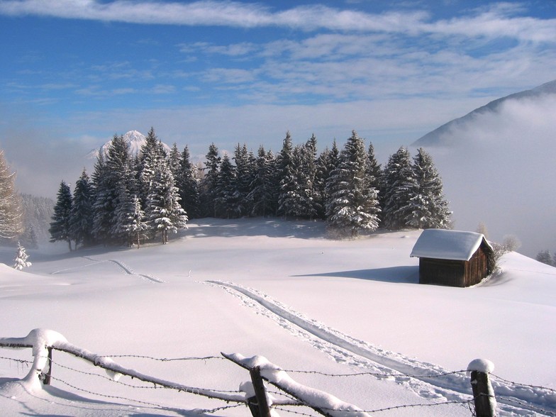
Latest snow reports near Pitztal Glacier:
| Top snow depth: | 0 cm |
|---|---|
| Bottom snow depth: | 0 cm |
| Fresh snowfall depth: | — |
| Last snowfall: | 12 Jun 2026 |
| Snow Alerts | Create Alert |
0.0 | Bluebird Powder days Fresh snow, mostly sunny, light wind. |
|---|---|
0.0 | Powder days Fresh snow, limited sun, any wind. |
0.0 | Bluebird days Average snow, mostly sunny, light wind. |
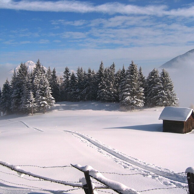
The above table gives the weather forecast for Pitztal Glacier at the specific elevation of 1740 m. Our sophisticated weather models allow us to provide snow forecasts for the top, middle and bottom ski stations of Pitztal Glacier. To access the weather forecasts for the other elevations, use the tab navigation above the table. For a wider view of the weather, check out the Weather Map of Austria.
Click here to read further information on freezing levels and how we forecast our temperatures.
Overall 4.4 Based on 19 votes and 3 reviews
First, I must say that this place is a gem of a find! It's all locals here. Some from Germany but hardly any from the UK. Which is great, not because I don't want to see my fellow countryman, it's just a nice indication that it isn't bombarded by tourists. In the area of Pitztal you have Pitztal glacier. Right next door you have Rifflsee and a couple of minutes down the valley you have Hochziger. You can get a lift pass for all three for a week at around 170 Euro's. First, the glacier is fantastic. The well looked after runs are not the greatest if you are a beginner but for intermediate and expert there's lots to keep you going. Not stacks of off-piste but they are working on a run from the top to the base station. This is off-piste at the mo and there are fantastic views on the way down. The summit at the glacier is over 3000 meters so take some o2! (or stop smoking.) Right next door is Rifflsee. Again, not the widest of runs but you can really get some great speed up here. A little better for the beginner here and a little more off-piste. There is a really nice cruisey blue run from the top to the base station car park. Good fun and if you want to come off early it brings you to Pitztal glacier base station. Now, Hochziger. This place is fantastic. Over 45k of runs. Loads and loads of off-piste. Great for everyone and one mammoth run from the top to the base. You know you are alive when you get to the bottom and waiting for you is beer! I would really recommend a trip here. You can fly cheaply from the UK to Salzburg. Innsbrook is closer but served by BA so not the cheapest. I stayed with a family. It was really cheap and very clean with everything you want and the view every morning was fantastic. Hausbritfuss in St Leonard is where they also run a ski racing camp. Check it out and have a ball.
chris wright from United Kingdom writes:
First, I must say that this place is a gem of a find! It's all locals here. Some from Germany but hardly any from the UK. Which is great, not because I don't want to see my fellow countryman, it's just a nice indication that it isn't bombarded by tourists. In the area of Pitztal you have Pitztal glacier. Right next door you have Rifflsee and a couple of minutes down the valley you have Hochziger. You can get a lift pass for all three for a week at around 170 Euro's.
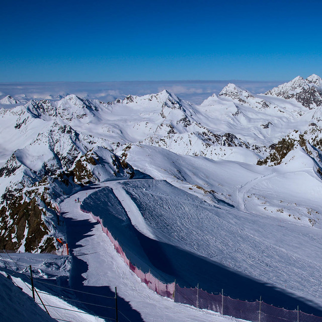
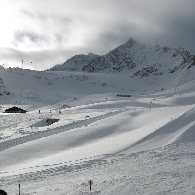
First, the glacier is fantastic. The well looked after runs are not the greatest if you are a beginner but for intermediate and expert there's lots to keep you going. Not stacks of off-piste but they are working on a run from the top to the base station. This is off-piste at the mo and there are fantastic views on the way down. The summit at the glacier is over 3000 meters so take some o2! (or stop smoking.)
Right next door is Rifflsee. Again, not the widest of runs but you can really get some great speed up here. A little better for the beginner here and a little more off-piste. There is a really nice cruisey blue run from the top to the base station car park. Good fun and if you want to come off early it brings you to Pitztal glacier base station.
Now, Hochziger. This place is fantastic. Over 45k of runs. Loads and loads of off-piste. Great for everyone and one mammoth run from the top to the base. You know you are alive when you get to the bottom and waiting for you is beer! I would really recommend a trip here. You can fly cheaply from the UK to Salzburg. Innsbrook is closer but served by BA so not the cheapest. I stayed with a family. It was really cheap and very clean with everything you want and the view every morning was fantastic. Hausbritfuss in St Leonard is where they also run a ski racing camp. Check it out and have a ball.


 Nearest