
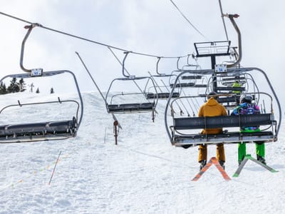
Solitude Sets Record-Breaking Season With 178 Days of Skiing
Updated April 30, 2025: North America holds strong with over 30 ski areas still spinning lifts—snowy peaks in the West, deep bases in the Midwest, and sunny spring turns coast to coast.
Please sign in with your Snow-Forecast account details below.


Nun-Kun Weather (Next 3 days): The snow forecast for Nun-Kun is: Mostly dry. Temperatures will be well below freezing (max -6°C on Fri afternoon, min -15°C on Wed night). Wind will be generally light.
Nun-Kun Weather (Days 4-6): A dusting of new snow. Temperatures will be below freezing (max -5°C on Mon afternoon, min -11°C on Sat night). Wind will be generally light.
| Resort | Snow Depth | Temp. (°C) | Wind (km/h) | Weather | ||
|---|---|---|---|---|---|---|
| Top Lift: | -22 | |||||
| Middle Lift: | -12 | |||||
| Bottom Lift: | -7 |
Latest snow reports near Nun-Kun:

Wed 30 | Thursday 1 | Friday 2 | Saturday 3 | Sunday 4 | Monday 5 | Tuesday 6 | ||||||||||||||
PM | night | AM | PM | night | AM | PM | night | AM | PM | night | AM | PM | night | AM | PM | night | AM | PM | night | |
snow shwrs | clear | clear | clear | clear | clear | some clouds | some clouds | some clouds | snow shwrs | snow shwrs | some clouds | snow shwrs | clear | some clouds | snow shwrs | clear | clear | clear | clear | |
km/h | ||||||||||||||||||||
Snow map | 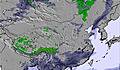 | 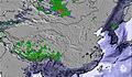 | 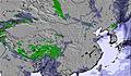 | 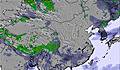 | 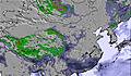 | 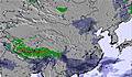 | 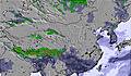 | |||||||||||||
— | — | — | — | — | — | — | — | — | 1.0 | — | — | — | — | — | — | — | — | — | — | |
— | — | — | — | — | — | — | — | — | — | — | — | — | — | — | — | — | — | — | — | |
max°C | -7 | -12 | -8 | -7 | -11 | -7 | -6 | -10 | -7 | -6 | -9 | -6 | -6 | -8 | -6 | -5 | -7 | -5 | -5 | -6 |
min°C | -8 | -15 | -10 | -8 | -13 | -9 | -7 | -11 | -8 | -6 | -11 | -7 | -6 | -10 | -7 | -5 | -9 | -6 | -5 | -8 |
-12 | -20 | -14 | -11 | -13 | -9 | -10 | -16 | -12 | -9 | -16 | -10 | -10 | -10 | -7 | -7 | -14 | -10 | -9 | -13 | |
40 | 36 | 31 | 29 | 24 | 25 | 38 | 32 | 55 | 85 | 76 | 70 | 81 | 64 | 59 | 60 | 53 | 36 | 31 | 19 | |
4250 | 2350 | 4250 | 4300 | 2700 | 4300 | 4350 | 2950 | 4300 | 4400 | 3350 | 4400 | 4500 | 3450 | 4500 | 4600 | 3850 | 4600 | 4650 | 3850 | |
— | — | 5:35 | — | — | 5:35 | — | — | 5:33 | — | — | 5:33 | — | — | 5:31 | — | — | 5:31 | — | — | |
7:07 | — | — | 7:07 | — | — | 7:07 | — | — | 7:08 | — | — | 7:09 | — | — | 7:10 | — | — | 7:10 | — | |
Mostly dry. Temperatures will be well below freezing (max -6°C on Fri afternoon, min -15°C on Wed night). Wind will be generally light.
A dusting of new snow. Temperatures will be below freezing (max -5°C on Mon afternoon, min -11°C on Sat night). Wind will be generally light.
Latest snow reports near Nun-Kun:
| Top snow depth: | — |
|---|---|
| Bottom snow depth: | — |
| Fresh snowfall depth: | — |
| Last snowfall: | 26 Apr 2025 |
| Snow Alerts | Create Alert |
3.0 | Bluebird Powder days Fresh snow, mostly sunny, light wind. |
|---|---|
1.5 | Powder days Fresh snow, limited sun, any wind. |
2.2 | Bluebird days Average snow, mostly sunny, light wind. |
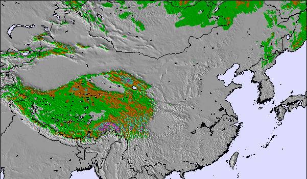
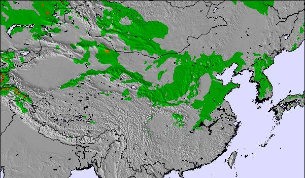
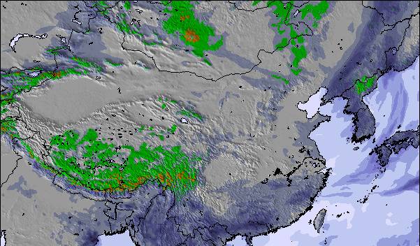
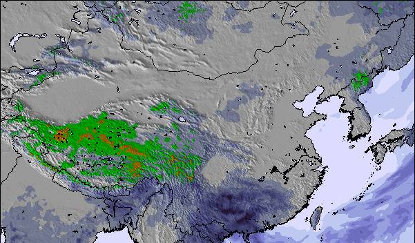
The above table gives the weather forecast for Nun-Kun at the specific elevation of 5318 m. Our sophisticated weather models allow us to provide snow forecasts for the top, middle and bottom ski stations of Nun-Kun. To access the weather forecasts for the other elevations, use the tab navigation above the table. For a wider view of the weather, check out the Weather Map of India.
Click here to read further information on freezing levels and how we forecast our temperatures.
The Nun-Kun skiing weather widget is available to embed on external websites free of charge. It provides a daily summary of our Nun-Kun snow forecast and current weather conditions. Simply go to the feed configuration page and follow the 3 simple steps to grab the custom html code snippet and paste it into your own site. You can choose the snow forecast elevation (summit, mid-mountain or bottom lift) and metric/imperial units for the snow forecast feed to suit your own website…. Click here to get the code.
View detailed snow forecast for Nun-Kun at:
snow-forecast.com

 Nearest