

Global Weekly Snow Roundup #314
Weekly Global Snow News, updated 14 May 2026: Fresh snowfall in Argentina, Australia and Lesotho signals winter’s approach, while Japan maintains the world’s deepest snowpack.

Next 3 days weather summary:Mostly dry. Very mild (max 13°C on Sat afternoon, min 9°C on Sat night). Winds increasing (calm on Sun morning, strong winds from the WSW by Mon morning). | Days 4-6 weather summary:Mostly dry. Very mild (max 11°C on Thu morning, min 8°C on Tue afternoon). Wind will be generally light. | ||||||||||||||||
Sat 16 | Sunday 17 | Monday 18 | Tuesday 19 | Wednesday 20 | Thursday 21 | ||||||||||||
PM | night | AM | PM | night | AM | PM | night | AM | PM | night | AM | PM | night | AM | PM | night | |
clear | some clouds | clear | clear | some clouds | some clouds | some clouds | some clouds | some clouds | cloudy | some clouds | some clouds | clear | clear | some clouds | some clouds | some clouds | |
km/h | |||||||||||||||||
Snow map | 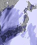 | 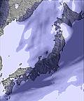 | 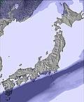 | 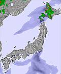 | 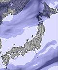 |  | |||||||||||
— | — | — | — | — | — | — | — | — | — | — | — | — | — | — | — | — | |
— | — | — | — | — | — | — | — | — | — | — | — | — | — | — | — | — | |
max °C | 13 | 11 | 9 | 10 | 10 | 12 | 12 | 11 | 9 | 8 | 8 | 10 | 10 | 9 | 11 | 11 | 9 |
min °C | 12 | 9 | 9 | 9 | 9 | 11 | 12 | 9 | 9 | 8 | 8 | 9 | 9 | 8 | 11 | 10 | 9 |
9 | 6 | 7 | 7 | 6 | 8 | 9 | 5 | 5 | 4 | 6 | 8 | 7 | 6 | 10 | 8 | 6 | |
68 | 88 | 59 | 73 | 72 | 63 | 57 | 88 | 78 | 69 | 46 | 50 | 51 | 36 | 36 | 59 | 33 | |
3500 | 3250 | 4000 | 3950 | 3250 | 3500 | 3650 | 3600 | 2850 | 2900 | 2750 | 2600 | 2550 | 2600 | 2800 | 2950 | 3000 | |
— | — | 4:13 | — | — | 4:11 | — | — | 4:11 | — | — | 4:09 | — | — | 4:09 | — | — | |
6:52 | — | — | 6:53 | — | — | 6:54 | — | — | 6:55 | — | — | 6:57 | — | — | 6:58 | — | |
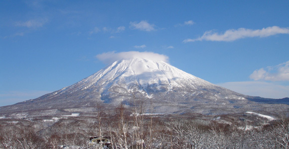
Latest snow reports near Niseko Village:
| Top snow depth: | — |
|---|---|
| Bottom snow depth: | — |
| Fresh snowfall depth: | — |
| Last snowfall: | 4 May 2026 |
| Snow Alerts | Create Alert |
0.1 | Bluebird Powder days Fresh snow, mostly sunny, light wind. |
|---|---|
0.0 | Powder days Fresh snow, limited sun, any wind. |
0.0 | Bluebird days Average snow, mostly sunny, light wind. |
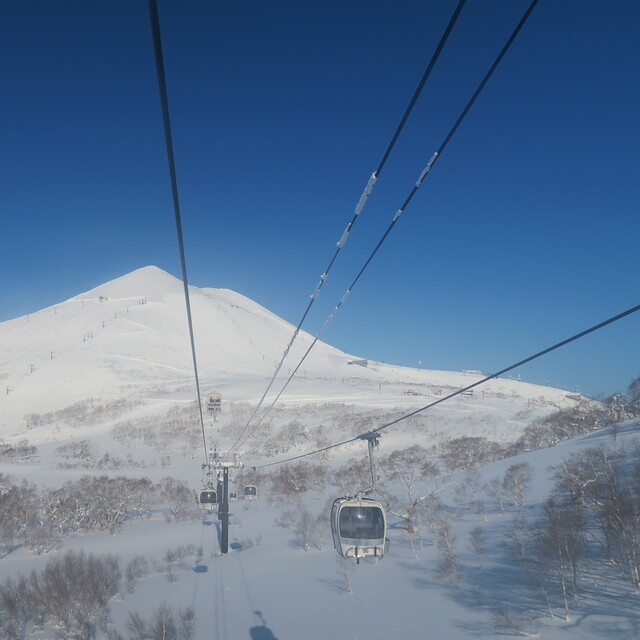
The above table gives the weather forecast for Niseko Village at the specific elevation of 1170 m. Our sophisticated weather models allow us to provide snow forecasts for the top, middle and bottom ski stations of Niseko Village. To access the weather forecasts for the other elevations, use the tab navigation above the table. For a wider view of the weather, check out the Weather Map of Japan.
Click here to read further information on freezing levels and how we forecast our temperatures.
Overall 4.4 Based on 1 vote and 3 reviews
Niseko Village is a great resort and has extremely user-friendly ski-in/ski-out services. I was in Niseko Village for 2009 Xmas to ski or, to be exact, learn to ski. Can't comment on the instructors because I have no comparison. However, the arrangement made by Hilton Niseko Village to assist skiers/boarders alike were really fantastic. Simply ski down the slope, take off your skis/board, enter the hotel building and within 10 steps there are welcoming hands from a counter help to store your equipment and right next to this, a second counter stores your boots in exchange for your own shoes. This will be the reverse when you want to go out skiing/boarding and the lift and gondola are only 10 to 20 steps after exiting the hotel building. Totally trouble-free and energy saving. Moreover, these are all carried out with broad smiles.
Kenneth from Hong Kong writes:
Niseko Village is a great resort and has extremely user-friendly ski-in/ski-out services. I was in Niseko Village for 2009 Xmas to ski or, to be exact, learn to ski. Can't comment on the instructors because I have no comparison. However, the arrangement made by Hilton Niseko Village to assist skiers/boarders alike were really fantastic. Simply ski down the slope, take off your skis/board, enter the hotel building and within 10 steps there are welcoming hands from a counter help to store your equipment and right next to this, a second counter stores your boots in exchange for your own shoes. This will be the reverse when you want to go out skiing/boarding and the lift and gondola are only 10 to 20 steps after exiting the hotel building. Totally trouble-free and energy saving. Moreover, these are all carried out with broad smiles.


 Nearest