

Global Weekly Snow Roundup #314
Weekly Global Snow News, updated 14 May 2026: Fresh snowfall in Argentina, Australia and Lesotho signals winter’s approach, while Japan maintains the world’s deepest snowpack.

Next 3 days weather summary:Heavy rain (total 29.0mm), heaviest during Sun afternoon. Mild temperatures (max 8°C on Sat afternoon, min 6°C on Sun morning). Winds decreasing (fresh winds from the N on Sat night, calm by Mon night). | Days 4-6 weather summary:Some drizzle, heaviest during Tue afternoon. Mild temperatures (max 6°C on Tue afternoon, min 2°C on Tue night). Wind will be generally light. | ||||||||||||||||
Sat 16 | Sunday 17 | Monday 18 | Tuesday 19 | Wednesday 20 | Thursday 21 | ||||||||||||
PM | night | AM | PM | night | AM | PM | night | AM | PM | night | AM | PM | night | AM | PM | night | |
clear | some clouds | mod. rain | heavy rain | mod. rain | rain shwrs | light rain | cloudy | some clouds | rain shwrs | some clouds | clear | clear | clear | clear | clear | clear | |
km/h | |||||||||||||||||
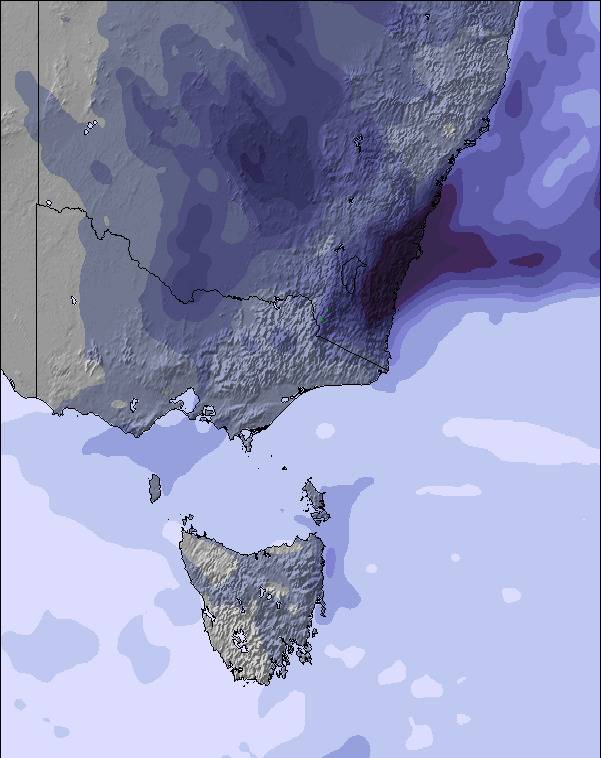
Snow map |  |  |  | 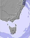 | 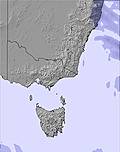 | 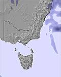 | |||||||||||
— | — | — | — | — | — | — | — | — | — | — | — | — | — | — | — | — | |
— | — | 6 | 14 | 7 | 1 | 1 | — | — | 1 | — | — | — | — | — | — | — | |
max °C | 8 | 8 | 6 | 6 | 6 | 6 | 6 | 6 | 6 | 6 | 4 | 3 | 4 | 4 | 4 | 6 | 5 |
min °C | 7 | 7 | 6 | 6 | 6 | 6 | 6 | 6 | 6 | 5 | 2 | 2 | 3 | 3 | 4 | 5 | 5 |
4 | 3 | 2 | 1 | 3 | 4 | 5 | 6 | 3 | 1 | -3 | -3 | -2 | 0 | 0 | 2 | 4 | |
70 | 77 | 95 | 97 | 98 | 93 | 90 | 85 | 76 | 75 | 79 | 60 | 66 | 58 | 60 | 62 | 53 | |
2900 | 2900 | 2700 | 2700 | 2850 | 2700 | 2700 | 2700 | 2650 | 2600 | 2350 | 2150 | 2500 | 3200 | 3150 | 3150 | 3400 | |
— | — | 7:03 | — | — | 7:05 | — | — | 7:05 | — | — | 7:05 | — | — | 7:07 | — | — | |
5:14 | — | — | 5:13 | — | — | 5:12 | — | — | 5:10 | — | — | 5:10 | — | — | 5:09 | — | |
Latest snow reports near Mount Buffalo:
| Top snow depth: | — |
|---|---|
| Bottom snow depth: | — |
| Fresh snowfall depth: | — |
| Last snowfall: | 7 May 2026 |
| Snow Alerts | Create Alert |
0.1 | Bluebird Powder days Fresh snow, mostly sunny, light wind. |
|---|---|
0.1 | Powder days Fresh snow, limited sun, any wind. |
0.0 | Bluebird days Average snow, mostly sunny, light wind. |
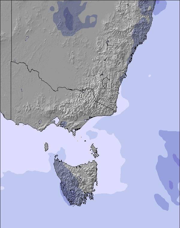
The above table gives the weather forecast for Mount Buffalo at the specific elevation of 1676 m. Our sophisticated weather models allow us to provide snow forecasts for the top, middle and bottom ski stations of Mount Buffalo. To access the weather forecasts for the other elevations, use the tab navigation above the table. For a wider view of the weather, check out the Weather Map of Australia.
Click here to read further information on freezing levels and how we forecast our temperatures.
Overall 2.4 Based on 3 votes and 5 reviews
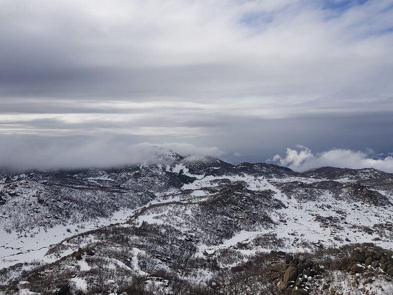
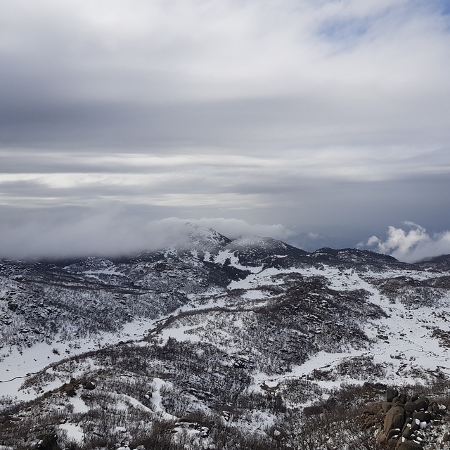
Mount Buffalo Snow Season 2018 Mount Buffalo has some of the best and most accessible snow in Victoria and it’s free as there are no resort fees to enter the park. Located only a 45 minute drive from Porepunkah and Bright, Mount Buffalo is “North East Victoria’s Winter Wonderland” and has extensive areas of snow at both Dingo Dell and Cresta Valley for snow play and tobogganing, cross country skiing or simply enjoying the amazing views. There is a warm and friendly café and day shelter at Dingo Dell where the Mount Buffalo Ski School is based and where there is excellent tobogganing for children and families. The ski school has a range of affordable snow clothes for those that might have forgotten winter warmers and also has toboggans for hire. Cresta Valley has extensive areas available for tobogganing as some of the old ski runs are now available to use for snow play and Cresta is also the hub for cross country skiers to access the groomed Cresta Beginners trail, Bogong Loop and Horn Road ski trails. There are also the longer ungroomed four and six kilometre trails (accessed off the Bogong Loop) and the Lyrebird Plain back country trail from the Horn Road. There is no café at Cresta Valley but there are portable toilets and a small day shelter (unheated). Take your winter woollies and wet weather gear. There is plenty of parking at both Dingo Dell and Cresta Other backcountry ski trails include the longer reservoir road trail. While the Mount McLeod and Rocky Creek ski trails take you further out backcountry. Mount Buffalo Ski School offer daily cross-country ski lessons at Dingo Dell plus half and full day ski tours. The mountain has snowshoe trails (and snow shoes for hire at the Ski School Shop) plus amazing snow hikes to the top of the Hump and the lookout at Dingo Dell. Mount Buffalo Ski School also run regular snowshoe rambles each Wednesday and Saturday afternoon at 2.30. The gorge precinct with its amazing views of the valleys below and the Alps is well worth a visit and the historical Mount Buffalo Chalet covered with snow is a great photo opportunity. Snow camping is available at Lake Catani and Mt McLeod camping areas While there are no ski lifts at Mount Buffalo (the old resort having burnt down in 2006) there are still areas at Cresta Valley where you can back country style alpine ski or snowboard by simply hiking uphill with your skis or board and then traveling back down the old ski runs and of course it is free!
David Chitty from Australia writes:
Mount Buffalo Snow Season 2018
Mount Buffalo has some of the best and most accessible snow in Victoria and it’s free as there are no resort fees to enter the park. Located only a 45 minute drive from Porepunkah and Bright, Mount Buffalo is “North East Victoria’s Winter Wonderland” and has extensive areas of snow at both Dingo Dell and Cresta Valley for snow play and tobogganing, cross country skiing or simply enjoying the amazing views.
There is a warm and friendly café and day shelter at Dingo Dell where the Mount Buffalo Ski School is based and where there is excellent tobogganing for children and families. The ski school has a range of affordable snow clothes for those that might have forgotten winter warmers and also has toboggans for hire.
Cresta Valley has extensive areas available for tobogganing as some of the old ski runs are now available to use for snow play and Cresta is also the hub for cross country skiers to access the groomed Cresta Beginners trail, Bogong Loop and Horn Road ski trails. There are also the longer ungroomed four and six kilometre trails (accessed off the Bogong Loop) and the Lyrebird Plain back country trail from the Horn Road. There is no café at Cresta Valley but there are portable toilets and a small day shelter (unheated). Take your winter woollies and wet weather gear.
There is plenty of parking at both Dingo Dell and Cresta
Other backcountry ski trails include the longer reservoir road trail. While the Mount McLeod and Rocky Creek ski trails take you further out backcountry. Mount Buffalo Ski School offer daily cross-country ski lessons at Dingo Dell plus half and full day ski tours.
The mountain has snowshoe trails (and snow shoes for hire at the Ski School Shop) plus amazing snow hikes to the top of the Hump and the lookout at Dingo Dell. Mount Buffalo Ski School also run regular snowshoe rambles each Wednesday and Saturday afternoon at 2.30.
The gorge precinct with its amazing views of the valleys below and the Alps is well worth a visit and the historical Mount Buffalo Chalet covered with snow is a great photo opportunity.
Snow camping is available at Lake Catani and Mt McLeod camping areas
While there are no ski lifts at Mount Buffalo (the old resort having burnt down in 2006) there are still areas at Cresta Valley where you can back country style alpine ski or snowboard by simply hiking uphill with your skis or board and then traveling back down the old ski runs and of course it is free!


 Nearest