

Global Weekly Snow Roundup #314
Weekly Global Snow News, updated 14 May 2026: Fresh snowfall in Argentina, Australia and Lesotho signals winter’s approach, while Japan maintains the world’s deepest snowpack.

Next 3 days weather summary:Heavy rain (total 21.0mm), heaviest during Sun morning. Very mild (max 10°C on Sat afternoon, min 5°C on Mon afternoon). Winds decreasing (strong winds from the NNW on Sat night, calm by Mon afternoon). | Days 4-6 weather summary:Light rain (total 7.0mm), mostly falling on Tue afternoon. Freeze-thaw conditions (max 7°C on Fri morning, min 0°C on Tue night). Winds decreasing (fresh winds from the SW on Tue night, light winds from the E by Fri morning). | ||||||||||||||||
Sat 16 | Sunday 17 | Monday 18 | Tuesday 19 | Wednesday 20 | Thursday 21 | ||||||||||||
PM | night | AM | PM | night | AM | PM | night | AM | PM | night | AM | PM | night | AM | PM | night | |
some clouds | light rain | light rain | light rain | light rain | rain shwrs | rain shwrs | light rain | some clouds | light rain | light snow | light rain | rain shwrs | light snow | rain shwrs | some clouds | clear | |
km/h | |||||||||||||||||
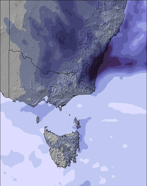
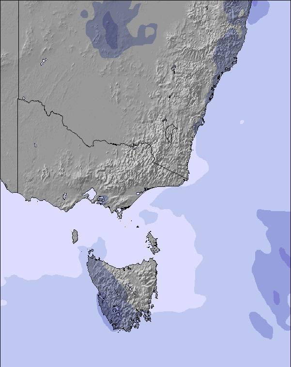
Snow map | 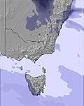 | 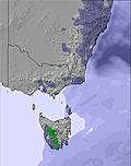 | 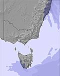 | 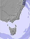 | 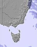 | 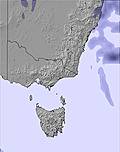 | |||||||||||
— | — | — | — | — | — | — | — | — | — | — | — | — | — | — | — | — | |
— | 1 | 4 | 3 | 4 | 3 | 3 | 3 | — | 1 | 1 | 1 | 2 | 1 | 1 | — | — | |
max °C | 10 | 8 | 7 | 7 | 6 | 7 | 7 | 6 | 6 | 5 | 3 | 2 | 3 | 2 | 4 | 3 | 3 |
min °C | 7 | 7 | 6 | 6 | 6 | 7 | 5 | 5 | 5 | 4 | 0 | 2 | 2 | 1 | 2 | 2 | 1 |
3 | 2 | 0 | 4 | 5 | 6 | 5 | 3 | 3 | 0 | -6 | -3 | -4 | -4 | -2 | -2 | -3 | |
68 | 74 | 84 | 92 | 99 | 85 | 90 | 88 | 85 | 88 | 98 | 99 | 97 | 99 | 96 | 93 | 87 | |
3000 | 3100 | 2800 | 2650 | 2650 | 2700 | 2700 | 2600 | 2450 | 2350 | 1800 | 1850 | 2500 | 3100 | 2950 | 3150 | 3250 | |
— | — | 7:09 | — | — | 7:09 | — | — | 7:09 | — | — | 7:11 | — | — | 7:11 | — | — | |
5:13 | — | — | 5:13 | — | — | 5:12 | — | — | 5:10 | — | — | 5:09 | — | — | 5:09 | — | |
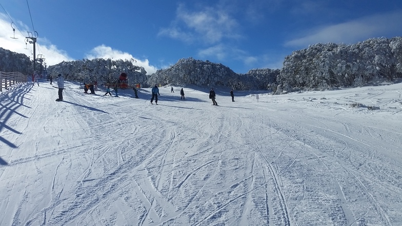
Latest snow reports near Mount Baw Baw:
| Top snow depth: | — |
|---|---|
| Bottom snow depth: | — |
| Fresh snowfall depth: | — |
| Last snowfall: | 7 May 2026 |
| Snow Alerts | Create Alert |
0.1 | Bluebird Powder days Fresh snow, mostly sunny, light wind. |
|---|---|
0.3 | Powder days Fresh snow, limited sun, any wind. |
0.1 | Bluebird days Average snow, mostly sunny, light wind. |
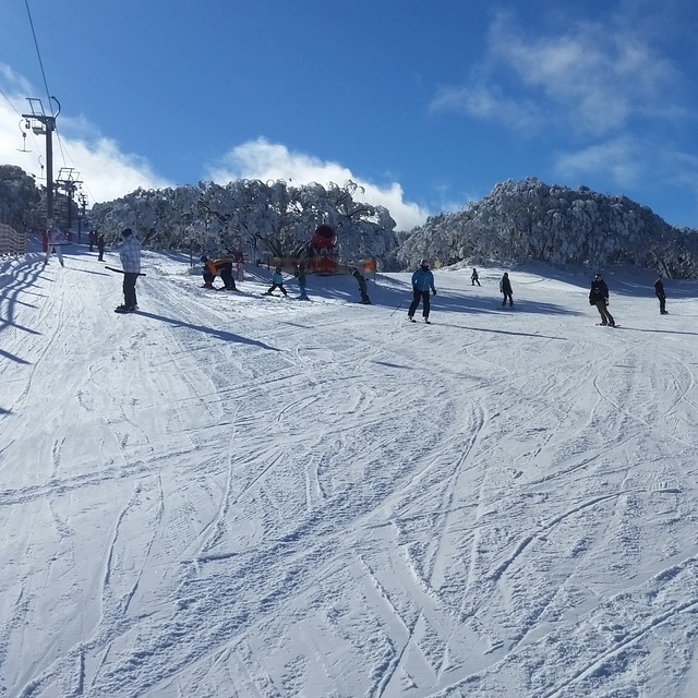

The above table gives the weather forecast for Mount Baw Baw at the specific elevation of 1450 m. Our sophisticated weather models allow us to provide snow forecasts for the top, middle and bottom ski stations of Mount Baw Baw. To access the weather forecasts for the other elevations, use the tab navigation above the table. For a wider view of the weather, check out the Weather Map of Australia.
Click here to read further information on freezing levels and how we forecast our temperatures.
Overall 3.4 Based on 5 votes and 2 reviews
I've had a great couple of seasons working at Mt. Baw Baw as a ski-instructor and working in the skihire from Franz Reiter. Nice mountain especially for families. We did have a lot of fun with the school groups as well. We hope to be back in 2005 again :-) Cu than and there!!!
Connie Huibregtse from Netherlands writes:
I've had a great couple of seasons working at Mt. Baw Baw as a ski-instructor and working in the skihire from Franz Reiter.
Nice mountain especially for families.
We did have a lot of fun with the school groups as well.
We hope to be back in 2005 again :-)
Cu than and there!!!


 Nearest