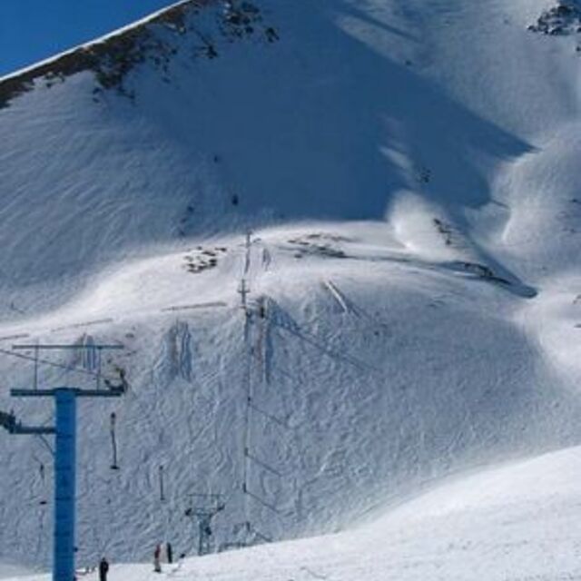
Weather Forecast for Mount Lyford at1750m altitude
Issued: 11 am 03 Aug 2026 (local time)
Forecast update in hr min
Next snow in Mount Lyford: 2.8cm on Mon 3rd (after 9 PM local time)
View forecast
Mount Lyfordat 1750 m altitude
Issued by Snow-Forecast.com at:11 am (local time) / 03 Aug 2026
Last 6 daysScroll left for last 6 daysNow
Next 3 days weather summary:
A moderate fall of snow, heaviest on Mon night. Freeze-thaw conditions (max 1°C on Mon morning, min -10°C on Tue morning). Winds decreasing (near gales from the W on Mon morning, light winds from the SW by Wed night).
Days 4-6 weather summary:
Mostly dry. Freeze-thaw conditions (max 4°C on Thu night, min -2°C on Sat night). Winds decreasing (fresh winds from the WNW on Fri night, calm by Sat night).
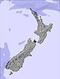
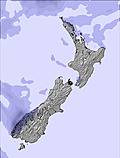
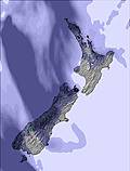
The above table gives the weather forecast for Mount Lyford at the specific elevation of 1750 m. Our sophisticated weather models allow us to provide snow forecasts for the top, middle and bottom ski stations of Mount Lyford. To access the weather forecasts for the other elevations, use the tab navigation above the table. For a wider view of the weather, check out the Weather Map of New Zealand.
Click here to read further information on freezing levels and how we forecast our temperatures.
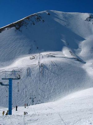
For those of us whom relish club atmosphere fields - Mount Lyford is one of the best that New Zealand has to offer. The snow gods were with us on our visit of 2008 with base of 400cm and 200cm of that being powder, only a dozen local 4wds and a blue bird day. Being a young student and not owning a flash ride, the ski field owner even towed us to the carpark as Billy the Civic could not handle the ride up - gotta love Kiwis.
As our last ride on our return drive home to Nelson from the crowds at nearby Mt Hutt, I had the best day in over 15 years riding with the Mount Lyford experience: great team, great snow and no showponys - just a hill covered with lovely white stuff and fantastic people enjoying it together; Bliss. Only gripe was no halfpipe, maybe it was buried that day aye? =)
Free Snow-Forecast.com weather widget for your website
Embed the Mount Lyford weather widget on your site for free. It provides a weekly snapshot of snow and rain conditions across all elevations. Follow the two quick steps to grab your custom code and paste it into your site. Choose between metric or imperial units. Click here to get the code.


 Nearest