Weather Forecast for Mount Lyford at1400m altitude
Issued: 11 pm 01 Aug 2026 (local time)
Forecast update in hr min
Next snow in Mount Lyford: 0.9cm on Mon 3rd (after 9 PM local time)
View forecast
Mount Lyfordat 1400 m altitude
Issued by Snow-Forecast.com at:11 pm (local time) / 01 Aug 2026
Last 6 daysScroll left for last 6 daysNow
Next 4 days weather summary:
A dusting of new snow. Freeze-thaw conditions (max 4°C on Sun afternoon, min -6°C on Mon night). Winds increasing (calm on Sun morning, near gales from the WNW by Mon morning).
Days 5-7 weather summary:
Mostly dry. Freeze-thaw conditions (max 1°C on Thu morning, min -7°C on Tue night). Winds decreasing (fresh winds from the SSW on Tue night, calm by Fri morning).
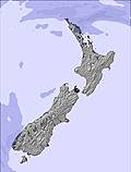
The above table gives the weather forecast for Mount Lyford at the specific elevation of 1400 m. Our sophisticated weather models allow us to provide snow forecasts for the top, middle and bottom ski stations of Mount Lyford. To access the weather forecasts for the other elevations, use the tab navigation above the table. For a wider view of the weather, check out the Weather Map of New Zealand.
Click here to read further information on freezing levels and how we forecast our temperatures.
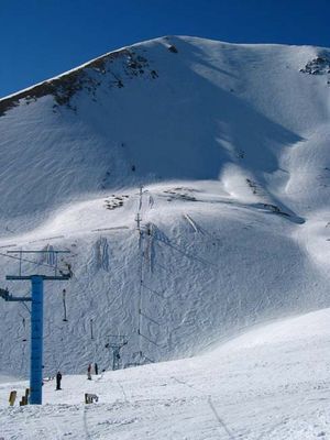
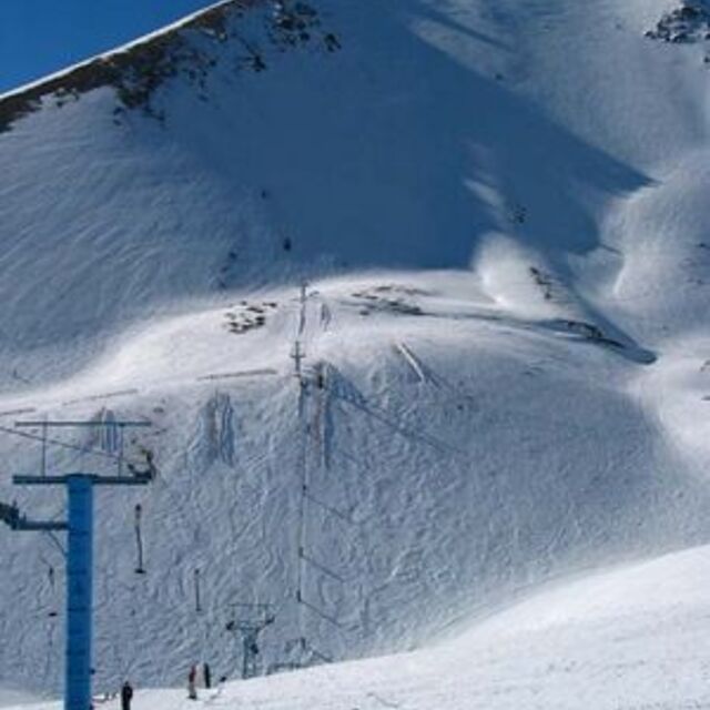
Mt Lyford is a very worthwhile little resort. It is located on the edge of the Kaikouras about 40 minutes drive from the famous surf breaks. The location gives it a rather different climate to any other New Zealand reports and so it can have good seasons when other places are poor and vice versa. It is not terribly far from either Hanmer or Rainbow yet the weather at Mount Lyford is often very different. Easterly winds favour snowfall here but there is some exposure to southerly fronts too. Depending on the season, snow bases can range from 50cm to almost 5m.
Mount Lyford is also unusual because there are many wooden chalets located above the winter snowline in the beech forest giving it a tranquil and Alpine feel. You can either hire a chalet here or stay in the ski-lodge down by the main road where there are rooms for all budgets. Alternatively, stay at popular Hanmer Springs or even at Kaikoura.
The actual ski area is located several kms away and chains and/or 4WD are usually needed for access. Skiing is all above the trees which can cause problems if it is windy or if visibility is poor.
Skiing facilities comprise of various drag lifts and a rope. They cover a modest area but as long as the lower lifts are running some longish runs are possible. It is nice terrain - not as challenging as say Broken River or Craigieburn, but good enough for most. Mid week tends to be very quiet here.
The top rope tow gives access to a very nice off-piste area and ski touring options abound as long as it is safe to do so. The staff are friendly and there is a small Day Lodge for food and drinks or just a break. The views are incredible.
Free Snow-Forecast.com weather widget for your website
Embed the Mount Lyford weather widget on your site for free. It provides a weekly snapshot of snow and rain conditions across all elevations. Follow the two quick steps to grab your custom code and paste it into your site. Choose between metric or imperial units. Click here to get the code.


 Nearest