

Global Weekly Snow Roundup #314
Weekly Global Snow News, updated 14 May 2026: Fresh snowfall in Argentina, Australia and Lesotho signals winter’s approach, while Japan maintains the world’s deepest snowpack.

Next 3 days weather summary:Mostly dry. Mild temperatures (max 6°C on Sat night, min 5°C on Sat morning). Wind will be generally light. | Days 4-6 weather summary:Mostly dry. Mild temperatures (max 8°C on Wed morning, min 5°C on Tue morning). Wind will be generally light. | |||||||||||||||||
Saturday 16 | Sunday 17 | Monday 18 | Tuesday 19 | Wednesday 20 | Thursday 21 | |||||||||||||
AM | PM | night | AM | PM | night | AM | PM | night | AM | PM | night | AM | PM | night | AM | PM | night | |
clear | clear | clear | clear | clear | clear | clear | clear | clear | clear | some clouds | some clouds | some clouds | some clouds | some clouds | some clouds | some clouds | some clouds | |
km/h | ||||||||||||||||||
Snow map |  |  |  |  |  |  | ||||||||||||
— | — | — | — | — | — | — | — | — | — | — | — | — | — | — | — | — | — | |
— | — | — | — | — | — | — | — | — | — | — | — | — | — | — | — | — | — | |
max °C | 5 | 5 | 6 | 6 | 5 | 5 | 5 | 5 | 5 | 6 | 6 | 7 | 8 | 8 | 8 | 8 | 7 | 7 |
min °C | 5 | 5 | 5 | 6 | 5 | 5 | 5 | 5 | 5 | 5 | 6 | 7 | 8 | 8 | 7 | 7 | 7 | 7 |
5 | 5 | 4 | 6 | 5 | 5 | 4 | 3 | 5 | 3 | 3 | 6 | 6 | 6 | 6 | 4 | 4 | 3 | |
26 | 30 | 16 | 15 | 22 | 23 | 23 | 28 | 27 | 12 | 16 | 7 | 7 | 8 | 11 | 9 | 17 | 33 | |
2750 | 2700 | 2700 | 2700 | 2650 | 2650 | 2600 | 2650 | 2650 | 2750 | 3000 | 3200 | 3450 | 3450 | 3300 | 3300 | 3450 | 3550 | |
7:39 | — | — | 7:41 | — | — | 7:41 | — | — | 7:43 | — | — | 7:45 | — | — | 7:46 | — | — | |
— | 5:19 | — | — | 5:17 | — | — | 5:16 | — | — | 5:15 | — | — | 5:15 | — | — | 5:14 | — | |
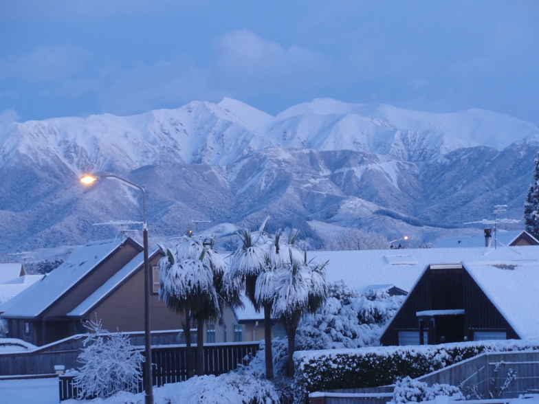
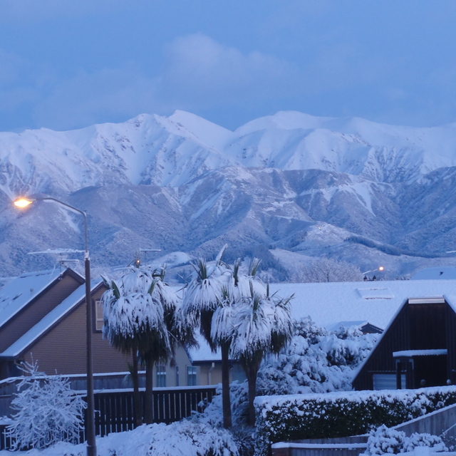
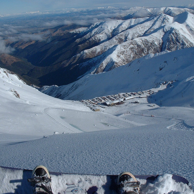
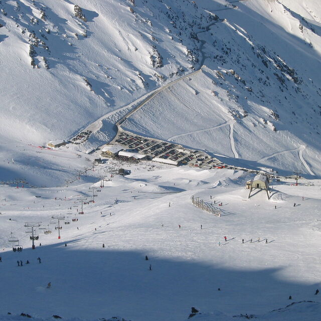
Latest snow reports near Mt Hutt:
| Top snow depth: | 0 cm |
|---|---|
| Bottom snow depth: | 0 cm |
| Fresh snowfall depth: | — |
| Last snowfall: | 10 May 2026 |
| Snow Alerts | Create Alert |
0.7 | Bluebird Powder days Fresh snow, mostly sunny, light wind. |
|---|---|
0.4 | Powder days Fresh snow, limited sun, any wind. |
0.6 | Bluebird days Average snow, mostly sunny, light wind. |
The above table gives the weather forecast for Mt Hutt at the specific elevation of 1743 m. Our sophisticated weather models allow us to provide snow forecasts for the top, middle and bottom ski stations of Mt Hutt. To access the weather forecasts for the other elevations, use the tab navigation above the table. For a wider view of the weather, check out the Weather Map of New Zealand.
Click here to read further information on freezing levels and how we forecast our temperatures.
Overall 3.6 Based on 44 votes and 19 reviews
Nearing the end of our sixth season at Mt Hutt and getting ready to early bird our passes for next season. We've made use of the instructors and lifts as our snowboarding family has grown and Mt Hutt has been brilliant. Friendly, courteous staff with consistently the best snow in Canterbury and sometimes the country. Not the cheapest, but its an alpine resort and still affordable for most families.
Callum from New Zealand writes:
Nearing the end of our sixth season at Mt Hutt and getting ready to early bird our passes for next season. We've made use of the instructors and lifts as our snowboarding family has grown and Mt Hutt has been brilliant. Friendly, courteous staff with consistently the best snow in Canterbury and sometimes the country. Not the cheapest, but its an alpine resort and still affordable for most families.


 Nearest