

Global Weekly Snow Roundup #314
Weekly Global Snow News, updated 14 May 2026: Fresh snowfall in Argentina, Australia and Lesotho signals winter’s approach, while Japan maintains the world’s deepest snowpack.

Next 3 days weather summary:Mostly dry. Mild temperatures (max 6°C on Fri afternoon, min 1°C on Fri night). Wind will be generally light. | Days 4-6 weather summary:Mostly dry. Very mild (max 10°C on Thu morning, min 2°C on Mon afternoon). Wind will be generally light. | ||||||||||||||||
Fri 15 | Saturday 16 | Sunday 17 | Monday 18 | Tuesday 19 | Wednesday 20 | ||||||||||||
PM | night | AM | PM | night | AM | PM | night | AM | PM | night | AM | PM | night | AM | PM | night | |
clear | clear | clear | clear | clear | clear | clear | clear | clear | clear | clear | some clouds | some clouds | some clouds | clear | some clouds | clear | |
km/h | |||||||||||||||||
Snow map |  |  |  |  |  |  | |||||||||||
— | — | — | — | — | — | — | — | — | — | — | — | — | — | — | — | — | |
— | — | — | — | — | — | — | — | — | — | — | — | — | — | — | — | — | |
max °C | 6 | 2 | 5 | 5 | 2 | 6 | 5 | 2 | 6 | 5 | 2 | 6 | 5 | 3 | 8 | 7 | 5 |
min °C | 3 | 1 | 3 | 2 | 2 | 4 | 2 | 2 | 4 | 2 | 2 | 3 | 2 | 3 | 5 | 5 | 5 |
3 | 1 | 3 | 2 | 2 | 4 | 2 | 2 | 3 | 2 | 2 | 2 | 0 | 1 | 4 | 2 | 2 | |
29 | 35 | 27 | 37 | 19 | 17 | 35 | 32 | 20 | 38 | 23 | 12 | 27 | 9 | 7 | 17 | 7 | |
2800 | 2800 | 2750 | 2750 | 2750 | 2750 | 2650 | 2650 | 2650 | 2600 | 2700 | 2900 | 3100 | 3350 | 3400 | 3600 | 3850 | |
— | — | 7:39 | — | — | 7:39 | — | — | 7:41 | — | — | 7:41 | — | — | 7:43 | — | — | |
5:20 | — | — | 5:19 | — | — | 5:17 | — | — | 5:16 | — | — | 5:15 | — | — | 5:15 | — | |
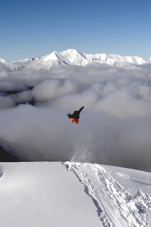
Latest snow reports near Mount Cheeseman:
| Top snow depth: | — |
|---|---|
| Bottom snow depth: | — |
| Fresh snowfall depth: | — |
| Last snowfall: | 10 May 2026 |
| Snow Alerts | Create Alert |
0.4 | Bluebird Powder days Fresh snow, mostly sunny, light wind. |
|---|---|
0.5 | Powder days Fresh snow, limited sun, any wind. |
0.1 | Bluebird days Average snow, mostly sunny, light wind. |
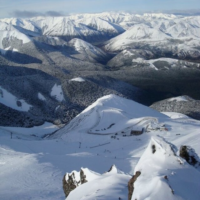
The above table gives the weather forecast for Mount Cheeseman at the specific elevation of 1634 m. Our sophisticated weather models allow us to provide snow forecasts for the top, middle and bottom ski stations of Mount Cheeseman. To access the weather forecasts for the other elevations, use the tab navigation above the table. For a wider view of the weather, check out the Weather Map of New Zealand.
Click here to read further information on freezing levels and how we forecast our temperatures.
Overall 3.8 Based on 11 votes and 9 reviews
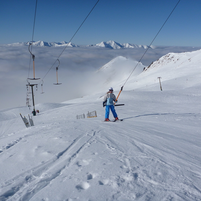
My brothers and I skied at Mt Cheeseman in August 2011 and I cannot speak highly enough of the mountain, it's facilities and the wonderful staff and members. We stayed on mountain and it is so good to get up in the morning and walk 15 metres to the T-bar to get skiing for the day. The field has a good variety of terrain for people of all abilities and even better, no crowds. After skiing in Australia and paying top dollar for crappy conditions, crowded slopes and rude people, Mt Cheeseman is heaven. The value for money is second to none and I have skied in Canada, U.S as well as other mountains in NZ. Most importantly, we were made to feel like family there. Within a couple of hours, we knew everyone there by name and had our meals together, swapping stories, having a laugh and an awesome time. I tell every Aussie who loves to ski uncrowded, challenging terrain, stay on the mountain and do it for under half the price of Australian slopes.... Go Cheesman!!!
Taylor H from Australia writes:
My brothers and I skied at Mt Cheeseman in August 2011 and I cannot speak highly enough of the mountain, it's facilities and the wonderful staff and members. We stayed on mountain and it is so good to get up in the morning and walk 15 metres to the T-bar to get skiing for the day. The field has a good variety of terrain for people of all abilities and even better, no crowds. After skiing in Australia and paying top dollar for crappy conditions, crowded slopes and rude people, Mt Cheeseman is heaven. The value for money is second to none and I have skied in Canada, U.S as well as other mountains in NZ. Most importantly, we were made to feel like family there. Within a couple of hours, we knew everyone there by name and had our meals together, swapping stories, having a laugh and an awesome time.
I tell every Aussie who loves to ski uncrowded, challenging terrain, stay on the mountain and do it for under half the price of Australian slopes.... Go Cheesman!!!


 Nearest