

Global Weekly Snow Roundup #314
Weekly Global Snow News, updated 14 May 2026: Fresh snowfall in Argentina, Australia and Lesotho signals winter’s approach, while Japan maintains the world’s deepest snowpack.

Next 4 days weather summary:Moderate rain (total 19.0mm), heaviest on Mon morning. Freeze-thaw conditions (max 7°C on Sun afternoon, min 0°C on Sat night). Wind will be generally light. | Days 5-7 weather summary:Mostly dry. Very mild (max 18°C on Fri afternoon, min 6°C on Tue night). Wind will be generally light. | |||||||||||||||
Sunday 17 | Monday 18 | Tuesday 19 | Wednesday 20 | Thursday 21 | ||||||||||||
night | AM | PM | night | AM | PM | night | AM | PM | night | AM | PM | night | AM | PM | night | |
rain shwrs | some clouds | cloudy | some clouds | light rain | light rain | mod. rain | light rain | light rain | some clouds | clear | some clouds | clear | some clouds | some clouds | clear | |
km/h | ||||||||||||||||
Snow map |  |  |  |  |  |  | ||||||||||
— | — | — | — | — | — | — | — | — | — | — | — | — | — | — | — | |
1 | — | — | — | 4 | 3 | 6 | 1 | 4 | — | — | — | — | — | — | — | |
max °C | 3 | 5 | 7 | 6 | 4 | 6 | 5 | 4 | 5 | 7 | 9 | 13 | 12 | 12 | 15 | 14 |
min °C | 0 | 1 | 7 | 4 | 3 | 6 | 3 | 4 | 5 | 6 | 7 | 12 | 10 | 10 | 14 | 12 |
0 | 1 | 6 | 3 | 1 | 4 | 2 | 3 | 3 | 5 | 7 | 11 | 10 | 10 | 14 | 12 | |
76 | 56 | 56 | 65 | 96 | 71 | 95 | 88 | 93 | 85 | 70 | 48 | 65 | 55 | 55 | 63 | |
1500 | 2250 | 2400 | 2250 | 2000 | 2300 | 2050 | 2400 | 2700 | 2600 | 2900 | 3050 | 3400 | 3750 | 3800 | 3950 | |
— | 5:58 | — | — | 5:56 | — | — | 5:56 | — | — | 5:54 | — | — | 5:54 | — | — | |
— | — | — | 9:00 | — | — | 9:01 | — | — | 9:02 | — | — | 9:04 | — | — | 9:05 | |
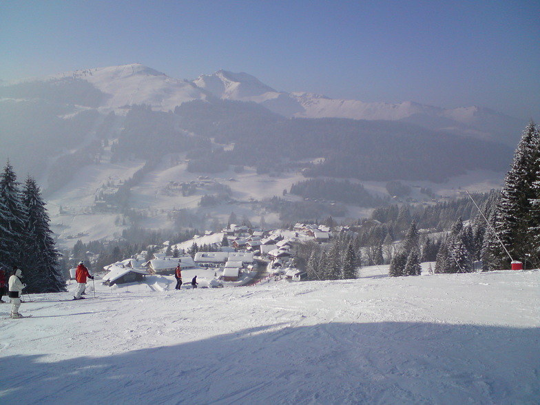
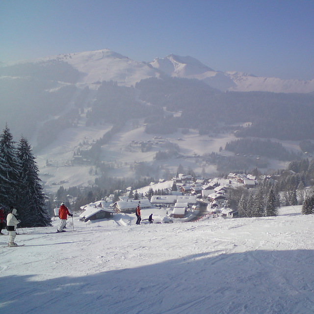
Latest snow reports near Morzine:
| Top snow depth: | — |
|---|---|
| Bottom snow depth: | — |
| Fresh snowfall depth: | 14 cm |
| Last snowfall: | 15 May 2026 |
| Snow Alerts | Create Alert |
0.0 | Bluebird Powder days Fresh snow, mostly sunny, light wind. |
|---|---|
0.0 | Powder days Fresh snow, limited sun, any wind. |
0.0 | Bluebird days Average snow, mostly sunny, light wind. |

The above table gives the weather forecast for Morzine at the specific elevation of 1509 m. Our sophisticated weather models allow us to provide snow forecasts for the top, middle and bottom ski stations of Morzine. To access the weather forecasts for the other elevations, use the tab navigation above the table. For a wider view of the weather, check out the Weather Map of France.
Click here to read further information on freezing levels and how we forecast our temperatures.
Overall 4.5 Based on 80 votes and 114 reviews
Been coming to Morzine and PDS skiing for many years. Morzine is a living mountain town in and out of season so no apologies for being more real than tourist-only ski resorts. A big enough town to wander about and find what suits you according to your age and stage of ski holidays. For us, now our children are adults, it’s about cruising over a few valleys for lunch. Mountain restaurants are everywhere, and what’s not to like about a fabulous view and a tartiflette lunch? If you think expensive then you haven’t been to the 3 valleys or Chamonix recently! The great advantages of being UK orientated with many UK people living there is the great choice of ski schools for adults and kids, and there’s always someone who can chat to you in the bar!
Shelly from United Kingdom writes:
Been coming to Morzine and PDS skiing for many years. Morzine is a
living mountain town in and out of season so no apologies for being more real than tourist-only ski resorts. A big enough town to wander about and find what suits you according to your age and stage of ski holidays. For us, now our children are adults, it’s about cruising over a few valleys for lunch. Mountain restaurants are everywhere, and what’s not to like about a fabulous view and a tartiflette lunch? If you think expensive then you haven’t been to the 3 valleys or Chamonix recently! The great advantages of being UK orientated with many UK people living there is the great choice of ski schools for adults and kids, and there’s always someone who can chat to you in the bar!


 Nearest