
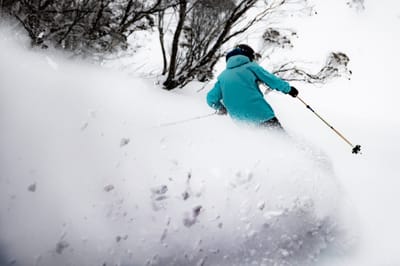
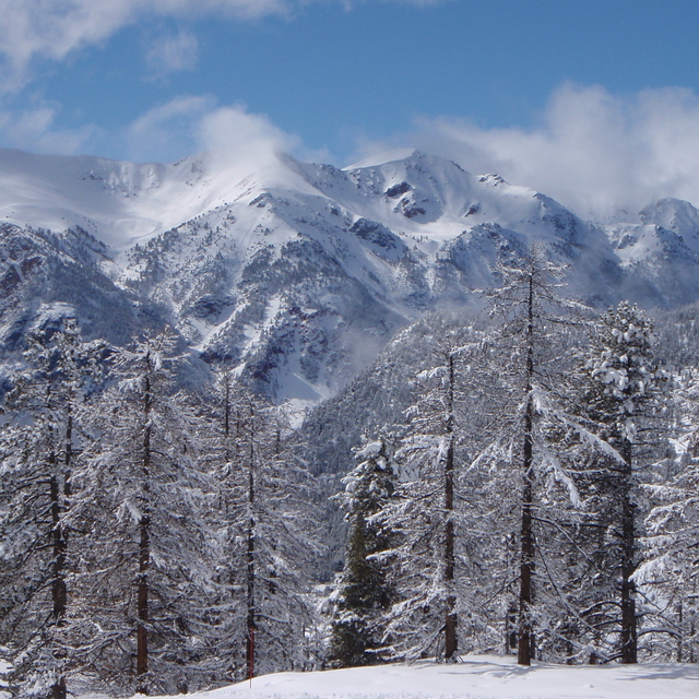
Late Season Storm Boosts Australia’s Bumper Season Even More
The latest in a series of major snowstorms has hit Australia’s ski slopes.
By using Snow-Forecast, you agree to our Terms & Services.
Don't have an account? Join now
Alternatively, you can now use your Outside account to sign in to any brand in the Outside digital ecosystem, including Snow-Forecast, Surf-Forecast, and Mountain-Forecast.


Montgenèvre (Vialattea) Weather (Next 3 days): The snow forecast for Montgenèvre (Vialattea) is: Heavy rain (total 35.0mm), heaviest during Mon afternoon. Very mild (max 15°C on Sun afternoon, min 5°C on Mon night). Wind will be generally light.
Montgenèvre (Vialattea) Weather (Days 4-6): Light rain (total 5.0mm), mostly falling on Tue night. Very mild (max 17°C on Thu afternoon, min 5°C on Tue night). Wind will be generally light.
| Resort | Snow Depth | Temp. (°C) | Wind (km/h) | Weather | ||
|---|---|---|---|---|---|---|
| Top Lift: | 6 | |||||
| Middle Lift: | 10 | |||||
| Bottom Lift: | 11 |
Latest snow reports near Montgenèvre (Vialattea):

Sunday 31 | Monday 1 | Tuesday 2 | Wednesday 3 | Thursday 4 | Friday 5 | ||||||||||||||
night | AM | PM | night | AM | PM | night | AM | PM | night | AM | PM | night | AM | PM | night | AM | PM | night | |
clear | clear | some clouds | rain shwrs | mod. rain | heavy rain | rain shwrs | some clouds | rain shwrs | rain shwrs | clear | clear | clear | clear | clear | rain shwrs | rain shwrs | risk thun- der | rain shwrs | |
km/h | |||||||||||||||||||
Snow map |  |  |  |  |  |  |  | ||||||||||||
— | — | — | — | — | — | — | — | — | — | — | — | — | — | — | — | — | — | — | |
— | — | — | 2 | 6 | 15 | 10 | — | 2 | 1 | — | — | — | — | — | 2 | 1 | 1 | 2 | |
max°C | 10 | 13 | 15 | 11 | 10 | 10 | 6 | 7 | 10 | 8 | 10 | 15 | 12 | 15 | 17 | 13 | 13 | 16 | 11 |
min°C | 8 | 9 | 15 | 9 | 9 | 8 | 5 | 5 | 9 | 5 | 6 | 13 | 9 | 10 | 17 | 9 | 10 | 14 | 9 |
8 | 9 | 15 | 7 | 7 | 6 | 4 | 4 | 8 | 3 | 5 | 13 | 9 | 10 | 17 | 8 | 10 | 14 | 9 | |
51 | 33 | 48 | 88 | 91 | 94 | 90 | 76 | 59 | 81 | 48 | 39 | 65 | 42 | 47 | 74 | 59 | 61 | 86 | |
4150 | 3950 | 4150 | 3800 | 3550 | 3400 | 3150 | 3050 | 3250 | 3250 | 3550 | 3950 | 4200 | 4150 | 4200 | 3950 | 3750 | 3850 | 3700 | |
— | 6:52 | — | — | 6:54 | — | — | 6:54 | — | — | 6:56 | — | — | 6:56 | — | — | 6:58 | — | — | |
— | — | — | 8:13 | — | — | 8:10 | — | — | 8:08 | — | — | 8:07 | — | — | 8:05 | — | — | 8:04 | |
Heavy rain (total 35.0mm), heaviest during Mon afternoon. Very mild (max 15°C on Sun afternoon, min 5°C on Mon night). Wind will be generally light.
Light rain (total 5.0mm), mostly falling on Tue night. Very mild (max 17°C on Thu afternoon, min 5°C on Tue night). Wind will be generally light.
Latest snow reports near Montgenèvre (Vialattea):
| Top snow depth: | — |
|---|---|
| Bottom snow depth: | — |
| Fresh snowfall depth: | — |
| Last snowfall: | 8 May 2025 |
| Snow Alerts | Create Alert |
0.0 | Bluebird Powder days Fresh snow, mostly sunny, light wind. |
|---|---|
0.0 | Powder days Fresh snow, limited sun, any wind. |
0.0 | Bluebird days Average snow, mostly sunny, light wind. |
The above table gives the weather forecast for Montgenèvre (Vialattea) at the specific elevation of 2015 m. Our sophisticated weather models allow us to provide snow forecasts for the top, middle and bottom ski stations of Montgenèvre (Vialattea). To access the weather forecasts for the other elevations, use the tab navigation above the table. For a wider view of the weather, check out the Weather Map of France.
Click here to read further information on freezing levels and how we forecast our temperatures.
Resort name is also written as Montgenevre (Via Lattea).
Overall 4.1 Based on 17 votes and 34 reviews
Montgenevre is a little gem. Usually great snow, no crowds and plenty of variety We have skied every year and sometimes twice, since 2006. Linked access to the Via Latea is a bonus. Again, booked to go in January: all fingers crossed that France will let us in! We are fully jabbed and healthy!
deborah scollan from United Kingdom writes:
Montgenevre is a little gem. Usually great snow, no crowds and plenty of variety We have skied every year and sometimes twice, since 2006. Linked access to the Via Latea is a bonus. Again, booked to go in January: all fingers crossed that France will let us in! We are fully jabbed and healthy!
Read 33 more reviews of Montgenèvre (Vialattea) or submit your own
The Montgenèvre (Vialattea) skiing weather widget is available to embed on external websites free of charge. It provides a daily summary of our Montgenèvre (Vialattea) snow forecast and current weather conditions. Simply go to the feed configuration page and follow the 3 simple steps to grab the custom html code snippet and paste it into your own site. You can choose the snow forecast elevation (summit, mid-mountain or bottom lift) and metric/imperial units for the snow forecast feed to suit your own website…. Click here to get the code.
View detailed snow forecast for Montgenèvre (Vialattea) at:
snow-forecast.com


 Nearest