

Global Weekly Snow Roundup #314
Weekly Global Snow News, updated 14 May 2026: Fresh snowfall in Argentina, Australia and Lesotho signals winter’s approach, while Japan maintains the world’s deepest snowpack.

Next 3 days weather summary:Moderate rain (total 15.0mm), heaviest on Sat afternoon. Freeze-thaw conditions (max 11°C on Sun afternoon, min -3°C on Sat night). Wind will be generally light. | Days 4-6 weather summary:Light rain (total 5.0mm), mostly falling on Tue afternoon. Very mild (max 18°C on Thu afternoon, min 5°C on Tue night). Wind will be generally light. | |||||||||||||||||
Saturday 16 | Sunday 17 | Monday 18 | Tuesday 19 | Wednesday 20 | Thursday 21 | |||||||||||||
AM | PM | night | AM | PM | night | AM | PM | night | AM | PM | night | AM | PM | night | AM | PM | night | |
light rain | light rain | rain shwrs | some clouds | some clouds | rain shwrs | light rain | light rain | light rain | cloudy | light rain | light rain | some clouds | some clouds | some clouds | some clouds | clear | clear | |
km/h | ||||||||||||||||||
Snow map |  |  |  |  |  |  | ||||||||||||
— | — | — | — | — | — | — | — | — | — | — | — | — | — | — | — | — | — | |
1 | 3 | 1 | — | — | 1 | 1 | 4 | 4 | — | 3 | 2 | — | — | — | — | — | — | |
max °C | 3 | 5 | 4 | 8 | 11 | 7 | 8 | 9 | 7 | 9 | 8 | 7 | 12 | 15 | 12 | 15 | 18 | 14 |
min °C | 0 | 4 | -3 | 2 | 11 | 4 | 6 | 8 | 4 | 6 | 7 | 5 | 7 | 14 | 6 | 9 | 18 | 8 |
0 | 2 | -6 | 2 | 11 | 3 | 6 | 8 | 4 | 6 | 7 | 5 | 7 | 14 | 6 | 9 | 18 | 7 | |
75 | 70 | 86 | 55 | 57 | 77 | 79 | 73 | 95 | 76 | 94 | 94 | 73 | 63 | 81 | 58 | 50 | 76 | |
1650 | 1900 | 1300 | 2300 | 2550 | 2200 | 2300 | 2350 | 2150 | 2550 | 2650 | 2650 | 3000 | 3100 | 3450 | 3650 | 3650 | 4050 | |
5:58 | — | — | 5:58 | — | — | 5:56 | — | — | 5:54 | — | — | 5:54 | — | — | 5:52 | — | — | |
— | — | 8:58 | — | — | 8:59 | — | — | 9:00 | — | — | 9:00 | — | — | 9:01 | — | — | 9:04 | |
Latest snow reports near Les Marécottes - Salvan:
| Top snow depth: | — |
|---|---|
| Bottom snow depth: | — |
| Fresh snowfall depth: | 13 cm |
| Last snowfall: | 15 May 2026 |
| Snow Alerts | Create Alert |
0.0 | Bluebird Powder days Fresh snow, mostly sunny, light wind. |
|---|---|
0.0 | Powder days Fresh snow, limited sun, any wind. |
0.0 | Bluebird days Average snow, mostly sunny, light wind. |
The above table gives the weather forecast for Les Marécottes - Salvan at the specific elevation of 1277 m. Our sophisticated weather models allow us to provide snow forecasts for the top, middle and bottom ski stations of Les Marécottes - Salvan. To access the weather forecasts for the other elevations, use the tab navigation above the table. For a wider view of the weather, check out the Weather Map of Switzerland.
Click here to read further information on freezing levels and how we forecast our temperatures.
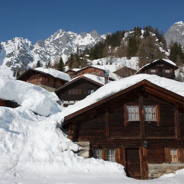
Resort name is also written as Les Marecottes - Salvan.
Overall 3.7 Based on 1 vote and 2 reviews
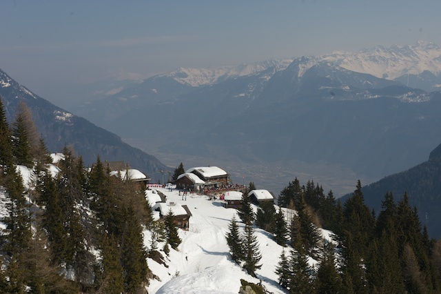
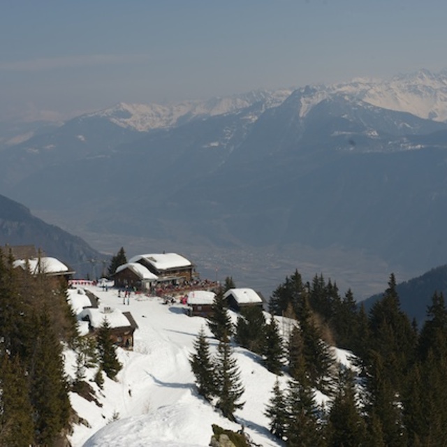
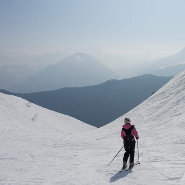
We skied at Les Marecottes for the first time last year and were utterly impressed. The resort is easily accessible - just minutes from the motorway, inbetween Verbier and Chamonix. While it's not a huge resort, the skiing is some of the best we've had. What struck us most was the lay-out of the pistes which ensured that our younger kids always skied past the restaurant terrace and there's no chance they'd end up who knows where. Our older boy had plenty of 'off-piste' to devour which is found right next to the lifts. There were no queues nor the mad morning rush after the snow fall. The village itself is untouched by development - no apartment blocks - something of a rarity. So, all this considered and knowing the kids were happy to get rid of us for a change, gave us the peace of mind we needed (and earned!). Well worth looking into. MH
Mike Hollingsworth from United Kingdom writes:
We skied at Les Marecottes for the first time last year and were utterly impressed. The resort is easily accessible - just minutes from the motorway, inbetween Verbier and Chamonix. While it's not a huge resort, the skiing is some of the best we've had. What struck us most was the lay-out of the pistes which ensured that our younger kids always skied past the restaurant terrace and there's no chance they'd end up who knows where. Our older boy had plenty of 'off-piste' to devour which is found right next to the lifts. There were no queues nor the mad morning rush after the snow fall. The village itself is untouched by development - no apartment blocks - something of a rarity. So, all this considered and knowing the kids were happy to get rid of us for a change, gave us the peace of mind we needed (and earned!). Well worth looking into. MH
Read 1 more reviews of Les Marécottes - Salvan or submit your own


 Nearest