

Portillo Storm Snowfall Total Passes 5m / 17 Feet
A snow storm that has now continued for nine days has taken Chilean ski resort Portillo to a snowfall total of 5.2 metres (17 feet) so far, with more snow forecast.

Next 3 days weather summary:Light rain (total 5.0mm), mostly falling on Thu night. Warm (max 24°C on Thu afternoon, min 16°C on Fri night). Wind will be generally light. | Days 4-6 weather summary:Light rain (total 4.0mm), mostly falling on Mon afternoon. Warm (max 23°C on Sun afternoon, min 13°C on Mon night). Wind will be generally light. | |||||||||||||||||
Thursday 30 | Friday 31 | Saturday 1 | Sunday 2 | Monday 3 | Tuesday 4 | |||||||||||||
AM | PM | night | AM | PM | night | AM | PM | night | AM | PM | night | AM | PM | night | AM | PM | night | |
clear | clear | rain shwrs | some clouds | some clouds | rain shwrs | clear | some clouds | rain shwrs | clear | some clouds | clear | some clouds | t-storm risk | rain shwrs | clear | some clouds | rain shwrs | |
km/h | ||||||||||||||||||
Snow map |  |  |  |  |  |  | ||||||||||||
— | — | — | — | — | — | — | — | — | — | — | — | — | — | — | — | — | — | |
mm | — | — | 1 | — | — | 2 | — | — | 2 | — | — | — | — | 1 | 2 | — | — | 1 |
max °C | 22 | 24 | 21 | 22 | 23 | 19 | 20 | 22 | 20 | 21 | 23 | 21 | 19 | 20 | 17 | 19 | 20 | 17 |
min °C | 19 | 24 | 18 | 18 | 22 | 16 | 16 | 21 | 16 | 17 | 23 | 17 | 17 | 19 | 13 | 15 | 19 | 15 |
chill °C | 19 | 24 | 18 | 18 | 22 | 16 | 16 | 21 | 16 | 17 | 23 | 17 | 16 | 19 | 12 | 15 | 19 | 15 |
Humid % | 30 | 31 | 47 | 32 | 38 | 66 | 41 | 40 | 60 | 39 | 32 | 52 | 40 | 47 | 70 | 45 | 55 | 64 |
Freeze m | 4800 | 5000 | 4800 | 4750 | 4900 | 4750 | 4650 | 4800 | 4750 | 4750 | 4950 | 4750 | 4600 | 4550 | 4600 | 4550 | 4800 | 4600 |
6:39 | — | — | 6:41 | — | — | 6:43 | — | — | 6:43 | — | — | 6:45 | — | — | 6:46 | — | — | |
— | — | 9:14 | — | — | 9:13 | — | — | 9:12 | — | — | 9:10 | — | — | 9:09 | — | — | 9:07 | |
Go pro and carve into:
Avalanche information: European Avalanche Warning Services (EAWS)
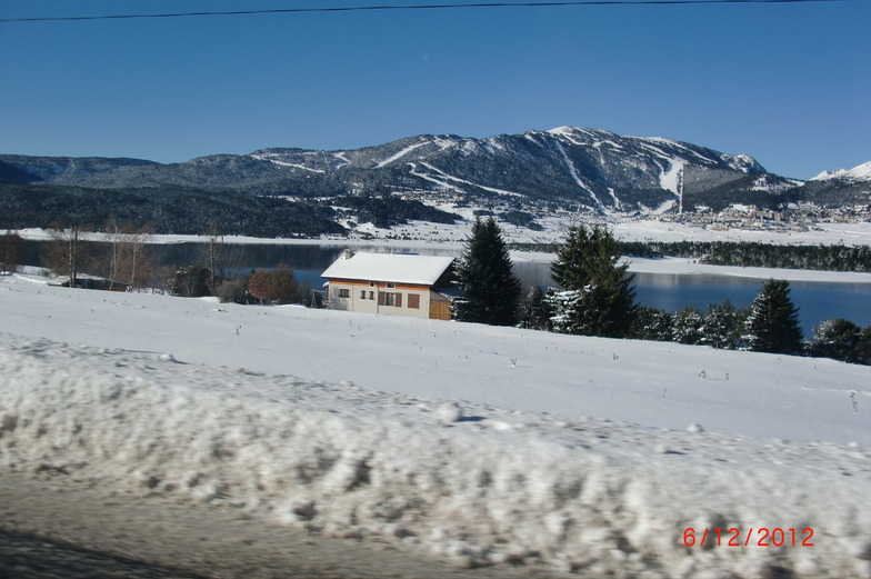
Latest snow reports near Les Angles:
| Top snow depth: | 0 cm |
|---|---|
| Bottom snow depth: | 0 cm |
| Fresh snowfall depth: | — |
| Last snowfall: | 17 May 2026 |
| Snow Alerts | Create Alert |
0.0 | Bluebird Powder days Fresh snow, mostly sunny, light wind. |
|---|---|
0.0 | Powder days Fresh snow, limited sun, any wind. |
0.0 | Bluebird days Average snow, mostly sunny, light wind. |
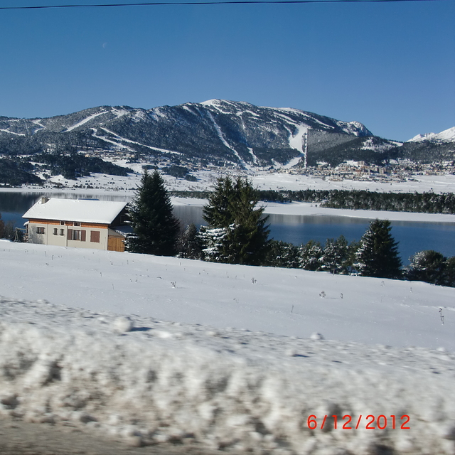
The above table gives the weather forecast for Les Angles at the specific elevation of 2025 m. Our sophisticated weather models allow us to provide snow forecasts for the top, middle and bottom ski stations of Les Angles. To access the weather forecasts for the other elevations, use the tab navigation above the table. For a wider view of the weather, check out the Weather Map of France.
Click here to read further information on freezing levels and how we forecast our temperatures.
Overall 3.9 Based on 15 votes and 8 reviews
I've visited Les Angles several times over the last 5 years. The mountain is great for a weekend trip with family. My boys aged 10 and 11 have both loved the slopes which are tree lined and easy cruising. The village centre is pretty with stone buildings, a dozen restaurants and bars. Within 30 mins drive are another 10 - 12 resorts. Choose Les Angles for a weekend trip which is a bit different from the norm.
Darren Papani from United Kingdom writes:
I've visited Les Angles several times over the last 5 years. The mountain is great for a weekend trip with family. My boys aged 10 and 11 have both loved the slopes which are tree lined and easy cruising. The village centre is pretty with stone buildings, a dozen restaurants and bars. Within 30 mins drive are another 10 - 12 resorts. Choose Les Angles for a weekend trip which is a bit different from the norm.


 Nearest