

Global Weekly Snow Roundup #314
Weekly Global Snow News, updated 14 May 2026: Fresh snowfall in Argentina, Australia and Lesotho signals winter’s approach, while Japan maintains the world’s deepest snowpack.

Next 3 days weather summary:Light rain (total 5.0mm) at first, then becoming colder with a dusting of snow on Mon night. Freeze-thaw conditions (max 5°C on Sun afternoon, min -4°C on Sat morning). Wind will be generally light. | Days 4-6 weather summary:Light rain (total 5.0mm), mostly falling on Tue afternoon. Very mild (max 12°C on Thu afternoon, min 2°C on Tue morning). Wind will be generally light. | |||||||||||||||||
Saturday 16 | Sunday 17 | Monday 18 | Tuesday 19 | Wednesday 20 | Thursday 21 | |||||||||||||
AM | PM | night | AM | PM | night | AM | PM | night | AM | PM | night | AM | PM | night | AM | PM | night | |
snow shwrs | light snow | snow shwrs | some clouds | some clouds | some clouds | light snow | light rain | light snow | cloudy | light rain | rain shwrs | clear | some clouds | some clouds | some clouds | some clouds | clear | |
km/h | ||||||||||||||||||
Snow map |  |  |  |  |  |  | ||||||||||||
— | 1 | — | — | — | — | — | — | 2 | — | — | — | — | — | — | — | — | — | |
— | — | — | — | — | — | — | 4 | 1 | — | 3 | 2 | — | — | — | — | — | — | |
max °C | -3 | 0 | 0 | 2 | 5 | 4 | 2 | 3 | 3 | 3 | 3 | 4 | 7 | 9 | 9 | 10 | 12 | 11 |
min °C | -4 | -2 | -1 | 0 | 4 | 2 | 1 | 3 | 1 | 2 | 3 | 4 | 4 | 9 | 7 | 8 | 12 | 10 |
-7 | -5 | -1 | 0 | 2 | 0 | -2 | 0 | -1 | 0 | 1 | 3 | 4 | 8 | 7 | 8 | 12 | 10 | |
81 | 76 | 68 | 46 | 61 | 76 | 86 | 72 | 96 | 83 | 94 | 81 | 71 | 63 | 61 | 46 | 43 | 45 | |
1650 | 1900 | 1700 | 2300 | 2500 | 2250 | 2250 | 2350 | 2100 | 2500 | 2650 | 2700 | 2950 | 3150 | 3550 | 3700 | 3750 | 4050 | |
6:01 | — | — | 6:00 | — | — | 5:58 | — | — | 5:58 | — | — | 5:56 | — | — | 5:56 | — | — | |
— | — | 8:59 | — | — | 9:00 | — | — | 9:00 | — | — | 9:01 | — | — | 9:04 | — | — | 9:05 | |
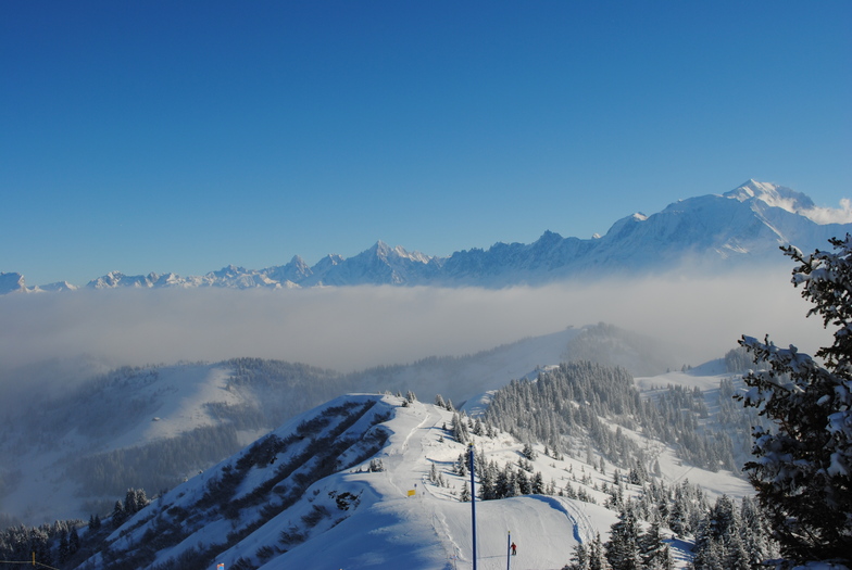
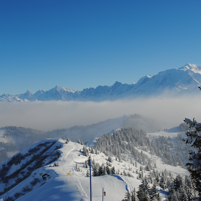
Latest snow reports near La Giettaz en Aravis:
Moderate rain reported from Haute-Savoie Mont Blanc Airport/Aéroport Annecy/Meythet at 711 metres elevation only 3 kms WNW of Annecy-LeSemnoz but it is forecast cold enough for snow at the ski area from Annecy-LeSemnoz
Light rain reported from Haute-Savoie Mont Blanc Airport/Aéroport Annecy/Meythet at 711 metres elevation only 3 kms WNW of Annecy-LeSemnoz but it is forecast cold enough for snow at the ski area from Annecy-LeSemnoz
| Top snow depth: | 60 cm |
|---|---|
| Bottom snow depth: | 5 cm |
| Fresh snowfall depth: | 14 cm |
| Last snowfall: | 15 May 2026 |
| Snow Alerts | Create Alert |
0.1 | Bluebird Powder days Fresh snow, mostly sunny, light wind. |
|---|---|
0.2 | Powder days Fresh snow, limited sun, any wind. |
0.0 | Bluebird days Average snow, mostly sunny, light wind. |
The above table gives the weather forecast for La Giettaz en Aravis at the specific elevation of 1951 m. Our sophisticated weather models allow us to provide snow forecasts for the top, middle and bottom ski stations of La Giettaz en Aravis. To access the weather forecasts for the other elevations, use the tab navigation above the table. For a wider view of the weather, check out the Weather Map of France.
Click here to read further information on freezing levels and how we forecast our temperatures.
Resort name is also written as La Giettaz.
Overall 4.0 Based on 13 votes and 2 reviews
Was an awesome place. Great skiing and wonderful village. With the surrounding towns within close proximity was the ideal place to relax after a day of skiing. Love the village. All 'round, will definitely be my choice of places to say with good accommodation at reasonable prices.
Stephane Vignes from Australia writes:
Was an awesome place. Great skiing and wonderful village. With the surrounding towns within close proximity was the ideal place to relax after a day of skiing. Love the village. All 'round, will definitely be my choice of places to say with good accommodation at reasonable prices.
Read 1 more reviews of La Giettaz en Aravis or submit your own


 Nearest