

Global Weekly Snow Roundup #314
Weekly Global Snow News, updated 14 May 2026: Fresh snowfall in Argentina, Australia and Lesotho signals winter’s approach, while Japan maintains the world’s deepest snowpack.

Next 3 days weather summary:Moderate rain (total 10.0mm) heaviest on Mon afternoon, then becoming colder with a dusting of snow on Mon night. Freeze-thaw conditions (max 5°C on Sun afternoon, min -5°C on Sat morning). Wind will be generally light. | Days 4-6 weather summary:Light rain (total 4.0mm), mostly falling on Tue afternoon. Very mild (max 13°C on Thu afternoon, min 2°C on Tue morning). Wind will be generally light. | |||||||||||||||||
Saturday 16 | Sunday 17 | Monday 18 | Tuesday 19 | Wednesday 20 | Thursday 21 | |||||||||||||
AM | PM | night | AM | PM | night | AM | PM | night | AM | PM | night | AM | PM | night | AM | PM | night | |
light snow | light snow | some clouds | cloudy | light rain | light snow | light snow | mod. rain | light snow | cloudy | light rain | rain shwrs | some clouds | clear | some clouds | clear | clear | clear | |
km/h | ||||||||||||||||||
Snow map |  |  |  |  |  |  | ||||||||||||
— | — | — | — | — | — | — | — | 2 | — | — | — | — | — | — | — | — | — | |
— | — | — | — | 1 | 1 | 2 | 6 | — | — | 2 | 2 | — | — | — | — | — | — | |
max °C | -3 | -1 | -1 | 3 | 5 | 2 | 3 | 3 | 2 | 3 | 4 | 4 | 7 | 9 | 8 | 11 | 13 | 11 |
min °C | -5 | -2 | -2 | 0 | 3 | 0 | 1 | 2 | 1 | 2 | 3 | 3 | 4 | 9 | 6 | 7 | 12 | 9 |
-10 | -6 | -2 | 0 | 2 | -2 | 0 | 0 | 0 | 2 | 1 | 3 | 4 | 8 | 6 | 7 | 12 | 9 | |
80 | 75 | 65 | 47 | 85 | 89 | 78 | 78 | 94 | 82 | 94 | 85 | 64 | 59 | 68 | 38 | 37 | 50 | |
1700 | 1950 | 1650 | 2400 | 2500 | 2250 | 2400 | 2450 | 2200 | 2600 | 2750 | 2850 | 3150 | 3350 | 3700 | 3850 | 3900 | 4150 | |
6:03 | — | — | 6:03 | — | — | 6:01 | — | — | 6:01 | — | — | 6:00 | — | — | 5:58 | — | — | |
— | — | 8:58 | — | — | 8:59 | — | — | 9:00 | — | — | 9:00 | — | — | 9:02 | — | — | 9:04 | |
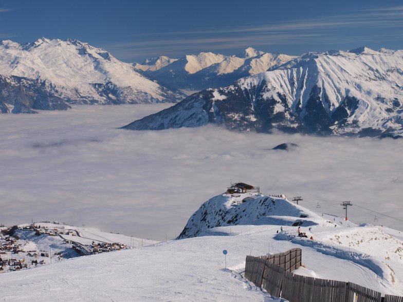
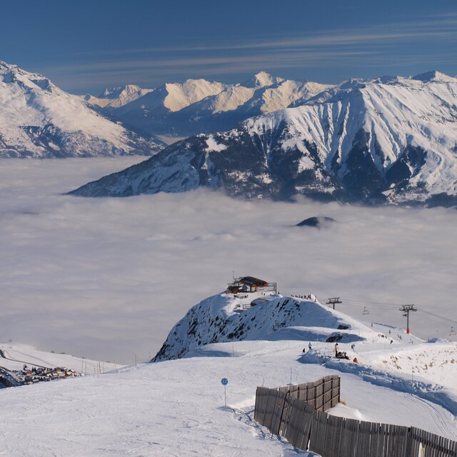
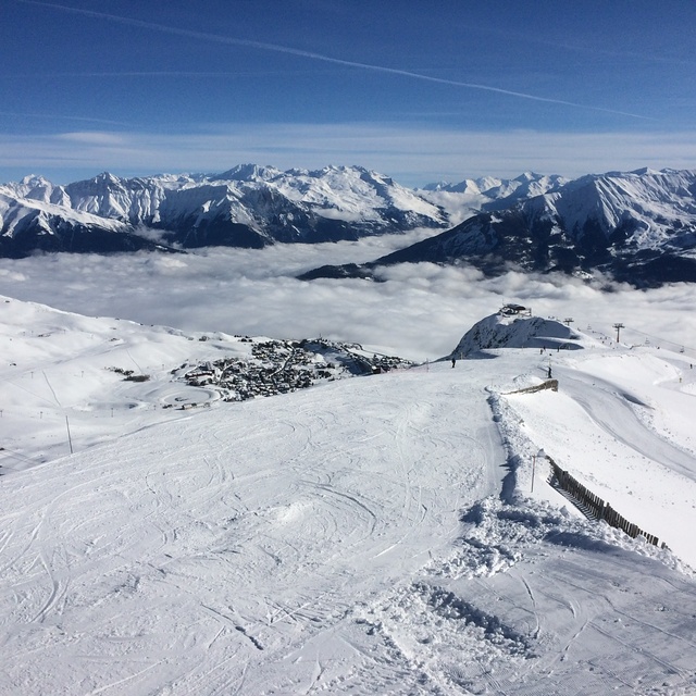
Latest snow reports near La Toussuire (Les Sybelles):
| Top snow depth: | — |
|---|---|
| Bottom snow depth: | — |
| Fresh snowfall depth: | 11 cm |
| Last snowfall: | 15 May 2026 |
| Snow Alerts | Create Alert |
0.0 | Bluebird Powder days Fresh snow, mostly sunny, light wind. |
|---|---|
0.5 | Powder days Fresh snow, limited sun, any wind. |
0.1 | Bluebird days Average snow, mostly sunny, light wind. |

The above table gives the weather forecast for La Toussuire (Les Sybelles) at the specific elevation of 2090 m. Our sophisticated weather models allow us to provide snow forecasts for the top, middle and bottom ski stations of La Toussuire (Les Sybelles). To access the weather forecasts for the other elevations, use the tab navigation above the table. For a wider view of the weather, check out the Weather Map of France.
Click here to read further information on freezing levels and how we forecast our temperatures.
Overall 3.8 Based on 17 votes and 10 reviews
This is easily the worst resort we have been to. There are good reasons to go to France but none of them are met here. Quality Slopeside accommodation: no, we had the best in terms of slope access and that was dubious, and the standard of service in the accommodation was abysmal. Good modern infrastructure: no, too many old fashioned fixed chair lifts, only one of those with a magic carpet to speed loading, and the need to use drags. Well laid out runs: not really, the northern section has very few skiers on it and the reason is plain if you try it, there are a lot of narrow runs, which should merit a grade increase. And of course all of the bad things France always has to offer are here as well. Overpriced poor quality mountain eating, and poor customer service in general. Corbier is far better but you may have to get the bus there, as the links do not lend themselves to beginners or low intermediates, especially if the weather is poor.
paul from United Kingdom writes:
This is easily the worst resort we have been to. There are good reasons to go to France but none of them are met here.
Quality Slopeside accommodation: no, we had the best in terms of slope access and that was dubious, and the standard of service in the accommodation was abysmal.
Good modern infrastructure: no, too many old fashioned fixed chair lifts, only one of those with a magic carpet to speed loading, and the need to use drags.
Well laid out runs: not really, the northern section has very few skiers on it and the reason is plain if you try it, there are a lot of narrow runs, which should merit a grade increase.
And of course all of the bad things France always has to offer are here as well. Overpriced poor quality mountain eating, and poor customer service in general.
Corbier is far better but you may have to get the bus there, as the links do not lend themselves to beginners or low intermediates, especially if the weather is poor.
Read 9 more reviews of La Toussuire (Les Sybelles) or submit your own


 Nearest