


View forecast
Klyuchevskaya at 4750 m altitude
Issued by Snow-Forecast.com at: 5 pm (local time) / 29 Apr 2024
Now
Mon 29 | Tuesday 30 | Wednesday 1 | Thursday 2 | Friday 3 | Saturday 4 | Sunday 5 | ||||||||||||||
PM | night | AM | PM | night | AM | PM | night | AM | PM | night | AM | PM | night | AM | PM | night | AM | PM | night | |
light snow | snow shwrs | cloudy | light snow | light snow | snow shwrs | snow shwrs | snow shwrs | snow shwrs | light snow | snow shwrs | clear | clear | light snow | some clouds | snow shwrs | some clouds | clear | clear | clear | |
km/h | ||||||||||||||||||||
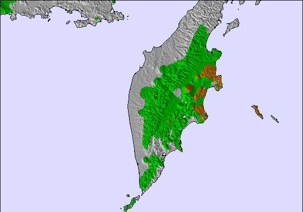
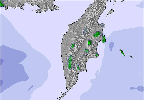
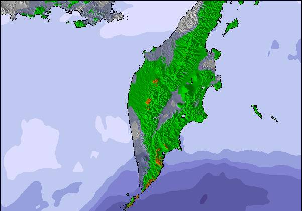
Snow map | 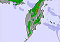 | 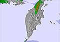 | 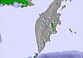 | 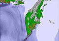 | 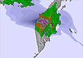 | 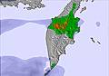 | 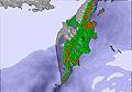 | |||||||||||||
2.0 | 1.0 | — | 2.0 | 4 | — | — | — | — | — | — | — | — | — | — | — | — | — | — | — | |
— | — | — | — | — | — | — | — | — | — | — | — | — | — | — | — | — | — | — | — | |
max°C | -26 | -26 | -25 | -24 | -24 | -23 | -21 | -20 | -21 | -21 | -23 | -25 | -26 | -26 | -26 | -26 | -26 | -27 | -28 | -28 |
min°C | -27 | -28 | -26 | -25 | -25 | -23 | -22 | -22 | -21 | -22 | -24 | -26 | -26 | -27 | -26 | -26 | -27 | -28 | -29 | -29 |
-32 | -38 | -43 | -40 | -43 | -40 | -37 | -38 | -36 | -37 | -37 | -39 | -40 | -42 | -40 | -39 | -42 | -44 | -45 | -44 | |
70 | 72 | 92 | 98 | 98 | 64 | 63 | 53 | 79 | 69 | 53 | 27 | 43 | 63 | 44 | 51 | 47 | 55 | 59 | 46 | |
600 | 150 | 300 | 400 | 100 | 400 | 800 | 350 | 450 | 500 | 0 | 200 | 500 | 0 | 400 | 750 | 0 | 350 | 600 | 0 | |
— | — | 5:35 | — | — | 5:33 | — | — | 5:31 | — | — | 5:28 | — | — | 5:26 | — | — | 5:24 | — | — | |
8:53 | — | — | 8:55 | — | — | 8:58 | — | — | — | 9:00 | — | — | 9:01 | — | — | 9:04 | — | — | 9:06 | |
Next 0-3 days weather summary:
A light covering of new snow, mostly falling on Tue night. Extremely cold (max -20°C on Wed night, min -28°C on Mon night). Mainly near gales.
Next 4-6 days weather summary:
A dusting of new snow. Extremely cold (max -21°C on Thu afternoon, min -28°C on Sun morning). Mainly strong winds.
Popular Klyuchevskaya Pages
Snow Radar
Latest snow reports near Klyuchevskaya:
Klyuchevskaya Snow Conditions
| Top snow depth: | — |
|---|---|
| Bottom snow depth: | — |
| Fresh snowfall depth: | 11 cm |
| Last snowfall: | 28 Apr 2024 |
| Snow Alerts | Create Alert |
Other resorts in Russia are reporting: powder (0) / good piste (0)
Snow-Forecast Partner Offers
Show your business here
Snow History
Week 4 of April has on average:
0.8 | Bluebird Powder days Fresh snow, mostly sunny, light wind. |
|---|---|
1.4 | Powder days Fresh snow, limited sun, any wind. |
3.4 | Bluebird days Average snow, mostly sunny, light wind. |

Klyuchevskaya Forecast Snowfall
Other resorts in Russia are reporting: powder (0) / good piste (0)
The above table gives the weather forecast for Klyuchevskaya at the specific elevation of 4750 m. Our sophisticated weather models allow us to provide snow forecasts for the top, middle and bottom ski stations of Klyuchevskaya. To access the weather forecasts for the other elevations, use the tab navigation above the table. For a wider view of the weather, check out the Weather Map of Russia.
Click here to read further information on freezing levels and how we forecast our temperatures.
Visitor Reviews of Klyuchevskaya
- Ghiurghy Jofréyin from Armenia writes:
I have been to this place (Klyuchevskaya) 2 years ago in February 2008. It is a very, very cold resort but the ski conditions over there are just amazing. There is no lift, but we were with a group of survival tourists and had the opportunity to fly to the top with a helicopter. There was a lot of wind so we had to go down quickly and did only 1 descent of the mountain, but I will never forget it. I hope that someday they will build a lift over there as it (Klyuchevskaya) is really a nice place!
Visitor Reviews of Klyuchevskaya
Ghiurghy Jofréyin from Armenia writes:
I have been to this place (Klyuchevskaya) 2 years ago in February 2008. It is a very, very cold resort but the ski conditions over there are just amazing. There is no lift, but we were with a group of survival tourists and had the opportunity to fly to the top with a helicopter. There was a lot of wind so we had to go down quickly and did only 1 descent of the mountain, but I will never forget it. I hope that someday they will build a lift over there as it (Klyuchevskaya) is really a nice place!
Free Snow-Forecast.com weather widget for your website
The Klyuchevskaya skiing weather widget is available to embed on external websites free of charge. It provides a daily summary of our Klyuchevskaya snow forecast and current weather conditions. Simply go to the feed configuration page and follow the 3 simple steps to grab the custom html code snippet and paste it into your own site. You can choose the snow forecast elevation (summit, mid-mountain or bottom lift) and metric/imperial units for the snow forecast feed to suit your own website…. Click here to get the code.
View detailed snow forecast for Klyuchevskaya at:
snow-forecast.com

 Nearest