
Solitude Sets Record-Breaking Season With 178 Days of Skiing
Updated April 30, 2025: North America holds strong with over 30 ski areas still spinning lifts—snowy peaks in the West, deep bases in the Midwest, and sunny spring turns coast to coast.
Please sign in with your Snow-Forecast account details below.


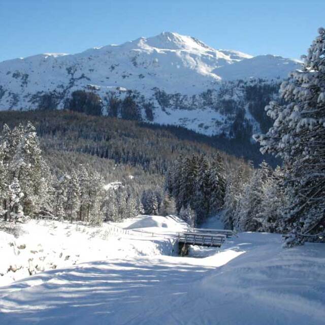
Klosters Weather (Next 3 days): The snow forecast for Klosters is: Heavy rain (total 48.0mm), heaviest during Sun night. Later becoming colder with a dusting of snow on Sun night. Very mild (max 16°C on Fri afternoon, min 2°C on Sun night). Wind will be generally light.
Klosters Weather (Days 4-6): A light covering of new snow on Mon morning turning to drizzle on Tue afternoon. Freeze-thaw conditions (max 2°C on Tue morning, min -1°C on Wed night). Wind will be generally light.
| Resort | Snow Depth | Temp. (°C) | Wind (km/h) | Weather | ||
|---|---|---|---|---|---|---|
| Top Lift: | 0.0 m | 7 | ||||
| Middle Lift: | 10 | |||||
| Bottom Lift: | 0.0 m | 11 |
Latest snow reports near Klosters:

Friday 2 | Saturday 3 | Sunday 4 | Monday 5 | Tuesday 6 | Wednesday 7 | Thursday 8 | |||||||||||||||
AM | PM | night | AM | PM | night | AM | PM | night | AM | PM | night | AM | PM | night | AM | PM | night | AM | PM | night | |
clear | clear | some clouds | some clouds | light rain | rain shwrs | light rain | mod. rain | light snow | light snow | light snow | light snow | light snow | light snow | light snow | light snow | light snow | snow shwrs | some clouds | light rain | light snow | |
km/h | |||||||||||||||||||||
Snow map |  |  |  |  |  |  |  | ||||||||||||||
— | — | — | — | — | — | — | — | 4 | 3 | — | — | 1.0 | 1.0 | 1.0 | — | — | — | — | — | 1.0 | |
— | — | — | — | 1.0 | 6 | 2.0 | 6 | 33 | — | — | — | — | 1.0 | — | — | — | — | — | 1.0 | 1.0 | |
max°C | 13 | 16 | 15 | 12 | 14 | 9 | 9 | 9 | 4 | 1 | 1 | 1 | 2 | 2 | 1 | 1 | 2 | 1 | 2 | 4 | 3 |
min°C | 10 | 15 | 10 | 10 | 12 | 7 | 8 | 8 | 2 | 1 | 1 | 0 | 1 | 2 | 0 | 0 | 1 | -1 | 0 | 3 | 0 |
10 | 15 | 9 | 9 | 12 | 7 | 8 | 7 | 1 | -2 | -1 | 0 | 1 | 1 | -2 | -2 | -1 | -1 | 0 | 3 | 0 | |
52 | 31 | 66 | 50 | 67 | 84 | 78 | 94 | 98 | 99 | 97 | 91 | 96 | 99 | 99 | 79 | 89 | 73 | 72 | 79 | 94 | |
3300 | 3650 | 3600 | 3350 | 3350 | 3100 | 2950 | 3000 | 2200 | 1900 | 1950 | 1800 | 2050 | 2050 | 1850 | 1900 | 2000 | 1850 | 2000 | 2250 | 1900 | |
6:03 | — | — | 6:03 | — | — | 6:01 | — | — | 6:00 | — | — | 5:58 | — | — | 5:56 | — | — | 5:54 | — | — | |
— | — | 8:30 | — | — | 8:31 | — | — | 8:32 | — | — | 8:35 | — | — | 8:36 | — | — | 8:37 | — | — | 8:38 | |
Heavy rain (total 48.0mm), heaviest during Sun night. Later becoming colder with a dusting of snow on Sun night. Very mild (max 16°C on Fri afternoon, min 2°C on Sun night). Wind will be generally light.
A light covering of new snow on Mon morning turning to drizzle on Tue afternoon. Freeze-thaw conditions (max 2°C on Tue morning, min -1°C on Wed night). Wind will be generally light.
Latest snow reports near Klosters:
| Top snow depth: | 0 cm |
|---|---|
| Bottom snow depth: | 0 cm |
| Fresh snowfall depth: | — |
| Last snowfall: | 23 Apr 2025 |
| Snow Alerts | Create Alert |
0.1 | Bluebird Powder days Fresh snow, mostly sunny, light wind. |
|---|---|
0.4 | Powder days Fresh snow, limited sun, any wind. |
0.1 | Bluebird days Average snow, mostly sunny, light wind. |
The above table gives the weather forecast for Klosters at the specific elevation of 1739 m. Our sophisticated weather models allow us to provide snow forecasts for the top, middle and bottom ski stations of Klosters. To access the weather forecasts for the other elevations, use the tab navigation above the table. For a wider view of the weather, check out the Weather Map of Switzerland.
Click here to read further information on freezing levels and how we forecast our temperatures.
Overall 4.3 Based on 13 votes and 7 reviews
Klosters is a brilliant resort. The skiing is great and the crowds are only present for short times, mainly for Christmas and New Year. Madrisa is a secret gem. The skiing is varied and caters for beginners to advanced. The off-piste skiing is to be looked for. The restaurants on the mountain have improved greatly in years. The views while you eat are spectacular. The run down can be fast and a challenge for the 8 kms. Stop at the bar at the bottom and after a drink ride back up again on the Madrisa Bahn. It is quiet in the evenings, although there are some excellent places to eat. If you like fresh milk you can buy this from a number of the farmers, along with Alp cheese and fresh eggs. All adds to the Swiss mountain village experience. Great place for a family holiday. We have been going for 33 years and will have our grandchildren join us this year for the first time-they need to start skiing as they can now stand.
Rowan Downing from Australia writes:
Klosters is a brilliant resort. The skiing is great and the crowds are only present for short times, mainly for Christmas and New Year. Madrisa is a secret gem. The skiing is varied and caters for beginners to advanced. The off-piste skiing is to be looked for. The restaurants on the mountain have improved greatly in years. The views while you eat are spectacular. The run down can be fast and a challenge for the 8 kms. Stop at the bar at the bottom and after a drink ride back up again on the Madrisa Bahn.
It is quiet in the evenings, although there are some excellent places to eat. If you like fresh milk you can buy this from a number of the farmers, along with Alp cheese and fresh eggs. All adds to the Swiss mountain village experience.
Great place for a family holiday. We have been going for 33 years and will have our grandchildren join us this year for the first time-they need to start skiing as they can now stand.
The Klosters skiing weather widget is available to embed on external websites free of charge. It provides a daily summary of our Klosters snow forecast and current weather conditions. Simply go to the feed configuration page and follow the 3 simple steps to grab the custom html code snippet and paste it into your own site. You can choose the snow forecast elevation (summit, mid-mountain or bottom lift) and metric/imperial units for the snow forecast feed to suit your own website…. Click here to get the code.
View detailed snow forecast for Klosters at:
snow-forecast.com


 Nearest