

Global Weekly Snow Roundup #318
Weekly Snow News for the world, updated 11 June 2026: Australia's season begins, Val d’Isère reopens and major snowfall is forecast for the Andes.

Next 4 days weather summary:Moderate rain (total 13.0mm), heaviest on Fri afternoon. Warm (max 20°C on Sun afternoon, min 4°C on Thu night). Wind will be generally light. | Days 5-7 weather summary:Mostly dry. Warm (max 21°C on Mon afternoon, min 7°C on Tue night). Winds increasing (calm on Sun night, fresh winds from the W by Tue afternoon). | |||||||||||||||
Friday 12 | Saturday 13 | Sunday 14 | Monday 15 | Tuesday 16 | ||||||||||||
night | AM | PM | night | AM | PM | night | AM | PM | night | AM | PM | night | AM | PM | night | |
rain shwrs | light rain | mod. rain | rain shwrs | some clouds | clear | clear | some clouds | some clouds | some clouds | cloudy | cloudy | some clouds | clear | clear | clear | |
km/h | ||||||||||||||||
Snow map |  |  |  | 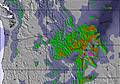 |  |  | ||||||||||
— | — | — | — | — | — | — | — | — | — | — | — | — | — | — | — | |
1 | 3 | 6 | 3 | — | — | — | — | — | — | — | — | — | — | — | — | |
max °C | 11 | 10 | 9 | 7 | 9 | 16 | 14 | 15 | 20 | 17 | 17 | 21 | 18 | 19 | 20 | 14 |
min °C | 4 | 7 | 9 | 4 | 6 | 14 | 8 | 11 | 19 | 12 | 14 | 21 | 12 | 16 | 19 | 7 |
3 | 7 | 8 | 4 | 6 | 14 | 8 | 11 | 19 | 12 | 14 | 21 | 11 | 16 | 18 | 6 | |
75 | 73 | 67 | 92 | 82 | 35 | 49 | 49 | 33 | 53 | 53 | 34 | 57 | 54 | 31 | 64 | |
2850 | 2650 | 2800 | 2550 | 2650 | 3000 | 3400 | 3350 | 3700 | 4050 | 4250 | 4300 | 4350 | 4050 | 4150 | 3400 | |
— | 5:35 | — | — | 5:35 | — | — | 5:35 | — | — | 5:35 | — | — | 5:35 | — | — | |
— | — | — | 9:51 | — | — | 9:52 | — | — | 9:52 | — | — | 9:52 | — | — | 9:52 | |
Go pro and carve into:
Avalanche information: Avalanche Canada
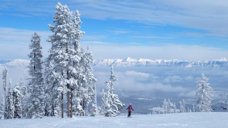
Latest snow reports near Kimberley:
| Top snow depth: | 0 cm |
|---|---|
| Bottom snow depth: | 0 cm |
| Fresh snowfall depth: | — |
| Last snowfall: | 17 May 2026 |
| Snow Alerts | Create Alert |
0.0 | Bluebird Powder days Fresh snow, mostly sunny, light wind. |
|---|---|
0.0 | Powder days Fresh snow, limited sun, any wind. |
0.0 | Bluebird days Average snow, mostly sunny, light wind. |

The above table gives the weather forecast for Kimberley at the specific elevation of 1606 m. Our sophisticated weather models allow us to provide snow forecasts for the top, middle and bottom ski stations of Kimberley. To access the weather forecasts for the other elevations, use the tab navigation above the table. For a wider view of the weather, check out the Weather Map of Canada.
Click here to read further information on freezing levels and how we forecast our temperatures.
Overall 3.9 Based on 24 votes and 11 reviews
Great hill, great people, great snow and great staff. What else do you want? Crowds, lines, ice, fog, rain? Sorry, that's found a few miles east! Hidden gem....in the Kootenays!
Mike G from Canada writes:
Great hill, great people, great snow and great staff. What else do you want?
Crowds, lines, ice, fog, rain? Sorry, that's found a few miles east!
Hidden gem....in the Kootenays!


 Nearest