

Global Weekly Snow Roundup #314
Weekly Global Snow News, updated 14 May 2026: Fresh snowfall in Argentina, Australia and Lesotho signals winter’s approach, while Japan maintains the world’s deepest snowpack.

Next 3 days weather summary:Moderate rain (total 15.0mm), heaviest on Sat morning. Very mild (max 14°C on Sun afternoon, min 1°C on Sat night). Wind will be generally light. | Days 4-6 weather summary:Moderate rain (total 11.0mm), heaviest on Tue night. Very mild (max 19°C on Thu afternoon, min 9°C on Tue morning). Wind will be generally light. | |||||||||||||||||
Saturday 16 | Sunday 17 | Monday 18 | Tuesday 19 | Wednesday 20 | Thursday 21 | |||||||||||||
AM | PM | night | AM | PM | night | AM | PM | night | AM | PM | night | AM | PM | night | AM | PM | night | |
light rain | light rain | rain shwrs | clear | cloudy | some clouds | light rain | light rain | rain shwrs | some clouds | cloudy | light rain | light rain | rain shwrs | light rain | some clouds | clear | clear | |
km/h | ||||||||||||||||||
Snow map |  |  |  |  |  |  | ||||||||||||
— | — | — | — | — | — | — | — | — | — | — | — | — | — | — | — | — | — | |
3 | 3 | 1 | — | — | — | 1 | 4 | 3 | — | — | 5 | 3 | 2 | 1 | — | — | — | |
max °C | 5 | 8 | 6 | 12 | 14 | 10 | 13 | 10 | 7 | 13 | 15 | 9 | 11 | 16 | 13 | 17 | 19 | 15 |
min °C | 4 | 8 | 1 | 6 | 14 | 6 | 10 | 8 | 5 | 9 | 14 | 9 | 10 | 16 | 10 | 13 | 19 | 10 |
3 | 6 | 1 | 6 | 14 | 6 | 10 | 7 | 5 | 9 | 14 | 9 | 9 | 16 | 10 | 13 | 19 | 10 | |
95 | 75 | 77 | 55 | 48 | 73 | 62 | 89 | 78 | 64 | 61 | 93 | 87 | 67 | 87 | 63 | 43 | 73 | |
1350 | 1750 | 1800 | 2050 | 2350 | 2400 | 2350 | 2100 | 2200 | 2400 | 2550 | 2500 | 2500 | 2850 | 2850 | 3000 | 3300 | 3500 | |
5:41 | — | — | 5:41 | — | — | 5:39 | — | — | 5:37 | — | — | 5:37 | — | — | 5:35 | — | — | |
— | — | 8:50 | — | — | 8:51 | — | — | 8:52 | — | — | 8:53 | — | — | 8:54 | — | — | 8:55 | |
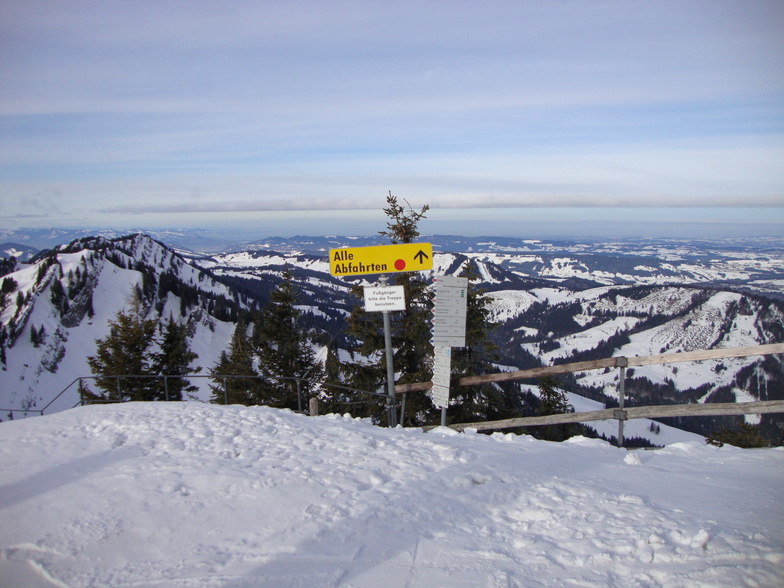
Latest snow reports near Oberstaufen/Hochgrat:
Light rain reported from Rheineck Airport at 420 metres elevation 5 kms NE of Heiden - Grub - Oberegg Appenzellerland but it is forecast cold enough for snow at higher elevations in the ski area from Heiden - Grub - Oberegg Appenzellerland
| Top snow depth: | — |
|---|---|
| Bottom snow depth: | — |
| Fresh snowfall depth: | 6 cm |
| Last snowfall: | 15 May 2026 |
| Snow Alerts | Create Alert |
0.0 | Bluebird Powder days Fresh snow, mostly sunny, light wind. |
|---|---|
0.0 | Powder days Fresh snow, limited sun, any wind. |
0.0 | Bluebird days Average snow, mostly sunny, light wind. |
The above table gives the weather forecast for Oberstaufen/Hochgrat at the specific elevation of 753 m. Our sophisticated weather models allow us to provide snow forecasts for the top, middle and bottom ski stations of Oberstaufen/Hochgrat. To access the weather forecasts for the other elevations, use the tab navigation above the table. For a wider view of the weather, check out the Weather Map of Germany.
Click here to read further information on freezing levels and how we forecast our temperatures.


 Nearest