
Ski Hire by Skiset
extra 5% off


Hauteluce Val Joly Weather (Next 3 days): The snow forecast for Hauteluce Val Joly is: Heavy rain (total 26.0mm), heaviest during Sun night. Very mild (max 14°C on Sat afternoon, min 8°C on Sun night). Wind will be generally light.
Hauteluce Val Joly Weather (Days 4-6): Heavy rain (total 38.0mm), mainly falling Tue night. Becoming colder with a light covering of snow, mostly falling on Wed morning. Very mild (max 10°C on Tue morning, min 1°C on Wed morning). Wind will be generally light.
| Resort | Snow Depth | Temp. (°C) | Wind (km/h) | Weather | ||
|---|---|---|---|---|---|---|
| Top Lift: | 9 | |||||
| Middle Lift: | 11 | |||||
| Bottom Lift: | 9 |
Latest snow reports near Hauteluce Val Joly:
It is snowing heavily on the slopes above Val d'Isere. from Val d'Isere

Saturday 11 | Sunday 12 | Monday 13 | Tuesday 14 | Wednesday 15 | Thursday 16 | Friday 17 | |||||||||||||||
AM | PM | night | AM | PM | night | AM | PM | night | AM | PM | night | AM | PM | night | AM | PM | night | AM | PM | night | |
clear | rain shwrs | rain shwrs | risk thun- der | risk thun- der | rain shwrs | light rain | rain shwrs | rain shwrs | cloudy | light rain | heavy rain | mod. snow | light rain | rain shwrs | light rain | light rain | light rain | light rain | rain shwrs | light rain | |
km/h | |||||||||||||||||||||
Snow map | 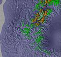 |  |  |  |  |  |  | ||||||||||||||
— | — | — | — | — | — | — | — | — | — | — | — | 5 | — | — | — | — | — | — | — | — | |
— | 2.0 | 1.0 | 1.0 | 4 | 10 | 3 | 3 | 2.0 | — | 3 | 23 | — | 2.0 | 1.0 | 1.0 | 3 | 5 | 2.0 | 3 | 3 | |
max°C | 12 | 14 | 12 | 12 | 12 | 11 | 10 | 11 | 10 | 10 | 10 | 6 | 2 | 3 | 3 | 4 | 5 | 4 | 4 | 7 | 6 |
min°C | 10 | 13 | 9 | 10 | 12 | 8 | 9 | 11 | 8 | 8 | 8 | 3 | 1 | 2 | 1 | 2 | 5 | 3 | 2 | 6 | 4 |
10 | 13 | 9 | 10 | 12 | 8 | 9 | 11 | 7 | 7 | 8 | 3 | 1 | 2 | 1 | 2 | 5 | 3 | 2 | 5 | 4 | |
62 | 66 | 80 | 68 | 72 | 89 | 73 | 78 | 77 | 73 | 93 | 99 | 99 | 99 | 82 | 75 | 88 | 96 | 84 | 71 | 81 | |
3150 | 3300 | 3250 | 3250 | 3300 | 3050 | 3050 | 3100 | 3250 | 3000 | 2950 | 2500 | 2000 | 2150 | 1950 | 2200 | 2300 | 2100 | 2250 | 2500 | 2350 | |
6:05 | — | — | 6:05 | — | — | 6:03 | — | — | 6:03 | — | — | 6:01 | — | — | 6:00 | — | — | 5:58 | — | — | |
— | — | 8:53 | — | — | 8:54 | — | — | 8:55 | — | — | 8:57 | — | — | 8:58 | — | — | 8:59 | — | — | 9:00 | |
Heavy rain (total 26.0mm), heaviest during Sun night. Very mild (max 14°C on Sat afternoon, min 8°C on Sun night). Wind will be generally light.
Heavy rain (total 38.0mm), mainly falling Tue night. Becoming colder with a light covering of snow, mostly falling on Wed morning. Very mild (max 10°C on Tue morning, min 1°C on Wed morning). Wind will be generally light.
Latest snow reports near Hauteluce Val Joly:
It is snowing heavily on the slopes above Val d'Isere. from Val d'Isere
| Top snow depth: | — |
|---|---|
| Bottom snow depth: | — |
| Fresh snowfall depth: | — |
| Last snowfall: | 2 May 2024 |
| Snow Alerts | Create Alert |
0.0 | Bluebird Powder days Fresh snow, mostly sunny, light wind. |
|---|---|
0.0 | Powder days Fresh snow, limited sun, any wind. |
0.0 | Bluebird days Average snow, mostly sunny, light wind. |
The above table gives the weather forecast for Hauteluce Val Joly at the specific elevation of 1650 m. Our sophisticated weather models allow us to provide snow forecasts for the top, middle and bottom ski stations of Hauteluce Val Joly. To access the weather forecasts for the other elevations, use the tab navigation above the table. For a wider view of the weather, check out the Weather Map of France.
Click here to read further information on freezing levels and how we forecast our temperatures.
Overall 3.0 Based on 2 votes and 1 review
Hauteluce is a small resort in itself, but it is linked into the Espace Diamant at one end of the commune, and into Les Contamines Montjoie at the other end. Unfortunately, there's no common lift pass, but either area is plenty big enough for everyone except the "mileage" skiers of this world (and frankly I don't see the fun in any of that). Hauteluce is also very close to Albertville.
James Smith from United Kingdom writes:
Hauteluce is a small resort in itself, but it is linked into the Espace Diamant at one end of the commune, and into Les Contamines Montjoie at the other end. Unfortunately, there's no common lift pass, but either area is plenty big enough for everyone except the "mileage" skiers of this world (and frankly I don't see the fun in any of that). Hauteluce is also very close to Albertville.
The Hauteluce Val Joly skiing weather widget is available to embed on external websites free of charge. It provides a daily summary of our Hauteluce Val Joly snow forecast and current weather conditions. Simply go to the feed configuration page and follow the 3 simple steps to grab the custom html code snippet and paste it into your own site. You can choose the snow forecast elevation (summit, mid-mountain or bottom lift) and metric/imperial units for the snow forecast feed to suit your own website…. Click here to get the code.
View detailed snow forecast for Hauteluce Val Joly at:
snow-forecast.com


 Nearest