

Global Weekly Snow Roundup #314
Weekly Global Snow News, updated 14 May 2026: Fresh snowfall in Argentina, Australia and Lesotho signals winter’s approach, while Japan maintains the world’s deepest snowpack.

Next 3 days weather summary:Moderate rain (total 15.0mm), heaviest on Mon afternoon. Freeze-thaw conditions (max 11°C on Sun afternoon, min -3°C on Sat night). Wind will be generally light. | Days 4-6 weather summary:Light rain (total 6.0mm), mostly falling on Tue afternoon. Very mild (max 18°C on Thu afternoon, min 5°C on Tue morning). Wind will be generally light. | |||||||||||||||||
Saturday 16 | Sunday 17 | Monday 18 | Tuesday 19 | Wednesday 20 | Thursday 21 | |||||||||||||
AM | PM | night | AM | PM | night | AM | PM | night | AM | PM | night | AM | PM | night | AM | PM | night | |
snow shwrs | light rain | rain shwrs | some clouds | some clouds | rain shwrs | light rain | mod. rain | light rain | cloudy | light rain | light rain | some clouds | some clouds | some clouds | some clouds | clear | clear | |
km/h | ||||||||||||||||||
Snow map |  |  |  |  |  |  | ||||||||||||
— | — | — | — | — | — | — | — | — | — | — | — | — | — | — | — | — | — | |
1 | 2 | 1 | — | — | 2 | 1 | 6 | 2 | — | 3 | 3 | — | — | — | — | — | — | |
max °C | 3 | 5 | 4 | 7 | 11 | 7 | 8 | 7 | 6 | 8 | 9 | 7 | 11 | 15 | 12 | 14 | 18 | 14 |
min °C | -1 | 4 | -3 | 2 | 10 | 3 | 5 | 7 | 4 | 5 | 7 | 6 | 7 | 15 | 6 | 9 | 18 | 8 |
-1 | 2 | -5 | 2 | 10 | 3 | 5 | 6 | 4 | 5 | 6 | 6 | 7 | 15 | 6 | 9 | 18 | 8 | |
67 | 66 | 85 | 50 | 51 | 88 | 73 | 83 | 91 | 73 | 91 | 97 | 73 | 56 | 80 | 53 | 43 | 73 | |
1700 | 1950 | 1300 | 2350 | 2600 | 2150 | 2350 | 2350 | 2150 | 2550 | 2650 | 2650 | 2950 | 3100 | 3450 | 3600 | 3550 | 4000 | |
5:56 | — | — | 5:56 | — | — | 5:54 | — | — | 5:54 | — | — | 5:52 | — | — | 5:52 | — | — | |
— | — | 8:57 | — | — | 8:58 | — | — | 8:59 | — | — | 9:00 | — | — | 9:00 | — | — | 9:02 | |
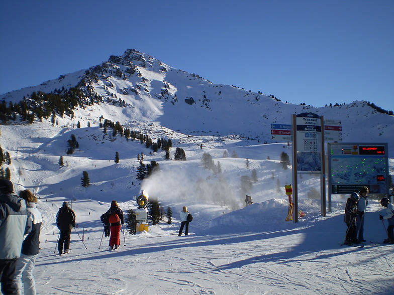
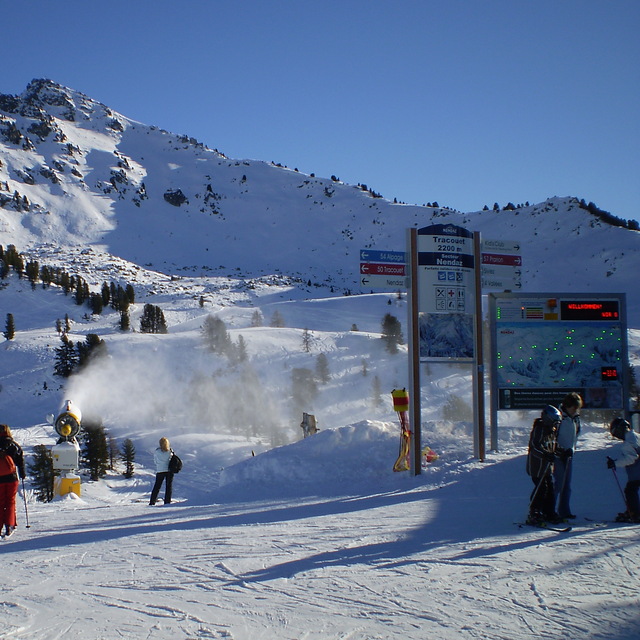
Latest snow reports near Haute Nendaz:
| Top snow depth: | — |
|---|---|
| Bottom snow depth: | — |
| Fresh snowfall depth: | 10 cm |
| Last snowfall: | 15 May 2026 |
| Snow Alerts | Create Alert |
0.0 | Bluebird Powder days Fresh snow, mostly sunny, light wind. |
|---|---|
0.0 | Powder days Fresh snow, limited sun, any wind. |
0.0 | Bluebird days Average snow, mostly sunny, light wind. |
The above table gives the weather forecast for Haute Nendaz at the specific elevation of 1400 m. Our sophisticated weather models allow us to provide snow forecasts for the top, middle and bottom ski stations of Haute Nendaz. To access the weather forecasts for the other elevations, use the tab navigation above the table. For a wider view of the weather, check out the Weather Map of Switzerland.
Click here to read further information on freezing levels and how we forecast our temperatures.
Overall 4.1 Based on 12 votes and 23 reviews
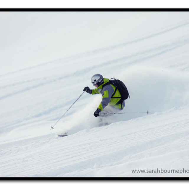
Just finished a week in Nendaz and I am coming back next year! The link to Verbier is much easier now, the slopes have more cannons and the other linked resorts (Thyon, Veysonnaz etc) are a true adventure. We had such fun. It's very expensive but that is Switzerland and the Swiss Franc but its so easy to get here. 1 quick train and a bus and you are in lovely town with stunning views and a laid back feel. So many Swiss have apartments and chalets here, they clearly know where to go. I really recommend it.
Joel from South Africa writes:
Just finished a week in Nendaz and I am coming back next year! The link to Verbier is much easier now, the slopes have more cannons and the other linked resorts (Thyon, Veysonnaz etc) are a true adventure. We had such fun. It's very expensive but that is Switzerland and the Swiss Franc but its so easy to get here. 1 quick train and a bus and you are in lovely town with stunning views and a laid back feel. So many Swiss have apartments and chalets here, they clearly know where to go. I really recommend it.


 Nearest