


View forecast
Hakuba Norikura at 1000 m altitude
Issued by Snow-Forecast.com at: 8 am (local time) / 11 May 2024
Now
Saturday 11 | Sunday 12 | Monday 13 | Tuesday 14 | Wednesday 15 | Thursday 16 | Friday 17 | |||||||||||||||
AM | PM | night | AM | PM | night | AM | PM | night | AM | PM | night | AM | PM | night | AM | PM | night | AM | PM | night | |
clear | some clouds | some clouds | some clouds | rain shwrs | heavy rain | heavy rain | heavy rain | clear | clear | clear | clear | clear | clear | some clouds | light rain | rain shwrs | rain shwrs | clear | some clouds | some clouds | |
km/h | |||||||||||||||||||||
Snow map | 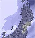 | 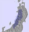 |  |  | 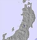 | 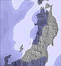 | 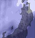 | ||||||||||||||
— | — | — | — | — | — | — | — | — | — | — | — | — | — | — | — | — | — | — | — | — | |
— | — | — | — | 1.0 | 14 | 28 | 18 | — | — | — | — | — | — | — | 3 | 2.0 | 2.0 | — | — | — | |
max°C | 20 | 22 | 15 | 19 | 20 | 14 | 12 | 9 | 6 | 14 | 14 | 12 | 18 | 19 | 13 | 12 | 7 | 6 | 15 | 16 | 12 |
min°C | 17 | 19 | 11 | 15 | 16 | 11 | 10 | 8 | 5 | 10 | 12 | 11 | 15 | 15 | 10 | 8 | 6 | 4 | 12 | 13 | 11 |
17 | 19 | 10 | 15 | 16 | 9 | 9 | 7 | 4 | 10 | 12 | 11 | 15 | 15 | 10 | 6 | 5 | 3 | 12 | 13 | 11 | |
30 | 30 | 63 | 40 | 43 | 88 | 99 | 98 | 81 | 40 | 39 | 52 | 37 | 41 | 70 | 77 | 91 | 69 | 32 | 35 | 53 | |
4000 | 3750 | 4050 | 3900 | 3550 | 3900 | 3800 | 3100 | 3200 | 2950 | 3300 | 3700 | 3600 | 3250 | 3250 | 2600 | 2100 | 1750 | 2800 | 3050 | 3500 | |
4:43 | — | — | 4:43 | — | — | 4:41 | — | — | 4:41 | — | — | 4:39 | — | — | 4:39 | — | — | 4:39 | — | — | |
— | 6:45 | — | — | 6:45 | — | — | 6:46 | — | — | 6:47 | — | — | 6:49 | — | — | 6:50 | — | — | 6:50 | — | |
Next 0-3 days weather summary:
Heavy rain (total 61.0mm), heaviest during Mon morning. Warm (max 22°C on Sat afternoon, min 5°C on Mon night). Wind will be generally light.
Next 4-6 days weather summary:
Light rain (total 7.0mm), mostly falling on Thu morning. Very mild (max 19°C on Wed afternoon, min 4°C on Thu night). Wind will be generally light.
Popular Hakuba Norikura Pages
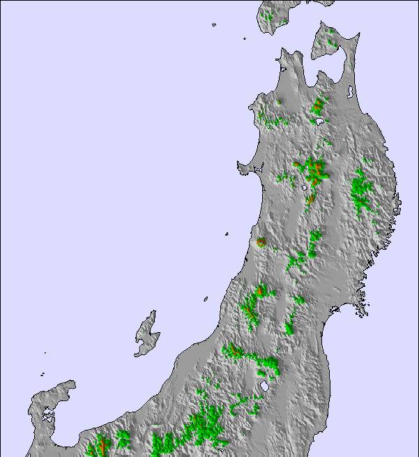
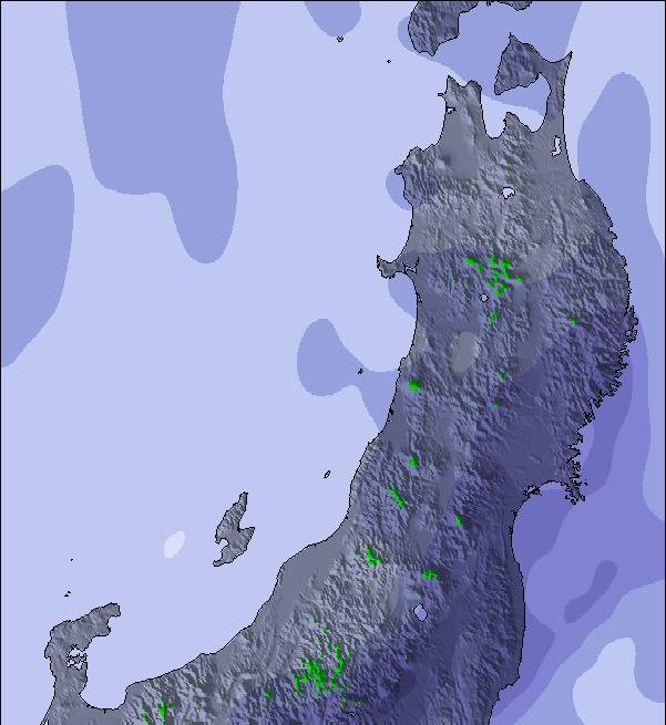
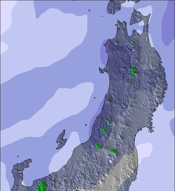
Snow Radar
Latest snow reports near Hakuba Norikura:
Hakuba Norikura Snow Conditions
| Top snow depth: | — |
|---|---|
| Bottom snow depth: | — |
| Fresh snowfall depth: | — |
| Last snowfall: | 9 Apr 2024 |
| Snow Alerts | Create Alert |
Other resorts in Japan - Nagano are reporting: powder (0) / good piste (0)
Snow-Forecast Partner Offers
Show your business here
Snow History
Week 2 of May has on average:
0.0 | Bluebird Powder days Fresh snow, mostly sunny, light wind. |
|---|---|
0.0 | Powder days Fresh snow, limited sun, any wind. |
0.0 | Bluebird days Average snow, mostly sunny, light wind. |
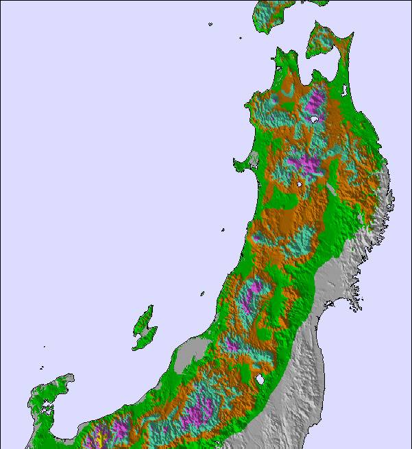
Hakuba Norikura Forecast Snowfall
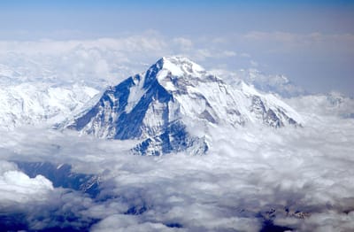
Photos of Hakuba Norikura
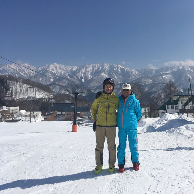
With my ski master by MASAAKI KONOO
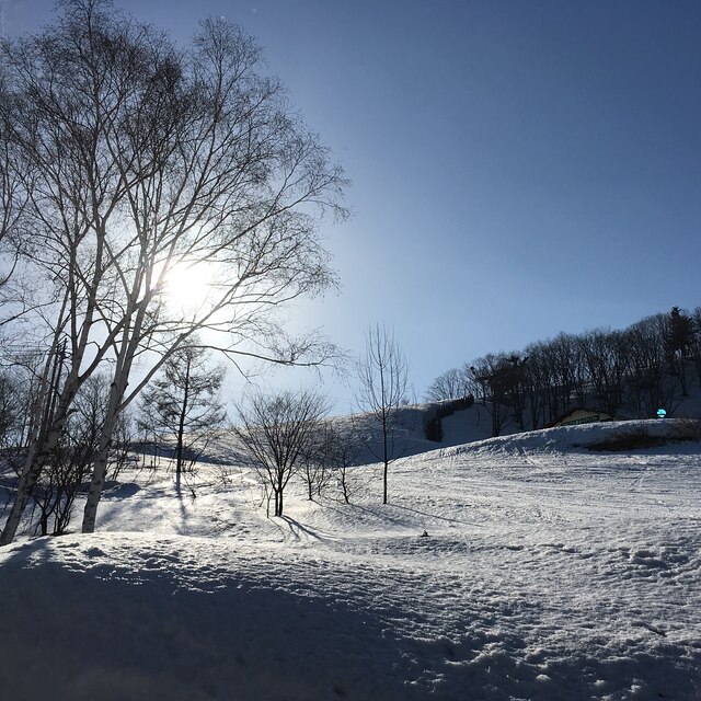
Twilight reflection in Satomi gelaende by MASAAKI KONOO
Other resorts in Japan - Nagano are reporting: powder (0) / good piste (0)
The above table gives the weather forecast for Hakuba Norikura at the specific elevation of 1000 m. Our sophisticated weather models allow us to provide snow forecasts for the top, middle and bottom ski stations of Hakuba Norikura. To access the weather forecasts for the other elevations, use the tab navigation above the table. For a wider view of the weather, check out the Weather Map of Japan.
Click here to read further information on freezing levels and how we forecast our temperatures.
Visitor Reviews of Hakuba Norikura
Overall 3.3 Based on 1 vote and 1 review
- Snowsure
- Variety of pistes
- Vote
- Dr Gordon Caldwell from United Kingdom writes:
We skied Norikura in the same day as Cortina on an amazing value lift pass of 4500 Yen. It was a clear blue ski day with stunning views of the Japanese Alps and the Hakuba valley. It's difficult to think of more beautiful scenery for skiing in. There is a huge area at the base, for beginners, with several runs to move on up to. One large open unpisted area at the top for powder hounds. Some tree skiing. Very easy access into Cortina which has one long run suitable for anyone who has skied 3 days. Cortina has vast areas of advanced skiing, best done straight after a dump. We ate in a big restaurant in Norikura, and like all eating in this area, easy ordering, unbelievably quick service, delicious food and not expensive (pork, rice, beer about 1400 Yen, in and out in under 30 minutes). Why ski anywhere else than Japan?
Visitor Reviews of Hakuba Norikura
Dr Gordon Caldwell from United Kingdom writes:
We skied Norikura in the same day as Cortina on an amazing value lift pass of 4500 Yen. It was a clear blue ski day with stunning views of the Japanese Alps and the Hakuba valley. It's difficult to think of more beautiful scenery for skiing in. There is a huge area at the base, for beginners, with several runs to move on up to. One large open unpisted area at the top for powder hounds. Some tree skiing. Very easy access into Cortina which has one long run suitable for anyone who has skied 3 days. Cortina has vast areas of advanced skiing, best done straight after a dump. We ate in a big restaurant in Norikura, and like all eating in this area, easy ordering, unbelievably quick service, delicious food and not expensive (pork, rice, beer about 1400 Yen, in and out in under 30 minutes). Why ski anywhere else than Japan?
Free Snow-Forecast.com weather widget for your website
The Hakuba Norikura skiing weather widget is available to embed on external websites free of charge. It provides a daily summary of our Hakuba Norikura snow forecast and current weather conditions. Simply go to the feed configuration page and follow the 3 simple steps to grab the custom html code snippet and paste it into your own site. You can choose the snow forecast elevation (summit, mid-mountain or bottom lift) and metric/imperial units for the snow forecast feed to suit your own website…. Click here to get the code.
View detailed snow forecast for Hakuba Norikura at:
snow-forecast.com

 Nearest