

Global Weekly Snow Roundup #314
Weekly Global Snow News, updated 14 May 2026: Fresh snowfall in Argentina, Australia and Lesotho signals winter’s approach, while Japan maintains the world’s deepest snowpack.

Next 3 days weather summary:Mostly dry. Very mild (max 17°C on Mon afternoon, min 11°C on Sun night). Winds increasing (light winds from the W on Sun morning, strong winds from the W by Mon afternoon). | Days 4-6 weather summary:Light rain (total 2.0mm), mostly falling on Wed morning. Very mild (max 14°C on Tue afternoon, min 10°C on Wed night). Wind will be generally light. | ||||||||||||||||
Sat 16 | Sunday 17 | Monday 18 | Tuesday 19 | Wednesday 20 | Thursday 21 | ||||||||||||
PM | night | AM | PM | night | AM | PM | night | AM | PM | night | AM | PM | night | AM | PM | night | |
clear | clear | clear | clear | clear | some clouds | some clouds | some clouds | cloudy | cloudy | cloudy | rain shwrs | rain shwrs | some clouds | some clouds | cloudy | cloudy | |
km/h | |||||||||||||||||
Snow map |  |  |  | 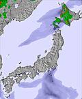 | 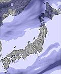 |  | |||||||||||
— | — | — | — | — | — | — | — | — | — | — | — | — | — | — | — | — | |
— | — | — | — | — | — | — | — | — | — | — | 1 | 1 | — | — | — | — | |
max °C | 16 | 14 | 14 | 14 | 13 | 16 | 17 | 15 | 16 | 14 | 12 | 12 | 13 | 11 | 13 | 13 | 11 |
min °C | 15 | 13 | 14 | 12 | 11 | 15 | 16 | 13 | 15 | 13 | 11 | 12 | 11 | 10 | 12 | 12 | 10 |
14 | 11 | 13 | 10 | 9 | 13 | 14 | 10 | 13 | 11 | 10 | 12 | 10 | 10 | 10 | 11 | 7 | |
55 | 48 | 52 | 68 | 72 | 44 | 40 | 46 | 50 | 65 | 74 | 68 | 67 | 55 | 46 | 56 | 74 | |
3750 | 3500 | 3800 | 4000 | 3750 | 4100 | 4200 | 4000 | 3650 | 3700 | 3400 | 2950 | 3000 | 2900 | 3150 | 3150 | 3000 | |
— | — | 4:18 | — | — | 4:16 | — | — | 4:16 | — | — | 4:15 | — | — | 4:15 | — | — | |
6:46 | — | — | 6:47 | — | — | 6:49 | — | — | 6:49 | — | — | 6:50 | — | — | 6:51 | — | |
Latest snow reports near Hakkoda:
| Top snow depth: | — |
|---|---|
| Bottom snow depth: | — |
| Fresh snowfall depth: | — |
| Last snowfall: | 4 May 2026 |
| Snow Alerts | Create Alert |
0.0 | Bluebird Powder days Fresh snow, mostly sunny, light wind. |
|---|---|
0.0 | Powder days Fresh snow, limited sun, any wind. |
0.0 | Bluebird days Average snow, mostly sunny, light wind. |
The above table gives the weather forecast for Hakkoda at the specific elevation of 997 m. Our sophisticated weather models allow us to provide snow forecasts for the top, middle and bottom ski stations of Hakkoda. To access the weather forecasts for the other elevations, use the tab navigation above the table. For a wider view of the weather, check out the Weather Map of Japan.
Click here to read further information on freezing levels and how we forecast our temperatures.
Overall 2.6 Based on 8 votes and 4 reviews
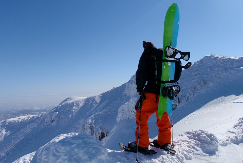
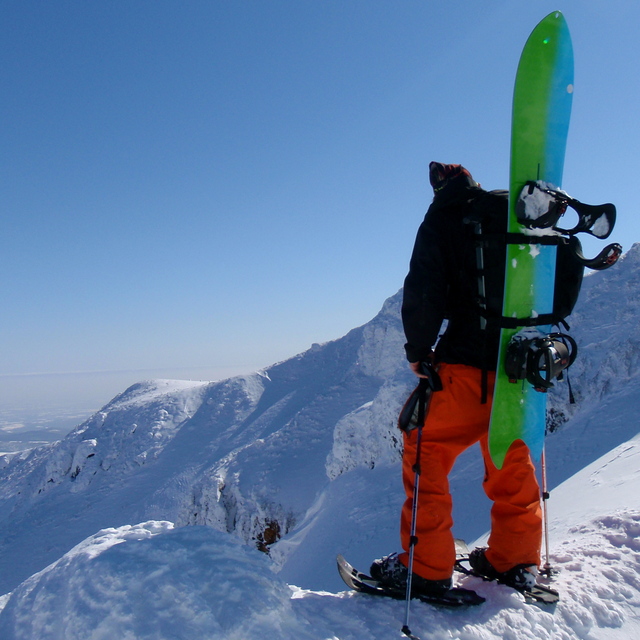
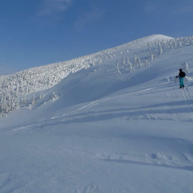
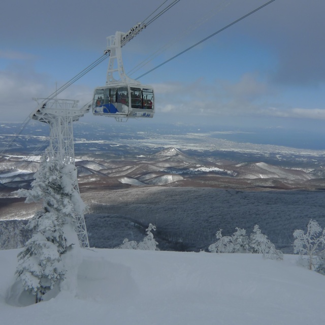
Time for an update. First of all, Hakkoda is not a resort. It is a set of mountains in a national park, one of which happens to have a ropeway/gondola. There are no amenities, no shops, no bars, no restaurants, no nightlife, no parties. Just mountains, onsens and snow. Except for the negligible tiny little old ski center at the foot of one of the mountains, there are no ski trails. Most winter days, the conditions at the top of the ropeway are stormy, with high winds and extremely low visibility. When the winds reach over 25m/s (which happens often), the ropeway suspends operations and there are few if any alternatives for skiing/snowboarding that day. Bring a book or two. There are no real / groomed ski trails from the top. There are lots of creeks, holes, treewells and windlips, which, in zero visibility represent significant challenges. Furthermore, if you are not intimately familiar with the geography of the area, the odds of getting lost, spending the night alone in the mountains and requiring (expensive) rescue are significantly high. The skills, physical strength and knowledge required to ski/ride at Hakkoda are not what you typically get from simply resort skiing/riding, even if you go every weekend. Again, this is not a resort. Do not come here if you are not properly prepared (and I don't mean simply buying the gear).
Local Gaijin from Japan writes:
Time for an update.
First of all, Hakkoda is not a resort. It is a set of mountains in a national park, one of which happens to have a ropeway/gondola.
There are no amenities, no shops, no bars, no restaurants, no nightlife, no parties. Just mountains, onsens and snow.
Except for the negligible tiny little old ski center at the foot of one of the mountains, there are no ski trails.
Most winter days, the conditions at the top of the ropeway are stormy, with high winds and extremely low visibility. When the winds reach over 25m/s (which happens often), the ropeway suspends operations and there are few if any alternatives for skiing/snowboarding that day. Bring a book or two.
There are no real / groomed ski trails from the top. There are lots of creeks, holes, treewells and windlips, which, in zero visibility represent significant challenges. Furthermore, if you are not intimately familiar with the geography of the area, the odds of getting lost, spending the night alone in the mountains and requiring (expensive) rescue are significantly high.
The skills, physical strength and knowledge required to ski/ride at Hakkoda are not what you typically get from simply resort skiing/riding, even if you go every weekend.
Again, this is not a resort. Do not come here if you are not properly prepared (and I don't mean simply buying the gear).


 Nearest