


Global Weekly Snow Roundup #314
Weekly Global Snow News, updated 14 May 2026: Fresh snowfall in Argentina, Australia and Lesotho signals winter’s approach, while Japan maintains the world’s deepest snowpack.

Next 4 days weather summary:Light rain (total 3.0mm), mostly falling on Fri night. Warm (max 24°C on Mon afternoon, min 7°C on Fri night). Winds increasing (light winds from the W on Fri night, strong winds from the WSW by Sat night). | Days 5-7 weather summary:Light rain (total 4.0mm), mostly falling on Mon night. Warm (max 24°C on Tue afternoon, min 8°C on Thu afternoon). Winds decreasing (strong winds from the W on Tue night, moderate winds from the WNW by Thu morning). | |||||||||||||||
Saturday 16 | Sunday 17 | Monday 18 | Tuesday 19 | Wednesday 20 | ||||||||||||
night | AM | PM | night | AM | PM | night | AM | PM | night | AM | PM | night | AM | PM | night | |
rain shwrs | clear | clear | rain shwrs | some clouds | clear | some clouds | some clouds | some clouds | risk thun- der | clear | clear | cloudy | some clouds | risk thun- der | light rain | |
km/h | ||||||||||||||||
Snow map | 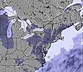 |  |  |  |  |  | ||||||||||
— | — | — | — | — | — | — | — | — | — | — | — | — | — | — | — | |
1 | — | — | 2 | — | — | — | — | — | 1 | — | — | — | — | 2 | 1 | |
max °C | 9 | 14 | 17 | 16 | 15 | 18 | 14 | 18 | 24 | 21 | 23 | 24 | 21 | 22 | 20 | 18 |
min °C | 7 | 9 | 16 | 12 | 13 | 17 | 12 | 14 | 22 | 18 | 20 | 24 | 20 | 20 | 19 | 13 |
4 | 6 | 15 | 10 | 11 | 16 | 10 | 13 | 22 | 17 | 19 | 24 | 20 | 20 | 18 | 10 | |
88 | 48 | 64 | 64 | 62 | 48 | 70 | 69 | 55 | 83 | 50 | 65 | 65 | 64 | 84 | 94 | |
2900 | 3200 | 3650 | 3550 | 3250 | 3550 | 3800 | 3850 | 4250 | 4150 | 4350 | 4350 | 4250 | 4100 | 4200 | 3950 | |
— | 5:30 | — | — | 5:28 | — | — | 5:28 | — | — | 5:26 | — | — | 5:26 | — | — | |
— | — | — | 8:15 | — | — | 8:15 | — | — | 8:16 | — | — | 8:17 | — | — | 8:19 | |
Latest snow reports near Gore Mountain:
| Top snow depth: | — |
|---|---|
| Bottom snow depth: | — |
| Fresh snowfall depth: | — |
| Last snowfall: | 1 May 2026 |
| Snow Alerts | Create Alert |
0.0 | Bluebird Powder days Fresh snow, mostly sunny, light wind. |
|---|---|
0.0 | Powder days Fresh snow, limited sun, any wind. |
0.0 | Bluebird days Average snow, mostly sunny, light wind. |
The above table gives the weather forecast for Gore Mountain at the specific elevation of 777 m. Our sophisticated weather models allow us to provide snow forecasts for the top, middle and bottom ski stations of Gore Mountain. To access the weather forecasts for the other elevations, use the tab navigation above the table. For a wider view of the weather, check out the Weather Map of United States.
Click here to read further information on freezing levels and how we forecast our temperatures.
Overall 1.9 Based on 12 votes and 1 review
Gore has amazing double black diamond trails, espessially hula-balloo and the rumour. The terrain park is for all levels (except for complete begginers). Gore has plenty of glades and is a good family skiing trail. Begginer? no problem! you wont have to go on double diamonds or glades, there is a green trail that is around 5 kilometers. Gore also has a gondola wich will keep you warm between runs.
Djordje from Canada writes:
Gore has amazing double black diamond trails, espessially hula-balloo and the rumour. The terrain park is for all levels (except for complete begginers). Gore has plenty of glades and is a good family skiing trail. Begginer? no problem! you wont have to go on double diamonds or glades, there is a green trail that is around 5 kilometers. Gore also has a gondola wich will keep you warm between runs.


 Nearest