

Global Weekly Snow Roundup #318
Weekly Snow News for the world, updated 11 June 2026: Australia's season begins, Val d’Isère reopens and major snowfall is forecast for the Andes.

Next 3 days weather summary:Light rain (total 9.0mm), mostly falling on Fri afternoon. Mild temperatures (max 9°C on Sun afternoon, min 3°C on Fri night). Winds decreasing (strong winds from the W on Fri night, light winds from the NW by Sun night). | Days 4-6 weather summary:Moderate rain (total 10.0mm), heaviest on Mon night. Very mild (max 11°C on Wed morning, min 6°C on Mon night). Wind will be generally light. | |||||||||||||||||
Friday 12 | Saturday 13 | Sunday 14 | Monday 15 | Tuesday 16 | Wednesday 17 | |||||||||||||
AM | PM | night | AM | PM | night | AM | PM | night | AM | PM | night | AM | PM | night | AM | PM | night | |
some clouds | light rain | light rain | light rain | rain shwrs | rain shwrs | clear | clear | clear | clear | light rain | light rain | light rain | cloudy | light rain | light rain | light rain | some clouds | |
km/h | ||||||||||||||||||
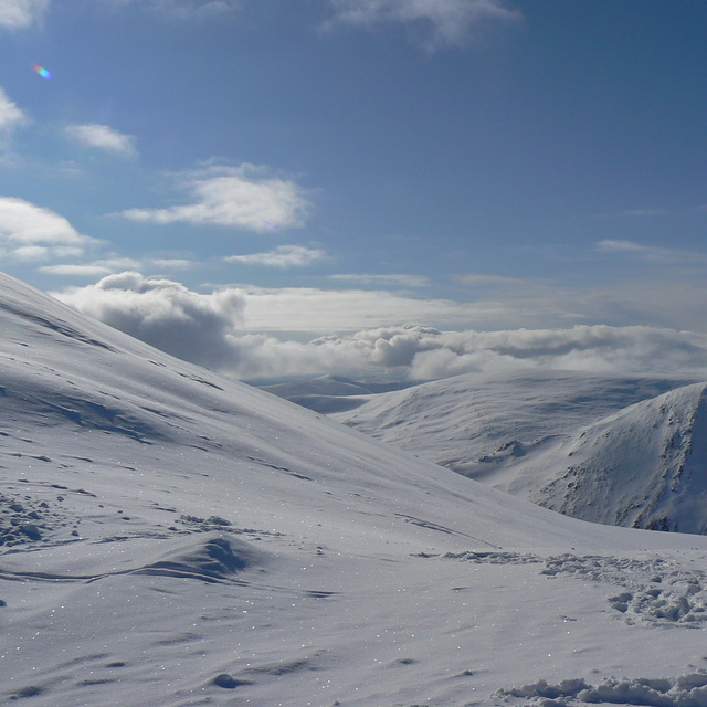
Snow map |  |  |  | 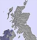 |  | 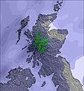 | ||||||||||||
— | — | — | — | — | — | — | — | — | — | — | — | — | — | — | — | — | — | |
— | 2 | 2 | 1 | 2 | 2 | — | — | — | — | 1 | 3 | 1 | — | 3 | 1 | 1 | — | |
max °C | 6 | 6 | 4 | 5 | 6 | 5 | 7 | 9 | 7 | 8 | 9 | 7 | 8 | 9 | 9 | 11 | 11 | 9 |
min °C | 6 | 4 | 3 | 4 | 6 | 4 | 6 | 8 | 6 | 7 | 8 | 6 | 7 | 8 | 8 | 9 | 11 | 8 |
1 | -2 | -4 | -2 | 0 | -1 | 2 | 5 | 3 | 5 | 6 | 3 | 4 | 6 | 5 | 7 | 9 | 5 | |
89 | 90 | 95 | 91 | 91 | 89 | 71 | 69 | 61 | 73 | 84 | 96 | 98 | 95 | 98 | 95 | 92 | 94 | |
1950 | 1850 | 1550 | 1600 | 2050 | 2050 | 2100 | 2350 | 2500 | 2500 | 2600 | 2300 | 2400 | 2650 | 2700 | 3050 | 3050 | 3000 | |
4:20 | — | — | 4:20 | — | — | 4:20 | — | — | 4:20 | — | — | 4:20 | — | — | 4:20 | — | — | |
— | — | 10:05 | — | — | 10:06 | — | — | 10:07 | — | — | 10:07 | — | — | 10:07 | — | — | 10:08 | |
Go pro and carve into:
Avalanche information: European Avalanche Warning Services (EAWS)
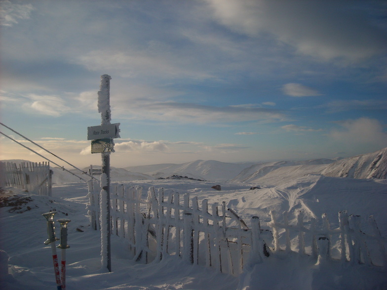
Latest snow reports near Glenshee:
| Top snow depth: | 0 cm |
|---|---|
| Bottom snow depth: | 0 cm |
| Fresh snowfall depth: | — |
| Last snowfall: | 17 May 2026 |
| Snow Alerts | Create Alert |
0.0 | Bluebird Powder days Fresh snow, mostly sunny, light wind. |
|---|---|
0.1 | Powder days Fresh snow, limited sun, any wind. |
0.0 | Bluebird days Average snow, mostly sunny, light wind. |
The above table gives the weather forecast for Glenshee at the specific elevation of 1029 m. Our sophisticated weather models allow us to provide snow forecasts for the top, middle and bottom ski stations of Glenshee. To access the weather forecasts for the other elevations, use the tab navigation above the table. For a wider view of the weather, check out the Weather Map of United Kingdom.
Click here to read further information on freezing levels and how we forecast our temperatures.
Overall 3.2 Based on 36 votes and 49 reviews
For Scotland it's a great ski area (I will not use the word "resort" to describe any Scottish ski area because it's ridiculously grandiose for what we have). There isn't much variety of terrain, it's all basically the same, but if you're just scratching your ski itch then that's fine. The lifts are very slow, and even though they have a "new" chair it hardly ever opens. Any wind will see it closed. The big problem for me is that most of the lifts don't actually go to the top of the runs they serve! There is an awkward flat/uphill link between the top of the tow (they are pretty much all tows there) and the run. Linking up between runs is also pretty poor, the layout hasn't really been thought through, but it's too late now. On a positive note the area is pretty big (for Scotland) and people can spread out, with lifts getting quieter the further back from the road you go. Parking is always pretty easy, never had an issue even in the busiest days (which is more than can be said for any of the other ski areas). However, because the bottom of the ski area is so high all of the runs are painfully short. You will be queuing for 60% of your time. The runs are not well delineated and only generally correspond to the piste map. But hey, if you're in Scotland and want to ski, then it's probably the best place unless you're looking for advanced runs. There's very little for advanced skiers here, although some of the off-piste(ish) areas between runs can be good if there's enough snow.
John from United Kingdom writes:
For Scotland it's a great ski area (I will not use the word "resort" to describe any Scottish ski area because it's ridiculously grandiose for what we have).
There isn't much variety of terrain, it's all basically the same, but if you're just scratching your ski itch then that's fine. The lifts are very slow, and even though they have a "new" chair it hardly ever opens. Any wind will see it closed.
The big problem for me is that most of the lifts don't actually go to the top of the runs they serve! There is an awkward flat/uphill link between the top of the tow (they are pretty much all tows there) and the run. Linking up between runs is also pretty poor, the layout hasn't really been thought through, but it's too late now.
On a positive note the area is pretty big (for Scotland) and people can spread out, with lifts getting quieter the further back from the road you go. Parking is always pretty easy, never had an issue even in the busiest days (which is more than can be said for any of the other ski areas). However, because the bottom of the ski area is so high all of the runs are painfully short. You will be queuing for 60% of your time. The runs are not well delineated and only generally correspond to the piste map.
But hey, if you're in Scotland and want to ski, then it's probably the best place unless you're looking for advanced runs. There's very little for advanced skiers here, although some of the off-piste(ish) areas between runs can be good if there's enough snow.


 Nearest