

Global Weekly Snow Roundup #314
Weekly Global Snow News, updated 14 May 2026: Fresh snowfall in Argentina, Australia and Lesotho signals winter’s approach, while Japan maintains the world’s deepest snowpack.

Next 3 days weather summary:A moderate fall of snow, heaviest on Sat morning. Temperatures will be below freezing (max -3°C on Sun night, min -10°C on Sat morning). Wind will be generally light. | Days 4-6 weather summary:A dusting of new snow. Freeze-thaw conditions (max 3°C on Thu night, min -4°C on Tue morning). Wind will be generally light. | |||||||||||||||||
Saturday 16 | Sunday 17 | Monday 18 | Tuesday 19 | Wednesday 20 | Thursday 21 | |||||||||||||
AM | PM | night | AM | PM | night | AM | PM | night | AM | PM | night | AM | PM | night | AM | PM | night | |
light snow | light snow | snow shwrs | clear | snow shwrs | snow shwrs | snow shwrs | light snow | light snow | some clouds | light snow | light snow | light snow | snow shwrs | light snow | some clouds | clear | clear | |
km/h | ||||||||||||||||||
Snow map |  |  |  |  |  |  | ||||||||||||
4 | 2 | — | — | — | — | — | 3 | 4 | — | — | 2 | — | 1 | — | — | — | — | |
— | — | — | — | — | — | — | — | — | — | — | — | — | — | — | — | — | — | |
max °C | -10 | -8 | -8 | -6 | -4 | -3 | -3 | -3 | -4 | -3 | -1 | -2 | -1 | 0 | 0 | 1 | 2 | 3 |
min °C | -10 | -8 | -8 | -7 | -5 | -4 | -4 | -3 | -4 | -4 | -2 | -2 | -2 | 0 | -1 | -1 | 2 | 3 |
-17 | -12 | -14 | -11 | -7 | -4 | -4 | -3 | -8 | -6 | -4 | -5 | -8 | -5 | -7 | -7 | -1 | -1 | |
93 | 92 | 77 | 50 | 74 | 70 | 86 | 96 | 85 | 61 | 85 | 97 | 89 | 72 | 87 | 53 | 79 | 41 | |
1400 | 1800 | 1600 | 2050 | 2400 | 2250 | 2400 | 2350 | 2050 | 2500 | 2650 | 2500 | 2600 | 2850 | 2750 | 2900 | 3050 | 3400 | |
5:37 | — | — | 5:37 | — | — | 5:35 | — | — | 5:35 | — | — | 5:33 | — | — | 5:33 | — | — | |
— | — | 8:45 | — | — | 8:47 | — | — | 8:49 | — | — | 8:50 | — | — | 8:51 | — | — | 8:52 | |
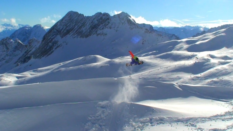
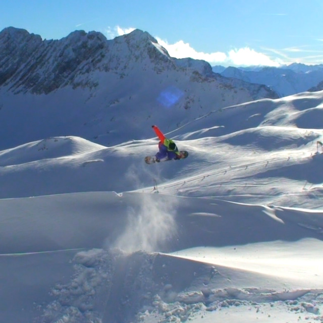
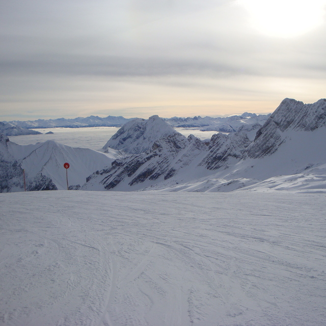
Latest snow reports near Garmisch-Partenkirchen-Zugspitze:
| Top snow depth: | — |
|---|---|
| Bottom snow depth: | — |
| Fresh snowfall depth: | 21 cm |
| Last snowfall: | 15 May 2026 |
| Snow Alerts | Create Alert |
0.3 | Bluebird Powder days Fresh snow, mostly sunny, light wind. |
|---|---|
1.0 | Powder days Fresh snow, limited sun, any wind. |
0.8 | Bluebird days Average snow, mostly sunny, light wind. |
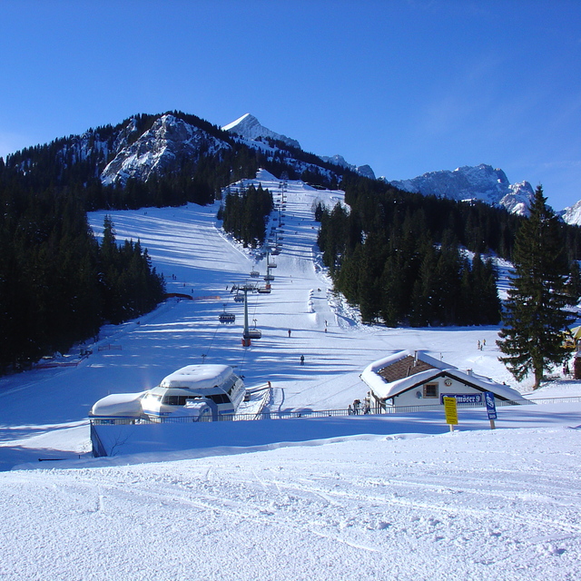
The above table gives the weather forecast for Garmisch-Partenkirchen-Zugspitze at the specific elevation of 2830 m. Our sophisticated weather models allow us to provide snow forecasts for the top, middle and bottom ski stations of Garmisch-Partenkirchen-Zugspitze. To access the weather forecasts for the other elevations, use the tab navigation above the table. For a wider view of the weather, check out the Weather Map of Germany.
Click here to read further information on freezing levels and how we forecast our temperatures.
Overall 4.1 Based on 15 votes and 10 reviews
Went skiing for a weekend in February 2012, stayed at the excellent Hostel der Athleten which is right by the Olympic ski jump. Snow conditions were perfect and despite being advised this was the busiest weekend of the year we did not find long waits at lifts or the slopes crowded. The queues there were very polite and orderly, and the lift systems 1st class, very impressed. Skiing area is not massive so a weekend was enough to ski all the 'Classic' area, we did not go up to the Zugspitze as the conditions closed in a bit on the 2nd day. The Kandahar run and the other runs down to the valley are superb and long if the snow is good all the way down (which it was when we were there). We hired ski's etc from the ski school at the bottom of the Hausberg lift, again very well organised. We ate at the Fraundorfer (trad Bavarian) and a Pizza place down the road in the Partenkirchen area (which was very pretty), Late nights there is only one place to go, Peaches in the Marianplatz area was great fun, check out their Mega Zombie cocktails if you are feeling brave and there is enough of you. Will defo be back as its only an hours drive from Munich, so can easily tag a weekend on the end of a work meeting.
Tony from United Kingdom writes:
Went skiing for a weekend in February 2012, stayed at the excellent Hostel der Athleten which is right by the Olympic ski jump.
Snow conditions were perfect and despite being advised this was the busiest weekend of the year we did not find long waits at lifts or the slopes crowded. The queues there were very polite and orderly, and the lift systems 1st class, very impressed. Skiing area is not massive so a weekend was enough to ski all the 'Classic' area, we did not go up to the Zugspitze as the conditions closed in a bit on the 2nd day. The Kandahar run and the other runs down to the valley are superb and long if the snow is good all the way down (which it was when we were there). We hired ski's etc from the ski school at the bottom of the Hausberg lift, again very well organised. We ate at the Fraundorfer (trad Bavarian) and a Pizza place down the road in the Partenkirchen area (which was very pretty), Late nights there is only one place to go, Peaches in the Marianplatz area was great fun, check out their Mega Zombie cocktails if you are feeling brave and there is enough of you. Will defo be back as its only an hours drive from Munich, so can easily tag a weekend on the end of a work meeting.
Read 9 more reviews of Garmisch-Partenkirchen-Zugspitze or submit your own


 Nearest