

Global Weekly Snow Roundup #314
Weekly Global Snow News, updated 14 May 2026: Fresh snowfall in Argentina, Australia and Lesotho signals winter’s approach, while Japan maintains the world’s deepest snowpack.

Next 3 days weather summary:Mostly dry. Mild temperatures (max 9°C on Sun afternoon, min 3°C on Sat afternoon). Wind will be generally light. | Days 4-6 weather summary:Mostly dry. Very mild (max 10°C on Wed morning, min 4°C on Tue afternoon). Wind will be generally light. | |||||||||||||||||
Saturday 16 | Sunday 17 | Monday 18 | Tuesday 19 | Wednesday 20 | Thursday 21 | |||||||||||||
AM | PM | night | AM | PM | night | AM | PM | night | AM | PM | night | AM | PM | night | AM | PM | night | |
clear | clear | clear | clear | clear | clear | clear | clear | clear | some clouds | some clouds | some clouds | some clouds | some clouds | some clouds | some clouds | some clouds | some clouds | |
km/h | ||||||||||||||||||
Snow map |  |  |  |  |  |  | ||||||||||||
— | — | — | — | — | — | — | — | — | — | — | — | — | — | — | — | — | — | |
— | — | — | — | — | — | — | — | — | — | — | — | — | — | — | — | — | — | |
max °C | 8 | 8 | 4 | 8 | 9 | 3 | 9 | 9 | 4 | 8 | 9 | 5 | 10 | 8 | 6 | 9 | 8 | 5 |
min °C | 5 | 3 | 3 | 5 | 3 | 3 | 5 | 4 | 3 | 5 | 4 | 4 | 6 | 5 | 5 | 6 | 4 | 4 |
5 | 3 | 3 | 5 | 3 | 3 | 5 | 4 | 3 | 4 | 2 | 2 | 4 | 3 | 4 | 5 | 1 | 1 | |
35 | 38 | 33 | 22 | 29 | 32 | 24 | 27 | 26 | 13 | 19 | 10 | 10 | 19 | 16 | 16 | 31 | 66 | |
2800 | 2800 | 2800 | 2750 | 2750 | 2650 | 2600 | 2650 | 2650 | 2800 | 3050 | 3250 | 3400 | 3350 | 3150 | 3200 | 3150 | 3050 | |
7:43 | — | — | 7:45 | — | — | 7:46 | — | — | 7:47 | — | — | 7:48 | — | — | 7:50 | — | — | |
— | 5:21 | — | — | 5:20 | — | — | 5:19 | — | — | 5:17 | — | — | 5:16 | — | — | 5:15 | — | |
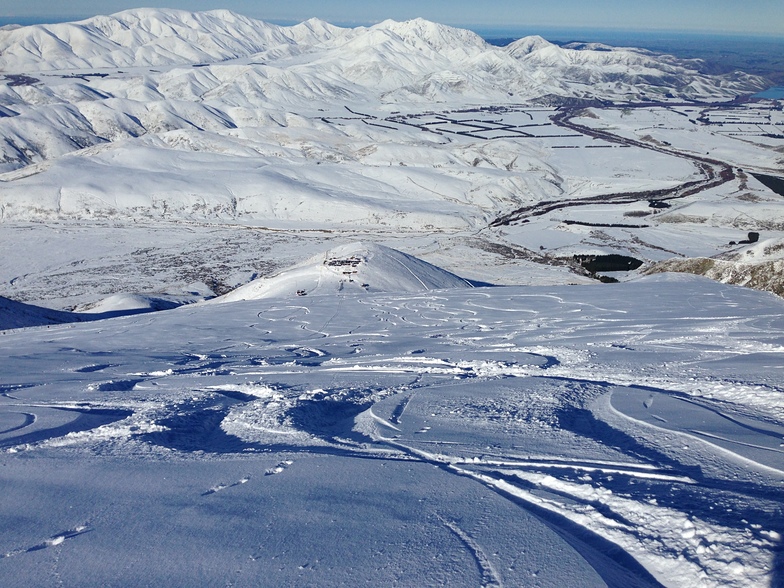
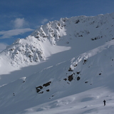
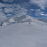
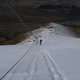
Latest snow reports near Fox Peak:
| Top snow depth: | — |
|---|---|
| Bottom snow depth: | — |
| Fresh snowfall depth: | — |
| Last snowfall: | 21 Apr 2026 |
| Snow Alerts | Create Alert |
0.1 | Bluebird Powder days Fresh snow, mostly sunny, light wind. |
|---|---|
0.0 | Powder days Fresh snow, limited sun, any wind. |
0.1 | Bluebird days Average snow, mostly sunny, light wind. |
The above table gives the weather forecast for Fox Peak at the specific elevation of 1170 m. Our sophisticated weather models allow us to provide snow forecasts for the top, middle and bottom ski stations of Fox Peak. To access the weather forecasts for the other elevations, use the tab navigation above the table. For a wider view of the weather, check out the Weather Map of New Zealand.
Click here to read further information on freezing levels and how we forecast our temperatures.


 Nearest