
Global Weekly Snow Roundup #314
Weekly Global Snow News, updated 14 May 2026: Fresh snowfall in Argentina, Australia and Lesotho signals winter’s approach, while Japan maintains the world’s deepest snowpack.

Next 3 days weather summary:A dusting of new snow. Temperatures will be well below freezing (max -9°C on Mon afternoon, min -12°C on Sat morning). Wind will be generally light. | Days 4-6 weather summary:A dusting of new snow. Temperatures will be well below freezing (max -6°C on Thu afternoon, min -11°C on Tue morning). Wind will be generally light. | |||||||||||||||||
Saturday 16 | Sunday 17 | Monday 18 | Tuesday 19 | Wednesday 20 | Thursday 21 | |||||||||||||
AM | PM | night | AM | PM | night | AM | PM | night | AM | PM | night | AM | PM | night | AM | PM | night | |
clear | some clouds | some clouds | clear | some clouds | clear | clear | snow shwrs | snow shwrs | clear | snow shwrs | clear | clear | snow shwrs | clear | clear | snow shwrs | clear | |
km/h | ||||||||||||||||||
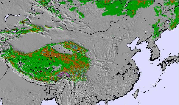
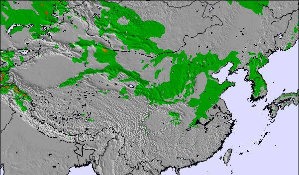
Snow map |  |  |  |  |  |  | ||||||||||||
— | — | — | — | — | — | — | — | 1 | — | — | — | — | — | — | — | 1 | — | |
— | — | — | — | — | — | — | — | — | — | — | — | — | — | — | — | — | — | |
max °C | -11 | -11 | -12 | -11 | -10 | -11 | -11 | -9 | -11 | -10 | -9 | -10 | -9 | -7 | -8 | -7 | -6 | -7 |
min °C | -12 | -11 | -12 | -11 | -11 | -12 | -11 | -10 | -12 | -11 | -10 | -10 | -9 | -7 | -9 | -7 | -7 | -8 |
-22 | -18 | -18 | -18 | -16 | -18 | -14 | -17 | -21 | -18 | -16 | -16 | -12 | -10 | -15 | -12 | -12 | -8 | |
51 | 35 | 31 | 23 | 62 | 57 | 69 | 77 | 21 | 16 | 43 | 48 | 45 | 49 | 42 | 21 | 55 | 46 | |
4850 | 4700 | 4150 | 4900 | 4850 | 4550 | 5100 | 5050 | 4550 | 5200 | 5150 | 4850 | 5400 | 5400 | 5150 | 5650 | 5500 | 5200 | |
5:07 | — | — | 5:07 | — | — | 5:05 | — | — | 5:05 | — | — | 5:05 | — | — | 5:05 | — | — | |
— | 6:39 | — | — | 6:40 | — | — | 6:40 | — | — | 6:42 | — | — | 6:42 | — | — | 6:43 | — | |
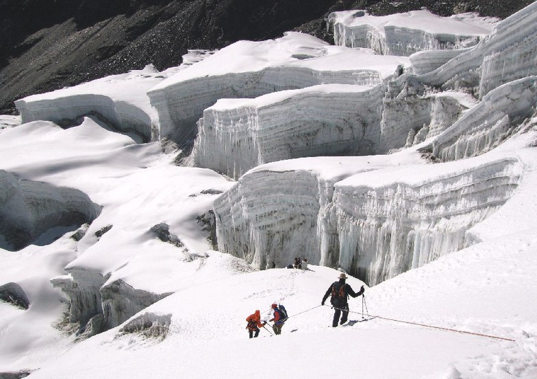
Latest snow reports near Mount Everest:
| Top snow depth: | — |
|---|---|
| Bottom snow depth: | — |
| Fresh snowfall depth: | — |
| Last snowfall: | 9 May 2026 |
| Snow Alerts | Create Alert |
2.7 | Bluebird Powder days Fresh snow, mostly sunny, light wind. |
|---|---|
0.8 | Powder days Fresh snow, limited sun, any wind. |
3.2 | Bluebird days Average snow, mostly sunny, light wind. |
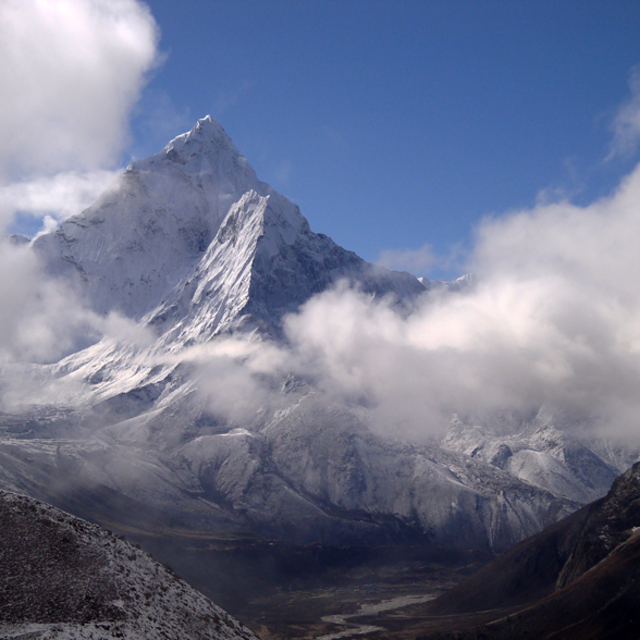
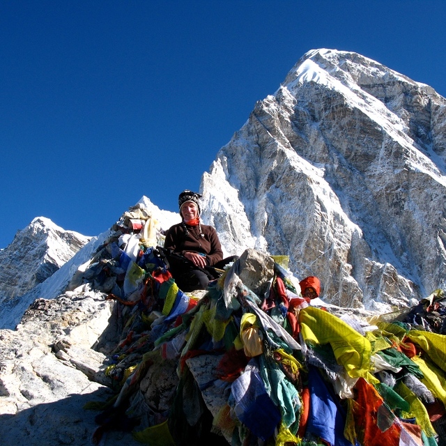
The above table gives the weather forecast for Mount Everest at the specific elevation of 6564 m. Our sophisticated weather models allow us to provide snow forecasts for the top, middle and bottom ski stations of Mount Everest. To access the weather forecasts for the other elevations, use the tab navigation above the table. For a wider view of the weather, check out the Weather Map of Nepal.
Click here to read further information on freezing levels and how we forecast our temperatures.
Overall 4.0 Based on 4 votes and 4 reviews
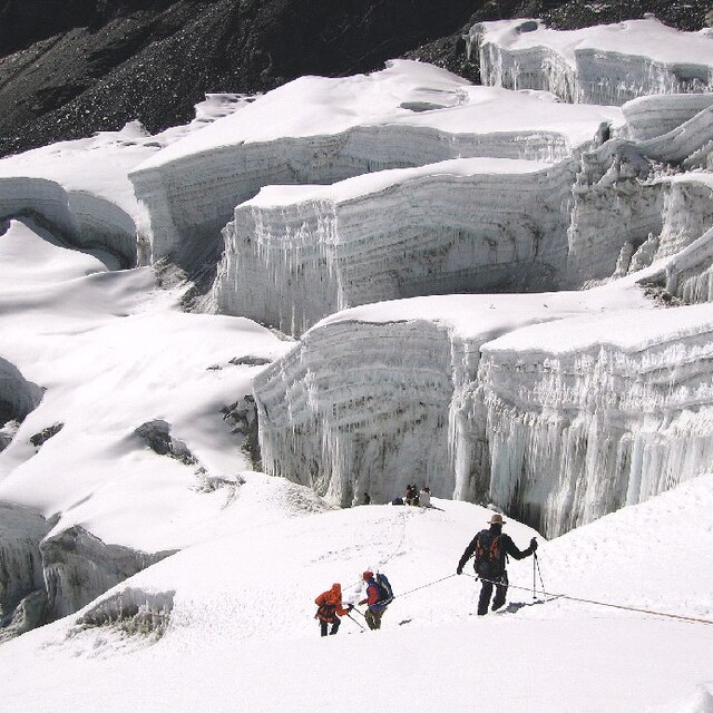
This is a great 'resort' that has more of a back country vibe to it compared to a typical commercialized ski resort. The terrain is very diverse and boasts the most vertical of any ski area catering to more advanced skiers and boarders. Ski conditions are typically 'blower', literally, as winds commonly surpass 90km/hr. And there are a few scattered terrain/crevasse parks that even the most seasoned adrenaline junkies will find challenging. Lift access is via Sherpa and can take anywhere from several weeks to 3 months, so bring snacks as on-mountain catering is limited. During high season, the mountain can appear to be fairly crowded. However, most of the other people are actually dead mountaineers of decades past long forgotten but perfectly preserved by the frigid temperatures of the unforgiving local climate. Apres' is pretty average with one main bar called base camp which serves the typical fare of porridge and boiled water. [note from the editor: an interesting 'review'.]
Alex from Canada writes:
This is a great 'resort' that has more of a back country vibe to it compared to a typical commercialized ski resort. The terrain is very diverse and boasts the most vertical of any ski area catering to more advanced skiers and boarders. Ski conditions are typically 'blower', literally, as winds commonly surpass 90km/hr. And there are a few scattered terrain/crevasse parks that even the most seasoned adrenaline junkies will find challenging. Lift access is via Sherpa and can take anywhere from several weeks to 3 months, so bring snacks as on-mountain catering is limited. During high season, the mountain can appear to be fairly crowded. However, most of the other people are actually dead mountaineers of decades past long forgotten but perfectly preserved by the frigid temperatures of the unforgiving local climate. Apres' is pretty average with one main bar called base camp which serves the typical fare of porridge and boiled water.
[note from the editor: an interesting 'review'.]

 Nearest